Cedar River (Iowa River tributary) facts for kids
Quick facts for kids Cedar Rivers |
|
|---|---|

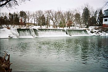
Cedar River at the Ramsey Mill Pond near Austin, Minnesota
|
|

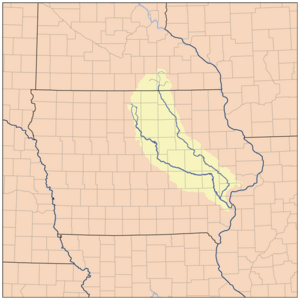
Map showing the Cedar (to the right) and Iowa (to the left) rivers.
|
|
| Country | United States |
| State | Iowa, Minnesota |
| Cities | Austin, Minnesota, Cedar Falls, Iowa, Waterloo, Iowa, and Cedar Rapids, Iowa |
| Physical characteristics | |
| Main source | Sargeant, Minnesota 43°50′05″N 92°48′28″W / 43.8346852°N 92.8076868°W |
| River mouth | Columbus Junction, Iowa 41°16′59″N 91°20′49″W / 41.28306°N 91.34694°W |
| Length | 338-mile-long (544 km) |
| Basin features | |
| River system | Mississippi River |
The Cedar River is a long river in the United States. It flows for about 338 miles (544 kilometers). This river starts in Minnesota and then flows through Iowa. It is a branch, or "tributary," of the Iowa River. The Iowa River then joins the mighty Mississippi River.
The Cedar River got its name from the red cedar trees. These trees grow along its banks. Long ago, the Meskwaki people called it the "Red Cedar River." In the 1800s, steamboats used the river. It was an important way to move goods. The area around the river is often called the "Cedar Valley."
Contents
Where the Cedar River Flows
The Cedar River begins in Dodge County, Minnesota. It has several small streams that come together. These starting points are called "headwaters." They are near towns like Blooming Prairie and Hayfield.
The river then flows into Mower County, Minnesota. It passes through different areas like Udolpho and Austin. In Austin, other streams like Turtle Creek join it.
After Minnesota, the Cedar River flows into Iowa. It goes through Mitchell County, Iowa and Floyd County, Iowa. Finally, it reaches Louisa County, Iowa. Here, near Columbus Junction, it joins the Iowa River. Even though it's a tributary, the Cedar River often looks bigger than the Iowa River where they meet.
A beautiful place called Palisades-Kepler State Park is located on the Cedar River. It is near the city of Cedar Rapids, Iowa. The county of Cedar County, Iowa is also named after this river.
Many important cities are built along the Cedar River. These include Austin, Minnesota, Cedar Falls, Iowa, Waterloo, Iowa, and Cedar Rapids, Iowa.
Understanding Flooding on the Cedar River
Flooding happens when a river gets too full of water. The water then overflows its banks. This can cause water to spread into nearby land and cities. The Cedar River has experienced some big floods in its history.
The Great Flood of 1993
In 1993, the Cedar River flooded parts of downtown Cedar Rapids. The water level reached almost 20 feet high. This was a very serious flood for Iowa at the time.
The Iowa Flood of 2008
Another major flood happened in 2008. This flood caused about 20,000 people in Cedar Rapids to leave their homes. Over 1,200 city blocks were covered in water.
Upstream, the cities of Waterloo and Cedar Falls were less affected. This was thanks to large walls called "dikes." These dikes helped protect the downtown areas. Further north, the flood also destroyed a famous bridge in Charles City. Many homes and parks were damaged there too.
 | Jessica Watkins |
 | Robert Henry Lawrence Jr. |
 | Mae Jemison |
 | Sian Proctor |
 | Guion Bluford |

