Floyd County, Iowa facts for kids
Quick facts for kids
Floyd County
|
|
|---|---|

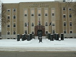
Courthouse in Charles City with Veterans Memorial in front
|
|

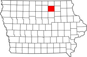
Location within the U.S. state of Iowa
|
|
 Iowa's location within the U.S. |
|
| Country | |
| State | |
| Founded | 1851 |
| Named for | Charles Floyd |
| Seat | Charles City |
| Largest city | Charles City |
| Area | |
| • Total | 501 sq mi (1,300 km2) |
| • Land | 501 sq mi (1,300 km2) |
| • Water | 0.8 sq mi (2 km2) 0.1% |
| Population
(2020)
|
|
| • Total | 15,627 |
| • Density | 31.19/sq mi (12.043/km2) |
| Time zone | UTC−6 (Central) |
| • Summer (DST) | UTC−5 (CDT) |
| Congressional district | 4th |
Floyd County is a county located in the state of Iowa. It's in the central-northern part of Iowa. As of the 2020 census, about 15,627 people lived here. The main city and county seat (the place where the county government is) is Charles City.
Contents
History
Floyd County was officially created in 1854. It was named after Sergeant Charles Floyd. He was part of the famous Lewis and Clark Expedition, which explored the western United States in the early 1800s. Charles Floyd was the only member of that expedition to die during the journey. He passed away in 1804 near what is now Sioux City, Iowa.
Education was important in Floyd County from early on. The very first school in the county opened in Nora Springs in 1854. Soon after, another school started in Charles City, and then a third in Floyd. Just twelve years later, by 1866, there were 54 schools across the county! By September 1875, the number of school-houses in Floyd County had grown to 100.
Geography
Floyd County covers a total area of about 501 square miles. Most of this area is land, with only a small amount (about 0.8 square miles) being water.
Major Highways
These are the main roads that go through Floyd County:
Neighboring Counties
Floyd County shares its borders with several other counties:
- Mitchell County (to the north)
- Chickasaw County (to the east)
- Butler County (to the south)
- Cerro Gordo County (to the west)
- Howard County (to the northeast)
- Bremer County (to the southeast)
- Franklin County (to the southwest)
Population Information
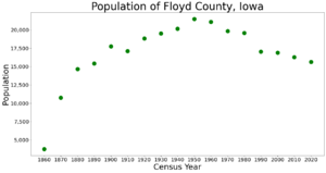
| Historical population | |||
|---|---|---|---|
| Census | Pop. | %± | |
| 1860 | 3,744 | — | |
| 1870 | 10,768 | 187.6% | |
| 1880 | 14,677 | 36.3% | |
| 1890 | 15,424 | 5.1% | |
| 1900 | 17,754 | 15.1% | |
| 1910 | 17,119 | −3.6% | |
| 1920 | 18,860 | 10.2% | |
| 1930 | 19,524 | 3.5% | |
| 1940 | 20,169 | 3.3% | |
| 1950 | 21,505 | 6.6% | |
| 1960 | 21,102 | −1.9% | |
| 1970 | 19,860 | −5.9% | |
| 1980 | 19,597 | −1.3% | |
| 1990 | 17,058 | −13.0% | |
| 2000 | 16,900 | −0.9% | |
| 2010 | 16,303 | −3.5% | |
| 2020 | 15,627 | −4.1% | |
| 2023 (est.) | 15,326 | −6.0% | |
| U.S. Decennial Census 1790–1960 1900–1990 1990–2000 2010–2018 |
|||
Every ten years, the United States counts its population in a process called the census. This helps us understand how many people live in different areas and how communities are changing.
2020 Census Details

The 2020 census showed that 15,627 people lived in Floyd County. This means there were about 31 people living in each square mile. Most people (96.21%) reported being of one race. There were 7,314 housing units (like houses or apartments), and 6,674 of them were lived in.
Here's a look at the different groups of people living in Floyd County according to the 2020 census:
| Race | Number of People | Percentage |
|---|---|---|
| White | 13,907 | 89% |
| Black or African American | 415 | 2.7% |
| Native American | 29 | 2.7% |
| Asian | 293 | 0.2% |
| Pacific Islander | 12 | 0.1% |
| Other/Mixed Race | 421 | 3.2% |
| Hispanic or Latino | 550 | 2.7% |
Communities
Floyd County has several towns and cities, as well as smaller unincorporated communities and townships.
Cities
Unincorporated Communities
These are smaller places that are not officially organized as cities or towns:
- Midway
- Powersville
- Roseville (a census-designated place, which is a special area defined by the census bureau)
Townships
Floyd County is divided into twelve townships. Townships are smaller local government areas within a county:
- Cedar
- Floyd
- Niles
- Pleasant Grove
- Riverton
- Rock Grove
- Rockford
- Rudd
- Saint Charles
- Scott
- Ulster
- Union
Population Ranking
This table shows the population of the cities and towns in Floyd County, based on the 2020 census. The † symbol means it is the county seat.
| Rank | City/Town/etc. | Type | Population (2020 Census) |
|---|---|---|---|
| 1 | † Charles City | City | 7,396 |
| 2 | Nashua (mostly in Chickasaw County) | City | 1,551 |
| 3 | Nora Springs (partially in Cerro Gordo County) | City | 1,369 |
| 4 | Greene (mostly in Butler County) | City | 990 |
| 5 | Rockford | City | 758 |
| 6 | Rudd | City | 358 |
| 7 | Floyd | City | 313 |
| 8 | Marble Rock | City | 271 |
| 9 | Colwell | City | 55 |
| 10 | Roseville | CDP | 39 |
See also
 In Spanish: Condado de Floyd (Iowa) para niños
 | Jessica Watkins |
 | Robert Henry Lawrence Jr. |
 | Mae Jemison |
 | Sian Proctor |
 | Guion Bluford |


