Freeborn County, Minnesota facts for kids
Quick facts for kids
Freeborn County
|
|
|---|---|

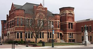
Freeborn County Courthouse
|
|

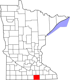
Location within the U.S. state of Minnesota
|
|
 Minnesota's location within the U.S. |
|
| Country | |
| State | |
| Founded | February 20, 1855 |
| Named for | William Freeborn |
| Seat | Albert Lea |
| Largest city | Albert Lea |
| Area | |
| • Total | 722 sq mi (1,870 km2) |
| • Land | 707 sq mi (1,830 km2) |
| • Water | 15 sq mi (40 km2) 2.1%% |
| Population
(2020)
|
|
| • Total | 30,895 |
| • Estimate
(2023)
|
30,515 |
| • Density | 43.7/sq mi (16.9/km2) |
| Time zone | UTC−6 (Central) |
| • Summer (DST) | UTC−5 (CDT) |
| Congressional district | 1st |
Freeborn County is a place in the state of Minnesota, USA. It's like a district or region within the state. In 2020, about 30,895 people lived here. The main city and government center of Freeborn County is Albert Lea. This county is also part of a larger area called the Albert Lea Micropolitan Statistical Area, which helps describe how cities and towns are connected.
Contents
History of Freeborn County
Freeborn County was officially created on February 20, 1855. It was formed from parts of Blue Earth and Rice Counties. On that same day, the Minnesota Territorial Legislature also created twelve other counties in Minnesota. Freeborn County got its name from William Freeborn. He was an early pioneer, a merchant, and a lawmaker in the Minnesota Territory.
Geography of Freeborn County
Freeborn County is located right on Minnesota's border with Iowa. Several rivers flow through the county. The Shell Rock River starts in Albert Lea Lake and flows south into Iowa. Turtle Creek flows east through the upper part of the county into Mower County.
The land here has hills, valleys, and small streams. The Le Sueur River, which is a branch of the Minnesota River, begins in the northern part of the county. It flows north into Waseca County. Other small rivers like the Cobb River and the Maple River also start in the county's northwest corner. Most of the land is used for farming. The highest point in the county is about 1,296 feet (395 meters) above sea level. The county covers about 722 square miles (1,870 square kilometers). Most of this area, 707 square miles (1,831 square kilometers), is land, and 15 square miles (39 square kilometers) is water.
Lakes in Freeborn County
Freeborn County has many lakes. Here are some of them:
- Albert Lea Lake
- Bear Lake
- Church Lake
- Everhart Lake
- Fountain Lake
- Freeborn Lake
- Geneva Lake
- Goose Lake
- Halls Lake
- Hickory Lake
- Lower Twin Lake
- Penny Lake
- Pickerel Lake
- School Section Lake
- State Line Lake
- Sugar Lake
- Trenton Lake (part)
- Upper Twin Lake
- White Lake
Protected Natural Areas
These are special places in Freeborn County that are protected to preserve nature and wildlife:
- Bear Lake State Wildlife Management Area
- Carex State Wildlife Management Area
- Halls Lake State Wildlife Area
- Moscow State Game Refuge
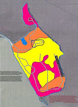
- Myre-Big Island State Park
- White Woods County Park
Transportation and Highways
You can get around Freeborn County using different ways.
- Southern Minnesota Area Rural Transit is a public transportation service.
Major Highways
Several important highways pass through Freeborn County:
 Interstate 35
 Interstate 90
 U.S. Highway 65
 U.S. Highway 69
 Minnesota State Highway 13
 Minnesota State Highway 109
 Minnesota State Highway 251
Neighboring Counties
Freeborn County shares its borders with these other counties:
- Steele County - to the northeast
- Mower County - to the east
- Worth County, Iowa - to the south
- Winnebago County, Iowa - to the southwest
- Faribault County - to the west
- Waseca County - to the northwest
Population and Demographics
The population of Freeborn County has changed over the years. Here's how it has grown and changed since 1860:
| Historical population | |||
|---|---|---|---|
| Census | Pop. | %± | |
| 1860 | 3,367 | — | |
| 1870 | 10,578 | 214.2% | |
| 1880 | 16,069 | 51.9% | |
| 1890 | 17,962 | 11.8% | |
| 1900 | 21,838 | 21.6% | |
| 1910 | 22,282 | 2.0% | |
| 1920 | 24,692 | 10.8% | |
| 1930 | 28,741 | 16.4% | |
| 1940 | 31,780 | 10.6% | |
| 1950 | 34,517 | 8.6% | |
| 1960 | 37,891 | 9.8% | |
| 1970 | 38,064 | 0.5% | |
| 1980 | 36,329 | −4.6% | |
| 1990 | 33,060 | −9.0% | |
| 2000 | 32,584 | −1.4% | |
| 2010 | 31,255 | −4.1% | |
| 2020 | 30,895 | −1.2% | |
| 2023 (est.) | 30,515 | −2.4% | |
| U.S. Decennial Census 1790-1960 1900-1990 1990-2000 2010-2020 |
|||
2020 Census Information
The 2020 census collected information about the people living in Freeborn County. This table shows the different groups of people who make up the county's population:
| Race | Number of People | Percentage of Total |
|---|---|---|
| White (Non-Hispanic) | 25,071 | 81.2% |
| Black or African American (Non-Hispanic) | 460 | 1.5% |
| Native American (Non-Hispanic) | 76 | 0.3% |
| Asian (Non-Hispanic) | 1,135 | 3.7% |
| Pacific Islander (Non-Hispanic) | 5 | 0.02% |
| Other/Mixed (Non-Hispanic) | 965 | 3.12% |
| Hispanic or Latino | 3,183 | 10.3% |
Communities in Freeborn County
Freeborn County has several cities and smaller communities where people live.
Cities
These are the main cities in Freeborn County:
- Albert Lea (This is the county seat, meaning it's where the county government is located)
- Alden
- Clarks Grove
- Conger
- Emmons
- Freeborn
- Geneva
- Glenville
- Hartland
- Hayward
- Hollandale
- Manchester
- Myrtle
- Twin Lakes
Unincorporated Communities
These are smaller communities that are not officially organized as cities:
- Armstrong
- Corning (partially in this county)
- Gordonsville
- Mansfield
- Maple Island
- Moscow
- Oakland
- Petran
Townships
Townships are smaller areas of land within a county, often including rural areas and small communities:
- Albert Lea Township
- Alden Township
- Bancroft Township
- Bath Township
- Carlston Township
- Freeborn Township
- Freeman Township
- Geneva Township
- Hartland Township
- Hayward Township
- London Township
- Manchester Township
- Mansfield Township
- Moscow Township
- Newry Township
- Nunda Township
- Oakland Township
- Pickerel Lake Township
- Riceland Township
- Shell Rock Township
See also
 In Spanish: Condado de Freeborn para niños
 | Jackie Robinson |
 | Jack Johnson |
 | Althea Gibson |
 | Arthur Ashe |
 | Muhammad Ali |


