Dakota County, Minnesota facts for kids
Quick facts for kids
Dakota County
|
|
|---|---|
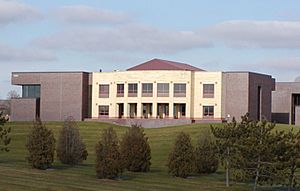
Dakota County Courthouse
|
|
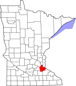
Location within the U.S. state of Minnesota
|
|
 Minnesota's location within the U.S. |
|
| Country | |
| State | |
| Founded | October 27, 1849 |
| Named for | Dakota people |
| Seat | Hastings |
| Largest city | Lakeville |
| Area | |
| • Total | 587 sq mi (1,520 km2) |
| • Land | 562 sq mi (1,460 km2) |
| • Water | 25 sq mi (60 km2) 4.2%% |
| Population
(2020)
|
|
| • Total | 439,882 |
| • Estimate
(2023)
|
447,440 |
| • Density | 749.4/sq mi (289.33/km2) |
| Time zone | UTC−6 (Central) |
| • Summer (DST) | UTC−5 (CDT) |
| Congressional district | 2nd |
Dakota County is a large county in Minnesota. It is the third most populated county in the state. In 2020, about 439,882 people lived here. By 2023, the population grew to an estimated 447,440. The main city, or county seat, is Hastings.
The county gets its name from the Dakota Sioux people. They used to live in this area. Dakota County is part of the big Minneapolis–St. Paul–Bloomington area. This is one of the largest city areas in the United States.
Lakeville is the biggest city in Dakota County. It is the ninth-largest city in Minnesota. The Minnesota and Mississippi Rivers form the northern border. Wisconsin is to the east.
Contents
History of Dakota County
Dakota County has a rich history. Many important events happened here. For example, materials for Fort Snelling came from this area. Also, the Treaty of Traverse des Sioux was signed here. This treaty gave land from the native Dakota nation to the Minnesota Territory.
The county's early history was linked to the meeting point of the Mississippi and Minnesota Rivers. These rivers were important for travel and trade. They were also sacred places for the Dakota and Ojibwe nations. After World War II, more people moved here. Interstate 35 helped connect the western part of the county to Minneapolis and Saint Paul. Many new towns grew quickly.
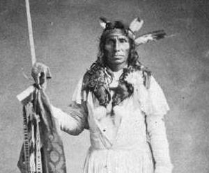
In the 1600s, the Mdewakanton Dakota moved from northern Minnesota. They moved because the Ojibwe nation was expanding. The Dakota people say their ancestors pushed out the Iowa people. The Iowa lived near the Minnesota River's mouth.
In 1680, French explorer Daniel Greysolon, Sieur du Lhut met the Mdewakanton Dakota. Later, in the 1700s, Joseph Nicollet met the Mendota band. Taoyateduta, also called Little Crow, led the Mendota in northern Dakota County. Further southwest, Chief Black Dog started a village around 1750. It was near Black Dog Lake, which is named after him.
In 1805, Zebulon Pike made a deal for military land. This land included parts of Dakota County. In 1819, Colonel Henry Leavenworth built a fort called "St. Peter's Cantonment." This fort helped build Fort Snelling. Henry Hastings Sibley built the first stone house in Minnesota in 1836. It overlooked Fort Snelling. Sibley was part of the American Fur Company. A lot of fur trade happened in Mendota because of the rivers.
The United States bought land from the Dakota people. This happened through treaties like the Treaty of Traverse des Sioux in 1851. After Minnesota became a territory in 1849, Dakota County was very large. It stretched from the Mississippi River to the Missouri River. By 1858, when Minnesota became a state, important activities moved. They moved from Mendota to Saint Paul and Minneapolis.
Hastings and South St. Paul's Growth
By 1900, Hastings was a busy center. It was the county seat. Hastings was important for transportation and trade. It had good water power from the Vermillion River. Lumber, milling, and railroads brought jobs.
Around this time, South St. Paul became famous. Its stockyards and meat-packing plants were the biggest in the world. Ranchers sent their animals here. Many immigrants from Eastern Europe worked in these plants.
Suburban Boom
After the 1950s, more people moved to western Dakota County. The building of Interstate 35W and 35E caused huge growth. Towns like Burnsville, Apple Valley, Eagan, and Lakeville grew very fast. Over 200,000 people moved into the county by the end of the century. Even though the county seat stayed in Hastings, government services spread out. New offices and courthouses were built in Burnsville and Lakeville.
Historic Places to Visit
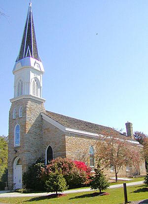
Dakota County has many historic places. These include the old settlement of Mendota. You can also see homes of important people in Hastings. There are also places where different groups of immigrants gathered in South Saint Paul.
Geography of Dakota County
Dakota County has gentle rolling hills. These hills slope down to river valleys. The highest point is Buck Hill in Burnsville. It is 1,168 feet above sea level. The county covers 587 square miles. About 562 square miles are land, and 25 square miles are water.
Rivers in Dakota County
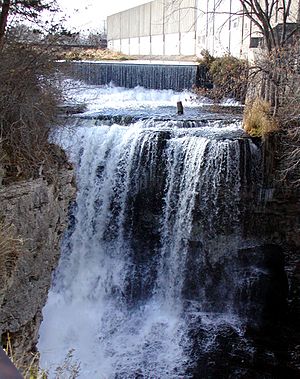
The Minnesota and Mississippi Rivers form the northern and eastern borders. Many groups help manage these rivers. The Minnesota Valley National Wildlife Refuge protects much of the Minnesota River bank.
- Mississippi River: Flows next to Mendota Heights, South St. Paul, and Hastings.
- Minnesota River: Next to Burnsville, Eagan, and Mendota.
- Vermillion River: Flows from Farmington to Hastings.
- Cannon River: Next to Randolph.
Lakes in Dakota County
- Alimagnet Lake (Burnsville, Apple Valley)
- Blackhawk Lake (Eagan)
- Bullfrog Pond (Hastings)
- Chub Lake (Eureka Township)
- Crystal Lake (Burnsville, Apple Valley)
- Earley Lake (Burnsville)
- East Lake (Eagan)
- Farquar Lake (Apple Valley)
- Fish Lake (Eagan)
- Holland Lake (Eagan)
- Jensen Lake (Eagan)
- Keegan Lake (Rosemount)
- Keller Lake (Apple Valley)
- Kingsley Lake (Lakeville)
- Lake Byllesby (Randolph Township)
- Lake Isabelle (Hastings)
- Lake Marion (Lakeville)
- Lake Rebecca (Hastings)
- Lee Lake (Lakeville)
- Long Lake (Apple Valley)
- Mud Hen Lakes (Ravenna Township)
- Orchard Lake (Lakeville)
- Pickerel Lake (Lilydale)
- Siedls Lake (South St. Paul)
- Spring Lake (Hastings)
- Thomas Lake (Eagan)
- Thompson Lake (West Saint Paul)
- Valley Lake (Lakeville)
Main Roads in Dakota County
 Interstate 35
 Interstate 35E
 Interstate 35W
 Interstate 494
 US Highway 52
 US Highway 61
 Minnesota State Highway 3
 Minnesota State Highway 13
 Minnesota State Highway 19
 Minnesota State Highway 20
 Minnesota State Highway 50
 Minnesota State Highway 55
 Minnesota State Highway 56
 Minnesota State Highway 62
 Minnesota State Highway 77
 Minnesota State Highway 149
 Minnesota State Highway 156
 Minnesota State Highway 316
 County Road 42
 County Road 23
- Other County Roads
Neighboring Counties
- Ramsey County - north
- Washington County - northeast
- Pierce County, Wisconsin - east
- Goodhue County - southeast
- Rice County - southwest
- Scott County - west
- Hennepin County - northwest
Protected Natural Areas
- Chub Lake Wildlife Management Area
- Fort Snelling State Park (part)
- Hastings Sand Coulee Scientific and Natural Area
- Miesville Ravine Park Reserve (part)
- Minnesota Valley National Wildlife Refuge (part)
- Mississippi National River and Recreation Area (part)
- Murphy-Hanrehan Park Reserve (part)
- National Wildlife Refuge, Bloomington (part)
- Spring Lake Regional Park & Park Reserve
- Vermillion Highlands
- Whitetail Woods Regional Park
Parks in Dakota County
- Big Rivers Regional Trail
- Dakota County Bikeway System
- Dakota Woods Dog Park
- Lake Byllesby Regional Park
- Lebanon Hills Regional Park
- Thompson County Park
Economy in Dakota County
Many people who live in Dakota County work outside the county. Over half of the residents (54%) commute to jobs in other areas. This is because the county grew as a place for people to live while working in Minneapolis and Saint Paul.
People of Dakota County
| Historical population | |||
|---|---|---|---|
| Census | Pop. | %± | |
| 1850 | 584 | — | |
| 1860 | 9,093 | 1,457.0% | |
| 1870 | 16,312 | 79.4% | |
| 1880 | 17,391 | 6.6% | |
| 1890 | 20,240 | 16.4% | |
| 1900 | 21,733 | 7.4% | |
| 1910 | 25,171 | 15.8% | |
| 1920 | 28,967 | 15.1% | |
| 1930 | 34,592 | 19.4% | |
| 1940 | 39,660 | 14.7% | |
| 1950 | 49,019 | 23.6% | |
| 1960 | 78,303 | 59.7% | |
| 1970 | 139,808 | 78.5% | |
| 1980 | 194,279 | 39.0% | |
| 1990 | 275,227 | 41.7% | |
| 2000 | 355,904 | 29.3% | |
| 2010 | 398,552 | 12.0% | |
| 2020 | 439,882 | 10.4% | |
| 2023 (est.) | 447,440 | 12.3% | |
| U.S. Decennial Census 1790-1960 1900-1990 1990-2000 2010-2020 |
|||
Population in 2020
In 2020, Dakota County had 439,882 people.
| Group | Population in 2010 | Population in 2020 | % in 2010 | % in 2020 |
|---|---|---|---|---|
| White (not Hispanic) | 327,962 | 323,629 | 82.29% | 73.57% |
| Black or African American (not Hispanic) | 18,235 | 32,191 | 4.58% | 7.32% |
| Native American or Alaska Native (not Hispanic) | 1,339 | 1,490 | 0.34% | 0.34% |
| Asian (not Hispanic) | 17,350 | 23,932 | 4.35% | 5.44% |
| Pacific Islander (not Hispanic) | 199 | 184 | 0.05% | 0.04% |
| Other Race (not Hispanic) | 647 | 2,144 | 0.16% | 0.49% |
| Mixed Race (not Hispanic) | 8,854 | 20,007 | 2.22% | 4.55% |
| Hispanic or Latino (any race) | 23,966 | 36,305 | 6.01% | 8.25% |
| Total Population | 398,552 | 439,882 | 100.00% | 100.00% |
Population in 2010
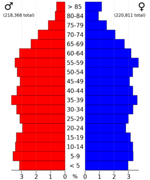
In 2010, Dakota County had 398,552 people. About 49.1% were male and 50.9% were female. The average age was 36.8 years old. Most people (85.2%) were White. About 6.0% of the population was Hispanic or Latino.
Most households (69.5%) were family households. About 36.6% of homes had children under 18. The average household had 2.60 people. Most homes (76.5%) were owned by the people living in them.
Education in Dakota County
Dakota County has some of Minnesota's largest school districts.
- Independent School District 196 (Rosemount–Apple Valley–Eagan) is the fourth largest in the state. It serves about 28,000 students.
- Other districts include Independent School District 191 (Burnsville–Eagan–Savage School District), Independent School District 194 (Lakeville–Elko–New Market), Independent School District 197 (West St. Paul–Mendota Heights–Eagan), and Independent School District 200 (Hastings).
Schools in Dakota County
High Schools
- Apple Valley High School
- Burnsville Senior High School
- Burnsville Alternative High School
- Eagan High School
- Eastview High School
- Farmington Senior High School
- Hastings Area Alternative School & Learning Center
- Hastings High School
- Two Rivers High School
- Lakeville North High School
- Lakeville South High School
- Rosemount High School
- School of Environmental Studies
- Simley High School
- South Saint Paul High School
Middle Schools
- Black Hawk Middle School
- Boeckman Middle School
- Century Middle School
- Dakota Hills Middle
- Dodge Middle School
- Falcon Ridge Middle School
- Friendly Hills Middle School
- Gateway Academy
- Hastings Middle School
- Heritage E-STEM Magnet School
- John Metcalf Junior High School
- Joseph Nicollet Junior High School
- Kenwood Trail Middle School
- Levi P. Dodge Middle School
- McGuire Middle School
- Robert Boeckman Middle School
- Rosemount Middle School
- Scott Highlands Middle School
- South Saint Paul Secondary
- Valley Middle School
Elementary Schools
- Akin Road Elementary
- Cedar Park Elementary School
- Cherry View Elementary School
- Christa McAuliffe Elementary
- Christina Huddleston Elementary School
- Cooper Elementary
- Deerwood Elementary
- Diamond Path Elementary
- East Lake Elementary
- Eastview Elementary School
- Echo Park Elementary
- Edward D. Neill Elementary
- Farmington Elementary
- Garlough Environmental Magnet School
- Gideon Pond Elementary
- Glacier Hills Elementary
- Greenleaf Elementary
- Highland Elementary
- John F. Kennedy Elementary
- Kaposia Education Center
- Lake Marion Elementary School
- Lakeview Elementary School
- Lincoln Center Elementary
- Meadowview Elementary
- Mendota Elementary School
- Moreland Arts & Health Sciences Magnet School
- North Trail Elementary
- Northview Elementary
- Oak Hills Elementary School
- Oak Ridge Elementary
- Orchard Lake Elementary
- Parkview Elementary
- Pilot Knob STEM Magnet School
- Pinecrest Elementary
- Pinewood Elementary
- Rahn Elementary
- Red Pine Elementary
- Riverview Elementary
- Rosemount Elementary
- Shannon Park
- Sioux Trail Elementary
- Sky Oaks Elementary
- Somerset Elementary School
- Southview Elementary
- Thomas Lake Elementary
- Tilden Elementary
- Vista View Elementary
- William Byrne Elementary
- Westview Elementary
- Woodland Elementary
Other Schools
- Saint Joseph Catholic School (Pre-K to 8th grade)
- St. Croix Lutheran High School and Middle School
- Holy Trinity Catholic School (Pre-K to 8th grade)
- Faithful Shepherd Catholic School (Pre-K to 8th grade)
Colleges and Universities
- Dakota County Technical College
- Inver Hills Community College
Libraries in Dakota County
- Burnhaven Library in Burnsville
- Farmington Library in Farmington
- Galaxie Library in Apple Valley
- Heritage Library in Lakeville
- Inver Glen Library in Inver Grove Heights
- Pleasant Hill Library in Hastings
- Robert Trail Library in Rosemount
- Kaposia Library in South St. Paul
- Wentworth Library in West St. Paul
- Wescott Library in Eagan
Communities in Dakota County
Dakota County has many important places. The Treaty of Mendota was signed in Mendota. This opened up southern Minnesota for settlement. Many wealthy people from Saint Paul built their homes there.
The county's growth really took off after World War II. Two major highways, I-35W and I-35E, connected the county to Minneapolis and St. Paul. This led to a lot of building in the northern part of the county. Today, cities like Burnsville, Eagan, Apple Valley, and Lakeville are big parts of the Twin Cities area. Burnsville and Eagan have grown so much they are almost like independent cities.
The southern part of Dakota County still feels more rural. It has small towns like Farmington, Coates, and Randolph. These towns have older buildings from the early 1900s.
Even though all of Dakota County is part of the big city area, the county government works to protect farmland. They also buy new natural lands in the southern townships. This creates a clear line between the busy cities and the quiet countryside. The northern part of the county has more people and a city feel. But culturally, Dakota County still has strong rural roots. The Dakota County Fair in Farmington is a big farming event each year.
The northern part of Dakota County is often called "South of the River." This is because it's located south of the Minnesota River.
Cities in Dakota County (2021 population estimate)
- Apple Valley (55,638 people)
- Burnsville (63,943 people)
- Coates (142 people)
- Eagan (68,642 people)
- Empire (2,444 people)
- Farmington (23,534 people)
- Hampton (736 people)
- Hastings (partly in Washington County) (21,925 people)
- Inver Grove Heights (35,541 people)
- Lakeville (72,812 people)
- Lilydale (800 people)
- Mendota (183 people)
- Mendota Heights (11,665 people)
- Miesville (134 people)
- New Trier (83 people)
- Northfield (mostly in Rice County) (20,709 people)
- Randolph (464 people)
- Rosemount (26,642 people)
- South St. Paul (20,536 people)
- Sunfish Lake (523 people)
- Vermillion (439 people)
- West St. Paul (20,822 people)
Unincorporated Communities
These are smaller places not officially part of a city.
Ghost Towns
These are towns that no longer exist.
Townships
These are smaller local government areas.
- Castle Rock Township
- Douglas Township
- Eureka Township
- Greenvale Township
- Hampton Township
- Marshan Township
- Nininger Township
- Randolph Township
- Ravenna Township
- Sciota Township
- Vermillion Township
- Waterford Township
Famous People from Dakota County
- Pierce Butler, a Supreme Court justice.
- Ignatius Donnelly, a politician.
- Steven Engler, a politician.
- David Knutson, a Minnesota State Senator.
- William Gates LeDuc, a pioneer and politician.
- Henry Hastings Sibley, the first Governor of Minnesota.
- Harold Stassen, a former Governor of Minnesota. He also helped create the United Nations Charter.
See also
 In Spanish: Condado de Dakota (Minnesota) para niños
 | Chris Smalls |
 | Fred Hampton |
 | Ralph Abernathy |


