Big Rivers Regional Trail facts for kids
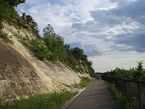
The Big Rivers Regional Trail is a fantastic paved path perfect for walking, biking, or even rollerblading! It stretches for about 4.5 miles (7.2 kilometers) and offers amazing views of where the Minnesota River and Mississippi River meet. This special spot is located along the northern edge of Dakota County, Minnesota, in the United States. The trail connects the cities of Eagan and Lilydale.
This trail is more than just a path; it's a gateway to adventure! It links up with the huge 72-mile (116-kilometer) Mississippi National River and Recreation Area. This means you can explore hundreds of miles of other trails all around the Minneapolis–Saint Paul area. You'll also find cool historical places nearby, like Fort Snelling, Pike Island, and the old town of Mendota, which is one of Minnesota's very first settlements.
The Big Rivers Trailhead is a great place to start your journey. The trail itself is mostly flat because it was built on an old railroad track. You can also get onto the trail from Minnesota State Highway 55 in Mendota Heights, I-494 in Eagan, and I-35E in Mendota Heights.
Contents
What Makes the Trail Special?
The Big Rivers Regional Trail is about 5.54 miles (8.92 kilometers) long. It's known for its beautiful scenery and interesting history. As you travel along the trail, you'll see different landscapes and learn about the area.
River Views and Nature
One of the best parts of the trail is getting to see the two big rivers, the Minnesota and Mississippi, come together. This meeting point is called a "confluence." The trail follows the river bluffs, which are steep cliffs overlooking the water. You might spot different kinds of rocks, like sandstone and limestone, in these bluffs.
The trail also passes by three special viewing spots. These overlooks are perfect places to stop, take photos, and enjoy the peaceful river scenery. Keep an eye out for local wildlife!
Historical Connections
The trail takes you through or near several historic places. You'll pass under the Mendota Bridge, which is a large bridge carrying highways over the river valley. You'll also go through the old village of Mendota. This small town has a lot of history and offers great views of the river confluence.
The trail also runs alongside the Canadian Pacific Railway line for a bit. This reminds us of the area's past, when trains were a major way to travel and transport goods.
How to Access the Trail
Getting to the Big Rivers Regional Trail is easy! There are several points where you can start your adventure:
- The main Big Rivers Trailhead.
- Near Minnesota State Highway 55 in Mendota Heights.
- Close to I-494 in Eagan.
- Near I-35E in Mendota Heights.
The trail is designed to be easy to use for everyone, whether you're walking, running, or cycling. It's a great way to enjoy nature and history right in the heart of the Twin Cities area.
 | Shirley Ann Jackson |
 | Garett Morgan |
 | J. Ernest Wilkins Jr. |
 | Elijah McCoy |


