Burnsville, Minnesota facts for kids
Quick facts for kids
Burnsville
|
||
|---|---|---|
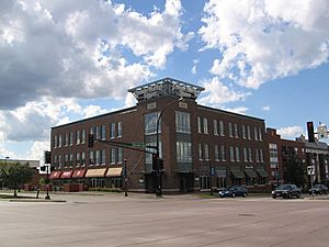
Grande Market Square at Nicollet Avenue and Burnsville Parkway is the cornerstone of the Heart of the City project.
|
||
|
||
| Nickname(s):
South of the River
|
||
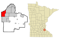
Location of the city of Burnsville within Dakota County, Minnesota
|
||
| Country | United States | |
| State | Minnesota | |
| County | Dakota | |
| Founded | 1855 | |
| Established | 1858 | |
| Incorporated | 1964 | |
| Government | ||
| • Type | Mayor-council government – Executive form | |
| Area | ||
| • City | 26.98 sq mi (69.89 km2) | |
| • Land | 24.94 sq mi (64.59 km2) | |
| • Water | 2.05 sq mi (5.30 km2) | |
| Elevation | 971 ft (297 m) | |
| Population
(2020)
|
||
| • City | 64,317 | |
| • Estimate
(2022)
|
63,936 | |
| • Rank | US: 603rd MN: 14th |
|
| • Density | 2,579.18/sq mi (995.82/km2) | |
| • Metro | 3,693,729 (US: 16th) | |
| Time zone | UTC−6 (Central (CST)) | |
| • Summer (DST) | UTC−5 (CDT) | |
| ZIP Codes |
55306, 55337
|
|
| Area code(s) | 952 | |
| FIPS code | 27-08794 | |
| GNIS feature ID | 0640669 | |
Burnsville (/ˈbɜːrnzvɪl/ BURNZ-vil) is a city in Dakota County, Minnesota. It's about 15 miles (24 km) south of downtown Minneapolis. The city sits on a hill overlooking the Minnesota River. Burnsville is part of the larger Minneapolis–Saint Paul area, which is home to about 3.7 million people. In 2020, Burnsville had a population of 64,317.
The city's name comes from an early Irish settler named William Byrne. His last name was written down as "Burns" by mistake, and it was never changed.
Burnsville was once a village for the Mdewakanton Dakota people. Later, it became a farming area settled by Irish families. Burnsville grew a lot after Interstate 35 was built. It is now the 14th-largest city in Minnesota and a popular place for people who work in Minneapolis or Saint Paul to live. The city's downtown area is called Heart of the City, with shops and homes. The Burnsville Transit Station helps people travel by bus to other nearby towns.
Burnsville has a big shopping mall called Burnsville Center. It also has parts of the Murphy-Hanrehan Park Reserve, a ski hill called Buck Hill, and part of the Minnesota Valley National Wildlife Refuge.
Contents
History of Burnsville
The Mdewakanton Dakota people were the first to live here. They arrived by the Minnesota River, following animals and birds. Around 1750, Chief Black Dog started a village near what is now Black Dog Lake. Early settlers said over 250 Dakota people lived there.
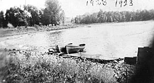
Crystal Lake, in southern Burnsville, was used for fishing and gatherings. People watched deer drink from the lake at the top of Buck Hill, which is how the hill got its name. After European settlers arrived, three large burial mounds were found.
The Dakota nation gave up their land in 1851. Many moved to Chief Shakopee's village in Prior Lake. The first European settlers were Irish, Scottish, and Norwegian farmers. They came upriver from Saint Paul. One of them was William Byrne, who came from Ireland in 1840. In 1855, he settled near the Scott County line. He gave land for a church, school, and cemetery.
In 1858, the area was named Byrnsville Township. There was some confusion about the name, as some people named "Burns" also lived there. When the city was officially formed in the 1960s, "Burnsville" became the official name. Irish and Scottish settlers left their names on many roads and parks.
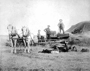
In the 1800s, Burnsville was considered far from Minneapolis. But in 1864, trains arrived, and Burnsville became a resort town. People built small houses along Crystal Lake. The Bloomington Ferry helped people cross the river until a bridge was built in 1889. Later, the Lyndale Avenue bridge opened in 1920, connecting Minneapolis to southern Minnesota.
In 1950, before a big housing boom, Burnsville was a quiet town with only 583 people. School was taught in a single room for all eight grades.
Growth and Modernization
After Interstate 35W was built in 1960, Burnsville grew very fast. Byrnesville Township officially became a city in 1964. Many new homes were built. City leaders planned for shopping areas close to homes. The Burnsville Center mall opened in 1977, making the area a major shopping spot.
By the late 1990s, Burnsville was mostly built up. The city then focused on improving existing buildings and areas. The "Heart of the City" project was started to create a modern downtown. Descendants of the Byrne family still live in Minnesota, keeping the original spelling of their name.
Geography and Nature
About 12,000 years ago, melting glaciers formed the Minnesota River valley. Burnsville's northern border is along the Minnesota River. This area includes marshland and flood plains. Much of the river area is part of the Minnesota Valley National Wildlife Refuge. This refuge protects fish, wildlife, and parkland.
Burnsville has an area of about 26.93 square miles (69.75 km²). About 24.91 square miles (64.52 km²) is land, and 2.02 square miles (5.23 km²) is water.
Roads and Highways
Interstate 35 splits in Burnsville. I-35W goes to downtown Minneapolis, and I-35E goes to downtown Saint Paul. Other important roads include Highway 13 and County Road 42. These roads help people travel east and west.
Population Changes
| Historical population | |||
|---|---|---|---|
| Census | Pop. | %± | |
| 1860 | 214 | — | |
| 1870 | 361 | 68.7% | |
| 1880 | 388 | 7.5% | |
| 1890 | 309 | −20.4% | |
| 1900 | 358 | 15.9% | |
| 1910 | 385 | 7.5% | |
| 1920 | 419 | 8.8% | |
| 1930 | 490 | 16.9% | |
| 1940 | 495 | 1.0% | |
| 1950 | 583 | 17.8% | |
| 1960 | 2,716 | 365.9% | |
| 1970 | 19,940 | 634.2% | |
| 1980 | 35,674 | 78.9% | |
| 1990 | 51,288 | 43.8% | |
| 2000 | 60,220 | 17.4% | |
| 2010 | 60,306 | 0.1% | |
| 2020 | 64,317 | 6.7% | |
| 2022 (est.) | 63,936 | 6.0% | |
| U.S. Decennial Census 2020 Census |
|||
The first settlers were about 250 Mdewakanton Dakota people. In the 1850s, people from the east coast of the United States and French Canadians moved to Dakota County. Later, many immigrants from Ireland, Scotland, and Great Britain arrived. By the 1900s, some Scandinavians also settled here.
In 1960, Burnsville had 2,716 people. After that, the population grew very quickly. By 1970, nearly 20,000 people lived in Burnsville. By 2000, the population was about 60,000. The city became much more diverse over time.
Economy and Jobs
Burnsville's largest employer is its school district, Independent School District 191. Other big employers include Fairview Ridges Hospital, UTAS Sensor Systems, and Northern Tool + Equipment. Many companies are in the industrial areas in the southwest and north of the city. These include manufacturing and corporate offices.
Shopping and Attractions
You can find many shops along County Road 42 and Highway 13. Burnsville Center is a very large regional mall. It covers about 1,275,703 square feet (118,516 m²).
Burnsville is also close to many fun places. These include the Mall of America, Valleyfair Amusement Park, and the Minneapolis–St. Paul International Airport. Nearby cities like Apple Valley and Eagan offer even more shopping and parks.
Heart of the City Project
The "Heart of the City" project is Burnsville's downtown development plan. It focuses on smart growth and new urban design. This area covers about 54 acres (22 hectares) in central Burnsville.
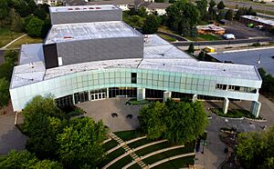
The Ames Performing Arts Center opened in January 2009. It has 1150 seats and is a big part of the "Heart of the City." Grande Market Square is another key part of this project.
Arts and Culture
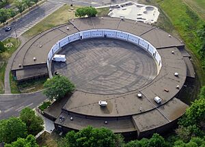
The Ames Performing Arts Center is located in the Heart of the City. It has two theaters and an art gallery.
The Garage is a music club and teen center near City Hall. It's a non-profit place that has hosted many music acts.
Every August or September, Burnsville holds the Burnsville Fire Muster. This event started in 1980. It includes a large parade, music, and fireworks. In 2004, the fire truck parade was named the longest of its kind in the world by the Guinness Book of World Records.
Parks and Recreation
Burnsville has about 1,800 acres (7.3 km²) of parkland across 79 parks. The Burnsville Parks Department manages these areas. Much of the land is kept as natural habitat. The city's border with the Minnesota River is part of the Minnesota Valley National Wildlife Refuge.
Crystal Lake is a major recreation lake. You can go boating, fishing, jet-skiing, and swimming there. Burnsville Skate Park is free to use in the summer. The Burnsville Ice Center has two large ice rinks.
Youth Sports and Activities
The Burnsville Athletic Club is a volunteer group for youth sports. Nearly 1,300 kids play baseball. There are also many basketball teams for boys and girls. Flag and tackle American football are popular too. Traveling teams play against other teams from around the state. The city's recreation department also offers sports for adults.
Burnsville has over 58 playgrounds. Popular lakes include Keller Lake, Crystal Lake, Kruse Lake, and Aligmanet Lake. In 2021, the city warned people not to release goldfish into Keller Lake. Goldfish are an invasive species and can harm the lake's environment.
Education in Burnsville
Most students in Burnsville attend schools in Independent School District 191. This district also includes parts of Savage and Eagan.
High Schools (Grades 9–12):
- Burnsville High School
- Cedar Alternative High School
Middle Schools (Grades 6–8):
- Eagle Ridge Middle School (in Savage)
- Joseph Nicollet Middle School
Elementary Schools (Grades K-5):
- Harriet Bishop (in Savage)
- Edward D. Neill
- Gideon Pond
- Hidden Valley (in Savage)
- Marion W. Savage (in Savage)
- Rahn (in Eagan)
- Sioux Trail
- Sky Oaks
- Vista View
- William Byrne
Some Burnsville students go to schools in Independent School District 196. These include Apple Valley High School. About 10% of students attend schools in Independent School District 194 in Lakeville. Good Shepherd Lutheran School is a private Christian school for Pre-K through 8th grade.
City Services
Burnsville is a well-developed suburban city. It has many types of homes, from single-family houses to apartment buildings. The "Heart of the City" area has new mixed-use buildings with homes and shops.
Since 2005, Burnsville has reduced its carbon emissions by almost 30%. They did this by improving energy efficiency and water systems.
Transportation in Burnsville
The Minnesota Valley Transit Authority provides bus service in Burnsville. Buses connect to places like the Mall of America and downtown Minneapolis. Most people in Burnsville travel by car.
Burnsville is where Interstate 35 splits into I-35W and I-35E. Important exits for I-35W are at Burnsville Parkway, County Road 42, and Highway 13. County Road 42 and Highway 13 connect Burnsville to nearby towns.
Utilities and Healthcare
Burnsville Public Works provides water to all homes and businesses from wells. Electricity is supplied by Dakota Electric Association and Xcel Energy. Natural gas comes from Centerpoint Minnegasco. Frontier Communications and Qwest provide phone and internet services.
Fairview Ridges Hospital is a 24-hour hospital. It offers emergency care, surgery, and other medical services. The hospital is part of The Ridges campus, which has many clinics.
Law Enforcement
The Burnsville Police Department provides law enforcement. It was formed in 1964. The department has 75 officers and 19 civilian staff. Tanya Schwartz became the chief of police in 2019. Burnsville was the first city in Minnesota to use body-worn cameras for all its officers. The police station was built in 1988 and was renovated in 2018.
Notable People from Burnsville
- Cole Aldrich, former basketball player
- Brock Boeser, professional hockey player
- J.T. Brown, professional hockey player
- Dropping Daylight, music band
- Breanne Düren, singer/songwriter
- Durry, indie rock band
- Sara Groves, Christian music artist
- Gao Hong, Chinese pipa player
- Ernie Hudson, actor
- Doron Jensen, founder of Timber Lodge Steakhouse
- Cayla Kluver, author
- Kristina Koznick, former ski racer
- M.A. Larson, screenwriter and author
- Trevor Laws, former American football player
- Connie Morrison, former Mayor of Burnsville
- Todd Okerlund, former hockey player
- Kirsten Olson, ice skater and actress
- Laura Osnes, Broadway singer and actress
- Melissa Peterman, actress
- Tabitha Peterson, curler
- James Ruffin, defensive lineman
- Randy Scheunemann, political adviser
- Sing It Loud, music band
- Lindsey Vonn, U.S. Ski Team alpine ski racer
- Cedric Yarbrough, actor
See also
 In Spanish: Burnsville (Minnesota) para niños
 | Bessie Coleman |
 | Spann Watson |
 | Jill E. Brown |
 | Sherman W. White |


