Fillmore County, Minnesota facts for kids
Quick facts for kids
Fillmore County
|
|
|---|---|

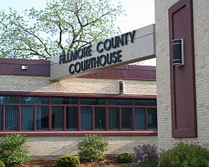
Fillmore County Courthouse
|
|

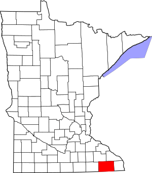
Location within the U.S. state of Minnesota
|
|
 Minnesota's location within the U.S. |
|
| Country | |
| State | |
| Founded | March 5, 1853 |
| Named for | Millard Fillmore |
| Seat | Preston |
| Largest city | Spring Valley |
| Area | |
| • Total | 862 sq mi (2,230 km2) |
| • Land | 861 sq mi (2,230 km2) |
| • Water | 0.8 sq mi (2 km2) 0.09%% |
| Population
(2020)
|
|
| • Total | 21,228 |
| • Estimate
(2023)
|
21,522 |
| • Density | 24.6/sq mi (9.5/km2) |
| Time zone | UTC−6 (Central) |
| • Summer (DST) | UTC−5 (CDT) |
| Congressional district | 1st |
Fillmore County is a beautiful area in the state of Minnesota, USA. It's known for its rolling hills and pretty rivers. A "county" is like a smaller division of a state, helping to organize local government.
As of the 2020 census, about 21,228 people live here. The main town, or "county seat," where the local government offices are, is Preston. Fillmore County is also part of the larger Rochester area.
Contents
History of Fillmore County
Fillmore County was officially created on March 5, 1853. It was named after Millard Fillmore, who was the 13th president of the United States.
This county was one of the first places in Minnesota where European-American settlers came to live. This happened after the United States made agreements with the Dakota Native American nations in 1851. Many people from Norway came to settle here. In 1860, Fillmore County was actually the most populated county in all of Minnesota!
Geography and Landscape
Fillmore County is located right on Minnesota's border with Iowa. The Root River is a major river that flows through the county, heading east. Many smaller streams, like the North Branch, Middle Branch, South Branch, Bear Creek, and Willow Creek, join the Root River. The Upper Iowa River also briefly enters the county near its southern edge.
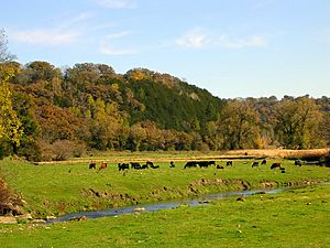
The land in Fillmore County has rolling hills and valleys. Much of the area is used for farming. The highest point in the county is about 1,378 feet (420 meters) above sea level. The county covers a total area of about 862 square miles (2,233 square kilometers). Most of this is land, with only a tiny bit of water.
This area is part of something called the Driftless Area. This means it was not covered by ice during the last ice age. Because of this, Fillmore County also has a special type of landscape called karst topography. This means there are many caves, sinkholes, and underground rivers formed by water dissolving the bedrock.
Main Roads in Fillmore County
Neighboring Counties
- Winona County - northeast
- Houston County - east
- Winneshiek County, Iowa - southeast
- Howard County, Iowa - southwest
- Mower County - west
- Olmsted County - northwest
Protected Natural Areas
Fillmore County is home to several important natural areas, including:
- Forestville/Mystery Cave State Park
- Mystery Cave State Park
- Pin Oak Prairie Scientific and Natural Area
- Rushford Sand Barrens Scientific and Natural Area
- Wycoff Balsam Fir Scientific and Natural Area
People and Population (Demographics)
| Historical population | |||
|---|---|---|---|
| Census | Pop. | %± | |
| 1860 | 13,542 | — | |
| 1870 | 24,887 | 83.8% | |
| 1880 | 28,162 | 13.2% | |
| 1890 | 25,996 | −7.7% | |
| 1900 | 28,288 | 8.8% | |
| 1910 | 25,680 | −9.2% | |
| 1920 | 25,330 | −1.4% | |
| 1930 | 24,748 | −2.3% | |
| 1940 | 25,830 | 4.4% | |
| 1950 | 24,465 | −5.3% | |
| 1960 | 23,768 | −2.8% | |
| 1970 | 21,916 | −7.8% | |
| 1980 | 21,930 | 0.1% | |
| 1990 | 20,777 | −5.3% | |
| 2000 | 21,122 | 1.7% | |
| 2010 | 20,866 | −1.2% | |
| 2020 | 21,228 | 1.7% | |
| 2023 (est.) | 21,522 | 3.1% | |
| U.S. Decennial Census 1790-1960 1900-1990 1990-2000 2010-2020 |
|||
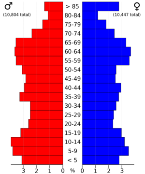
Population in 2020
In 2020, the population of Fillmore County was 21,228 people. Most residents, about 95%, identified as White. Smaller groups included Black or African American, Asian, and people of mixed races. About 1.6% of the population identified as Hispanic or Latino.
Population in 2010
In 2010, there were 20,866 people living in Fillmore County. The population density was about 24 people per square mile. Most people (98.2%) were White.
About 29.4% of households had children under 18 living with them. The average household had 2.40 people. The median age in the county was 43 years old. This means half the people were older than 43, and half were younger.
Communities in Fillmore County
Cities in Fillmore County
Smaller Unincorporated Communities
These are smaller places that are not officially cities:
- Bratsberg
- Carimona
- Cherry Grove
- Clear Grit
- Elliota
- Etna
- Fillmore
- Forestville
- Granger
- Greenleafton
- Hamilton
- Henrytown
- Highland
- Lenora
- Newburg
- Prosper
- York
Townships in Fillmore County
Townships are another type of local government area, often covering rural land:
- Amherst Township
- Arendahl Township
- Beaver Township
- Bloomfield Township
- Bristol Township
- Canton Township
- Carimona Township
- Carrolton Township
- Chatfield Township
- Fillmore Township
- Forestville Township
- Fountain Township
- Harmony Township
- Holt Township
- Jordan Township
- Newburg Township
- Norway Township
- Pilot Mound Township
- Preble Township
- Preston Township
- Spring Valley Township
- Sumner Township
- York Township
Education in Fillmore County
Students in Fillmore County attend schools in various school districts, including:
- Chatfield Public Schools
- Fillmore Central School District
- Kingsland Public School District
- Lanesboro Public School District
- LeRoy-Ostrander Public Schools
- Mabel-Canton Public School District
- Rushford-Peterson Public Schools
- St. Charles Public School District
- Stewartville Public School District
See also
 In Spanish: Condado de Fillmore (Minnesota) para niños
 | Chris Smalls |
 | Fred Hampton |
 | Ralph Abernathy |


