
Peterson, Minnesota facts for kids
Quick facts for kids
Peterson
|
|
|---|---|

Root River runs by town
|
|
| Motto(s):
"A Hidden Treasure Nestled In The Bluffs Of Southeast Minnesota"
|
|

Location of Peterson, Minnesota
|
|
| Country | United States |
| State | Minnesota |
| County | Fillmore |
| Area | |
| • Total | 0.49 sq mi (1.28 km2) |
| • Land | 0.47 sq mi (1.23 km2) |
| • Water | 0.02 sq mi (0.05 km2) |
| Elevation | 748 ft (228 m) |
| Population
(2020)
|
|
| • Total | 234 |
| • Density | 492.63/sq mi (190.04/km2) |
| Time zone | UTC-6 (Central (CST)) |
| • Summer (DST) | UTC-5 (CDT) |
| ZIP code |
55962
|
| Area code(s) | 507 |
| FIPS code | 27-50596 |
| GNIS feature ID | 2396194 |
| Website | http://www.petersonmn.org/ |
Peterson is a small city in Fillmore County, Minnesota, USA. It's known for its beautiful location along the Root River. In 2020, about 234 people lived here. The city's motto is "A Hidden Treasure Nestled In The Bluffs Of Southeast Minnesota."
Contents
History of Peterson

Peterson was founded by Peter Peterson Haslerud in 1853. He bought the land and planned the town. The community was named after him.
Peter Haslerud was very important in the early days of Peterson. He helped bring the railroad through the area in 1867. He even gave the railroad company 15 acres of land. He also helped raise money to build a station and warehouse in Peterson.
In 1870, Peterson got its first post office. Peter Haslerud also started a "trout farm" on his land in 1871. This farm helped raise fish for local waters.
Over the next few years, more businesses opened in Peterson. These included a blacksmith shop, general stores, and a hardware store. In 1875, the telegraph came to the railroad station. More land was added to the village, and streets like Prospect Park and Church Street were named. A flour mill was built in 1876, along with a hotel and other small businesses.
Peterson officially became a village in 1909.
About Peter Peterson Haslerud, the Founder
Peter Peterson Haslerud was born in Norway on July 21, 1828. When he was 14, he moved to the United States with his sister and her husband. They sailed on a ship called "Hercules" and arrived in New York after a long journey.
After living in Wisconsin and Illinois, Peter came to Minnesota in 1853. He bought the land that would become Peterson. He planned the village, making sure there were schools and churches. He also named the streets and parks.
Peter was very active in the community. He helped set up grain elevators and the famous trout farm. This trout farm has been providing fish for Minnesota's lakes for over 150 years! Today, the State of Minnesota runs it.
Before 1874, Peter owned a lot of land in Fillmore County. He was key in getting a railroad station for Peterson. He also helped many businesses start in the town. He even served in the Minnesota state government.
Peter's Home: The First Building
The very first building in Peterson was Peter Haslerud's home. It started as a small house with a living room, kitchen, and two bedrooms. As his family grew, more rooms were added. These included a "summer kitchen," a music room with a pipe organ, and large screened porches.
Over time, the house became known as the "House of Seven Gables." Peter lived there from 1853 until he passed away in 1880. His family continued to live in the home until 2003.
Peter and his wife, Cornelia, had five children. His oldest child, George, is thought to be the first white child born in Rushford Township, Minnesota.
Geography
Peterson covers a total area of about 0.49 square miles (1.28 square kilometers). Most of this is land, with a small part being water.
Population Information
| Historical population | |||
|---|---|---|---|
| Census | Pop. | %± | |
| 1910 | 266 | — | |
| 1920 | 291 | 9.4% | |
| 1930 | 291 | 0.0% | |
| 1940 | 331 | 13.7% | |
| 1950 | 318 | −3.9% | |
| 1960 | 283 | −11.0% | |
| 1970 | 269 | −4.9% | |
| 1980 | 291 | 8.2% | |
| 1990 | 259 | −11.0% | |
| 2000 | 269 | 3.9% | |
| 2010 | 199 | −26.0% | |
| 2020 | 234 | 17.6% | |
| U.S. Decennial Census | |||
In 2010, Peterson had 199 people living in 97 homes. About 60 families lived in the city. The population density was about 406 people per square mile. Most residents were White.
About 19.6% of homes had children under 18. Many homes (51.5%) were married couples living together. The average age of people in Peterson was about 50.4 years old.
Parks and Recreation
Peterson is a great place for outdoor activities. The Root River runs through the town. This river is part of the Blufflands State Trail, which is popular for biking and walking.
Images for kids
-
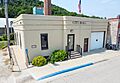
Peterson City Hall

See also
 In Spanish: Peterson (Minnesota) para niños
