
Houston County, Minnesota facts for kids
Quick facts for kids
Houston County
|
|
|---|---|

Houston County Courthouse in Caledonia
|
|

Location within the U.S. state of Minnesota
|
|
 Minnesota's location within the U.S. |
|
| Country | |
| State | |
| Founded | February 23, 1854 (created) April 4, 1854 (organized) |
| Named for | Sam Houston |
| Seat | Caledonia |
| Largest city | La Crescent |
| Area | |
| • Total | 569 sq mi (1,470 km2) |
| • Land | 552 sq mi (1,430 km2) |
| • Water | 17 sq mi (40 km2) 2.9%% |
| Population
(2020)
|
|
| • Total | 18,843 |
| • Estimate
(2023)
|
18,582 |
| • Density | 33.116/sq mi (12.786/km2) |
| Time zone | UTC−6 (Central) |
| • Summer (DST) | UTC−5 (CDT) |
| Congressional district | 1st |
Houston County is a county located in the southeastern part of Minnesota, a state in the United States. In 2020, about 18,843 people lived there. The main town, or county seat, where the county government is located, is Caledonia. Houston County is also part of the larger area around La Crosse and Onalaska.
Contents
History of Houston County
The land that is now Houston County was first organized in 1839 as part of St. Croix County. This was when it was still a territory, not yet a state. Later, in 1849, a new area called Wabashaw County was created from part of St. Croix County.
On February 23, 1854, the government decided to split Wabashaw County into two new counties: Fillmore County and Houston County. The county government for Houston County was officially set up on April 4, 1854.
Houston County was named after Sam Houston. He was a very famous person who had been the president of the Republic of Texas and later a US senator.
The first county seat was the village of Houston. However, in 1855, the county government decided to move the records to Caledonia. This made Caledonia the main town for the county.
The first court hearings were held in a simple cabin. In 1857, a small courthouse and jail were built in Caledonia. A larger building was constructed in 1867. After several votes, Caledonia officially became the county seat by 1874. From then on, Caledonia grew, while the original town of Houston became less important. Another important town was La Crescent, which grew because it was connected to La Crosse, Wisconsin.
Geography of Houston County
Houston County is located in the very southeast corner of Minnesota. Its eastern border is next to Wisconsin, across the Mississippi River. Its southern border touches Iowa. The Mississippi River flows south along the county's eastern side.
Several rivers flow through the county. The Root River flows east through the northern part of the county and empties into the Mississippi. Pine Creek flows through the northeast, and Crooked Creek flows through the south, both also joining the Mississippi.
The land in Houston County changes from gently rolling hills in the west to steeper hills with many valleys in the east. The middle and western parts of the county are like a flat top, called a plateau. The highest point is about 1,273 feet (388 meters) above sea level. The county covers about 569 square miles (1,474 square kilometers). Most of this is land, with about 17 square miles (44 square kilometers) being water.

The county is part of a special area called the Driftless Zone. This means that glaciers did not cover this area a long time ago. Because of this, the land has steep hills and valleys carved by streams, instead of flat land left by glaciers. The plateau around Caledonia has flat, rich farmland and green, hilly areas for animals to graze.
Lakes in Houston County
The Upper Mississippi River National Wildlife and Fish Refuge is a protected area along the county's eastern border. Four lakes within this refuge are found in Houston County:
- Blue Lake
- Hayshore Lake
- Lawrence Lake
- Target Lake
Neighboring Counties
Houston County shares its borders with several other counties:
- Winona County to the north
- La Crosse County, Wisconsin to the northeast
- Vernon County, Wisconsin to the east
- Allamakee County, Iowa to the south
- Winneshiek County, Iowa to the southwest
- Fillmore County to the west
Protected Natural Areas
Houston County is home to several beautiful natural areas:
- Beaver Creek Valley State Park
- Mound Prairie Scientific and Natural Area
- Part of the Upper Mississippi River National Wildlife and Fish Refuge
Population Data
| Historical population | |||
|---|---|---|---|
| Census | Pop. | %± | |
| 1860 | 6,645 | — | |
| 1870 | 14,936 | 124.8% | |
| 1880 | 16,332 | 9.3% | |
| 1890 | 14,653 | −10.3% | |
| 1900 | 15,400 | 5.1% | |
| 1910 | 14,297 | −7.2% | |
| 1920 | 14,013 | −2.0% | |
| 1930 | 13,845 | −1.2% | |
| 1940 | 14,735 | 6.4% | |
| 1950 | 14,435 | −2.0% | |
| 1960 | 16,588 | 14.9% | |
| 1970 | 17,556 | 5.8% | |
| 1980 | 18,382 | 4.7% | |
| 1990 | 18,497 | 0.6% | |
| 2000 | 19,718 | 6.6% | |
| 2010 | 19,027 | −3.5% | |
| 2020 | 18,843 | −1.0% | |
| 2023 (est.) | 18,582 | −2.3% | |
| U.S. Decennial Census 1790–1960 1900–1990 1990–2000 2010–2020 |
|||
2020 Census Information
According to the 2020 census, Houston County had a population of 18,843 people. Most of the residents, about 94.7%, identified as White. Smaller percentages of the population included people who identified as Black or African American (0.5%), Native American (0.22%), Asian (0.54%), and Pacific Islander (0.02%). About 2.8% of the population identified as other races or mixed races. Around 1.3% of the population identified as Hispanic or Latino.
Transportation
Public Transit
- La Crosse MTU provides public transportation services.
Main Roads
Several important highways run through Houston County, connecting it to other areas:
- U.S. Highway 14
- U.S. Highway 61
- Minnesota State Highway 16
- Minnesota State Highway 26
- Minnesota State Highway 44
- Minnesota State Highway 76
Airport
- Houston County Airport serves the area.
Communities in Houston County
Cities
Houston County has several cities:
- Brownsville
- Caledonia (the county seat)
- Eitzen
- Hokah
- Houston
- La Crescent (partly in Winona County)
- Spring Grove
Unincorporated Communities
These are smaller communities that are not officially organized as cities:
- Bee
- Black Hammer
- Freeburg
- Jefferson
- Mayville
- Money Creek
- Newhouse
- Pine Creek (partial)
- Reno
- River Junction
- Sheldon
- Willington Grove
- Wilmington
- Yucatan
Townships
Townships are local government areas, usually rural:
- Black Hammer Township
- Brownsville Township
- Caledonia Township
- Crooked Creek Township
- Hokah Township
- Houston Township
- Jefferson Township
- La Crescent Township
- Mayville Township
- Money Creek Township
- Mound Prairie Township
- Sheldon Township
- Spring Grove Township
- Union Township
- Wilmington Township
- Winnebago Township
- Yucatan Township
Education
Students in Houston County attend schools in several different school districts:
- Caledonia Public School District
- Houston Public School District
- La Crescent-Hokah School District
- Mabel-Canton Public School District
- Rushford-Peterson Public Schools
- Spring Grove School District
Images for kids
-
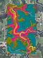
Soils of Beaver Creek Valley State Park neighborhood

See also
 In Spanish: Condado de Houston (Minnesota) para niños
