Eitzen, Minnesota facts for kids
Quick facts for kids
Eitzen
|
|
|---|---|

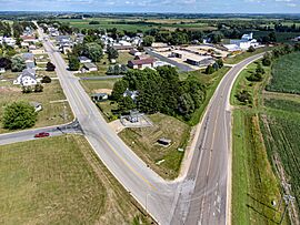
Minnesota State Highway 76 and Main Street
|
|

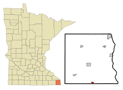
Location of Eitzen, Minnesota
|
|
| Country | United States |
| State | Minnesota |
| County | Houston |
| Area | |
| • Total | 0.61 sq mi (1.58 km2) |
| • Land | 0.61 sq mi (1.58 km2) |
| • Water | 0.00 sq mi (0.00 km2) |
| Elevation | 1,165 ft (355 m) |
| Population
(2020)
|
|
| • Total | 279 |
| • Density | 457.38/sq mi (176.69/km2) |
| Time zone | UTC-6 (Central (CST)) |
| • Summer (DST) | UTC-5 (CDT) |
| ZIP code |
55931
|
| Area code(s) | 507 |
| FIPS code | 27-18368 |
| GNIS feature ID | 2394630 |
Eitzen is a small city located in Houston County, Minnesota, in the United States. It is a quiet place where people live and work. In 2020, about 279 people lived there.
Contents
History of Eitzen
The city of Eitzen got its name from early settlers. These first residents came from a place called Eitzen in Germany. A post office has been open in Eitzen since 1868.
In September 2020, a group of officials from the CDC (Centers for Disease Control) visited Eitzen. They were going to homes to gather information. However, the city leaders were not told about this visit beforehand.
The mayor of Eitzen, Jeff Adamson, said that city officials and residents were concerned. They saw people going door-to-door in an unmarked car. The mayor felt the CDC should apologize for not letting the city know.
Geography of Eitzen
Eitzen is a small city in terms of its size. According to the United States Census Bureau, the city covers an area of about 1.58 square kilometers (0.61 square miles). All of this area is land.
Population and People
| Historical population | |||
|---|---|---|---|
| Census | Pop. | %± | |
| 1950 | 151 | — | |
| 1960 | 181 | 19.9% | |
| 1970 | 208 | 14.9% | |
| 1980 | 226 | 8.7% | |
| 1990 | 221 | −2.2% | |
| 2000 | 229 | 3.6% | |
| 2010 | 243 | 6.1% | |
| 2020 | 279 | 14.8% | |
| U.S. Decennial Census | |||
Eitzen's Population in 2010
In 2010, there were 243 people living in Eitzen. These people made up 112 households. About 61 of these households were families.
The city had 119 housing units. All the people living in Eitzen at that time were identified as White.
Households and Families
About 24.1% of the households had children under 18 years old. Nearly half of the households (49.1%) were married couples living together. A small number of households had a single parent.
About 33% of all households were individuals living alone. Many of these were people aged 65 or older. The average household had about 2.17 people. The average family had about 2.89 people.
Age and Gender in Eitzen
The average age of people in Eitzen in 2010 was 44.5 years. About 17.7% of residents were under 18 years old. About 28.4% were 65 years or older.
The population was almost evenly split between males and females. About 49.4% of the residents were male, and 50.6% were female.
See also
 In Spanish: Eitzen (Minnesota) para niños
 | Dorothy Vaughan |
 | Charles Henry Turner |
 | Hildrus Poindexter |
 | Henry Cecil McBay |


