Hokah, Minnesota facts for kids
Quick facts for kids
Hokah
|
|
|---|---|
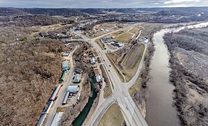
Hokah, Minnesota
Looking South West |
|
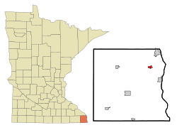
Location of Hokah, Minnesota
|
|
| Country | United States |
| State | Minnesota |
| County | Houston |
| Founded | 1851 |
| Area | |
| • Total | 0.72 sq mi (1.86 km2) |
| • Land | 0.70 sq mi (1.81 km2) |
| • Water | 0.02 sq mi (0.04 km2) |
| Elevation | 643 ft (196 m) |
| Population
(2020)
|
|
| • Total | 553 |
| • Density | 791.13/sq mi (305.36/km2) |
| Time zone | UTC-6 (Central (CST)) |
| • Summer (DST) | UTC-5 (CDT) |
| ZIP code |
55941
|
| Area code(s) | 507 |
| FIPS code | 27-29510 |
| GNIS feature ID | 2394395 |
| Website | www.cityofhokah-mn.gov |
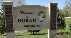
Hokah (/ˈhoʊkə/ hoh-kə) is a small city in Houston County, Minnesota, United States. In 2020, about 553 people lived there. Hokah is located where the Root River meets the mighty Mississippi River. It sits across from La Crosse, Wisconsin.
Contents
History of Hokah
Before Europeans arrived, the area of Hokah was a home for Native American people called the Dakota people. The city's name, Hokah, comes from a Native American word. It might mean "gar fish" or be the Dakota name for the nearby Root River. The name also comes from a leader of the settlement, Chief Wecheschatope Hokah.
Long ago, there were over thirty Indian mounds in the area. These mounds were built by Native Americans. Some were even shaped like animals, called effigy mounds. Sadly, most of these ancient mounds are now gone.
Early European Settlement
The first European settler recorded in Hokah was Edward Thompson. He arrived in 1851 with his family. Edward Thompson built a flour mill and a dam on Thompson Creek. This creek flows through the city and is now named after him.
The first town meeting happened in 1858. Hokah officially became a village in Minnesota on March 2, 1871.
Growth and Industry
By 1875, Hokah was a busy place with several big industries. It had four flour mills, where grain was ground into flour. There were also cooper shops, which made wooden barrels. A railroad depot was also built, which was a station for trains.
Hokah's location helped it grow. It was on the Root River, which was good for boats. The Root River also flowed into the Mississippi River. A railroad called the Root River Valley Railroad also ran through the village. This railroad connected Hokah to nearby towns like La Crescent and Rochester, Minnesota.
The railroad depot in Hokah was very important. It could do all kinds of railroad work. Workers even built railroad engines and passenger cars there. Up to 500 people worked at the depot. They built as many as 300 coaches in one year. By 1880, Hokah also had other factories. These included a plow factory and a furniture factory. There were also blacksmith shops, shoe shops, drug stores, and general stores.
Changes and Challenges
In 1876, a railroad bridge was built across the Mississippi River from La Crosse. This bridge connected the Root River Valley Railroad to other railroads. In 1880, a larger company bought the Root River Valley Railroad. This company was called the Chicago, Milwaukee, St. Paul and Pacific Railroad.
After the purchase, the railroad depot in Hokah was taken down. The company decided to use other facilities elsewhere. This meant hundreds of workers in Hokah lost their jobs. Many people then left the area. Hokah's other businesses also suffered. Many of them eventually closed down.
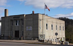
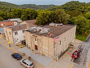
On April 23, 1923, Hokah changed from a village to a city. The Hokah City Hall was built in 1938. It was constructed by the Works Progress Administration, a government program that created jobs during the Great Depression. This building is now listed on the National Register of Historic Places. This means it is an important historical building.
Major Flood Event
On August 19, 2007, Hokah experienced a record-breaking rainfall. About 15.10 inches of rain fell in just 24 hours. This broke the old Minnesota state record. This heavy rain was part of a big weather system. It caused widespread damage in Hokah and nearby towns. There were landslides, damaged homes, and washed-out roads. Hokah also holds the record for the most rain in any month for Minnesota. This happened in August 2007, with 23.86 inches of rain.
Geography of Hokah
Hokah is located in a special area of southeastern Minnesota. This area is called the Driftless Area. It has a hilly landscape with tall bluffs and low river valleys. These valleys are known as coulees.
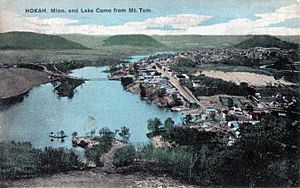
The main part of Hokah is on a small bluff. It sits between the Root River valley and the Thompson Creek valley. To the east of downtown is Thompson Bluff, also called Mt. Tom. This bluff rises over 400 feet above the downtown area. Like Thompson Creek, Thompson Bluff is named after Edward Thompson, an early settler.
Como Falls and Lake Como
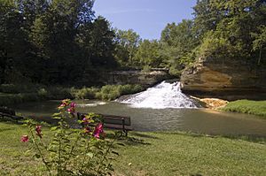
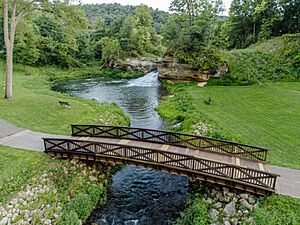
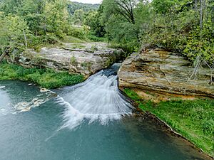
Hokah was once home to Como Falls, a waterfall on Thompson Creek. From 1858 until the 1930s, there was also a man-made lake called Lake Como. It was 90 acres big and 20 feet deep. The lake was created by building a dam on Thompson Creek at Como Falls.
Lake Como was a very popular vacation spot. People from La Crosse and nearby areas came to visit. They enjoyed lakeside cabins and rented boats. The dam that created Lake Como broke during a flood in 1909. This caused the lake to drain. However, the dam was rebuilt in 1922.
By the late 1930s, the lake began to disappear. Soil from nearby farms washed into the lake bed. This happened before farmers started using contour plowing, which helps stop soil erosion. The lake bed filled in, and Lake Como was gone.
Until August 2018, the area where Lake Como used to be was a community park. It had a pool and a baseball field. A big storm in August 2018 brought nearly eight inches of rain. This caused a lot of damage to the park. It also changed the path of the water around Como Falls, almost destroying the falls. Later, money was given to help rebuild the water's path to bring Como Falls back.
Transportation in Hokah
Hokah is about six miles west-southwest of downtown La Crosse, Wisconsin. By car, it's about nine miles. You can get there by crossing the Mississippi River Bridge in La Crescent.
Minnesota State Highway 44 goes right through downtown Hokah. It ends where it meets Minnesota State Highway 16, just northeast of downtown. Highway 16 passes just north of the downtown area. Minnesota State Highway 26 follows the Mississippi River. It is part of the scenic Great River Road and passes just east of Hokah.
There are two bridges nearby that cross the Mississippi River. They connect southeastern Minnesota to the La Crosse area in Wisconsin. Six miles north of Hokah is the Mississippi River Bridge. It carries U.S. routes 14 and 61. This bridge connects downtown La Crescent, Minnesota, to downtown La Crosse, Wisconsin.
Eight miles north of Hokah, in Dresbach, is the I-90 Mississippi River Bridge. This bridge carries Interstate 90 across the Mississippi River. It connects to northern La Crosse and Onalaska, Wisconsin. South of Hokah, the closest place to cross the Mississippi River by vehicle is the Black Hawk Bridge. This bridge is thirty miles away in Lansing, Iowa.
For train travel, the nearby La Crosse Amtrak station offers daily service. This is for the Empire Builder Amtrak route. The La Crosse Regional Airport also has daily flights. You can fly to Chicago and Minneapolis with American Airlines and Delta Air Lines.
Hokah Population Information
| Historical population | |||
|---|---|---|---|
| Census | Pop. | %± | |
| 1860 | 309 | — | |
| 1870 | 525 | 69.9% | |
| 1880 | 961 | 83.0% | |
| 1890 | 582 | −39.4% | |
| 1900 | 536 | −7.9% | |
| 1910 | 400 | −25.4% | |
| 1920 | 407 | 1.8% | |
| 1930 | 452 | 11.1% | |
| 1940 | 546 | 20.8% | |
| 1950 | 643 | 17.8% | |
| 1960 | 685 | 6.5% | |
| 1970 | 697 | 1.8% | |
| 1980 | 686 | −1.6% | |
| 1990 | 687 | 0.1% | |
| 2000 | 614 | −10.6% | |
| 2010 | 580 | −5.5% | |
| 2020 | 553 | −4.7% | |
| U.S. Decennial Census | |||
2010 Census Details
In 2010, there were 580 people living in Hokah. There were 275 households, which are groups of people living together. About 152 of these were families. The city had about 794.5 people per square mile. There were 287 housing units, like houses or apartments.
Most of the people in Hokah were White (96.6%). A small number were African American (0.2%), Native American (0.7%), or from other backgrounds. About 1.4% of the population was Hispanic or Latino.
About 28.4% of households had children under 18 living with them. About 37.8% were married couples. Some households had a female head without a husband (12.0%). Others had a male head without a wife (5.5%). About 44.7% were not families. Many households (38.5%) had only one person living there. About 10.5% had someone aged 65 or older living alone. The average household had 2.11 people. The average family had 2.76 people.
The average age in Hokah was 39.4 years. About 24% of residents were under 18. About 9% were between 18 and 24. About 24.3% were between 25 and 44. About 31.9% were between 45 and 64. And about 11% were 65 years old or older. The city had slightly more males (51.0%) than females (49.0%).
Notable People from Hokah
- William H. Harries, who was a U.S. representative for Minnesota. This means he helped make laws for the country.
- Clark W. Thompson, who was a Minnesota state senator. This means he helped make laws for the state.
Education in Hokah
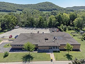
Hokah, along with the nearby community of La Crescent, is part of the La Crescent-Hokah Public School District. This district serves students in the area.
There is also a private school in Hokah called St. Peter's School. It is a Catholic school that teaches students from pre-kindergarten up to 8th grade. Several colleges and universities are also located nearby. These include the University of Wisconsin–La Crosse, Viterbo University, St. Mary's University of Minnesota, and Winona State University.
The city's public library is the Hokah Public Library. It is part of a system called Southeastern Libraries Cooperating (SELCO). This system helps libraries in the southeastern part of Minnesota work together.
See also
 In Spanish: Hokah para niños
 | Ernest Everett Just |
 | Mary Jackson |
 | Emmett Chappelle |
 | Marie Maynard Daly |


