Menoken Lake facts for kids
Quick facts for kids Menoken Lake |
|
|---|---|
| North Topeka Oxbow Lake | |
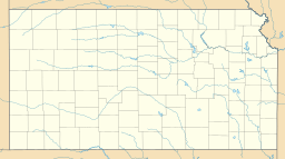
| Location | Shawnee County, Kansas, inside Topeka, Kansas |
| Coordinates | 39°05′38″N 95°42′51″W / 39.09388°N 95.71416°W |
| Type | natural freshwater oxbow lake |
| Basin countries | United States |
| Surface area | 12 acres (5 ha) |
| Settlements | Topeka, Kansas |
Menoken Lake, also known as North Topeka Oxbow Lake, is a natural freshwater lake found just outside the northern part of Topeka, Kansas. This lake covers about 12-acre (49,000 m2) of land. It is a special kind of lake called an oxbow lake. This means it was once a bend in a river that got cut off.
Contents
Discovering Menoken Lake
Menoken Lake is one of about six lakes in the area that used to be part of the Kansas River. The Kansas River is now about a mile south of Menoken Lake. Long ago, the river's current shifted its path. When the river moved south, this section of water was left behind, forming the lake we see today.
What is an Oxbow Lake?
An oxbow lake is a U-shaped lake that forms when a wide bend of a river is cut off from the main river channel. Rivers often curve and wind across flat land. Over time, the river might find a straighter path. When this happens, the old, curved part of the river becomes a separate lake. It often looks like the U-shaped collar worn by an ox, which is how it got its name!
Size and Shape of Menoken Lake
Menoken Lake is shaped like a curve or an arc. It is about 225 feet (69 m) wide and stretches for about 1,200 feet (370 m) in length. The lake was actually longer in the past. On its east side, a road for US 24 was built right through the lakebed. This left only a small patch of water south of the highway. On the west side, an entrance and exit ramp for a road was built. This road also filled in part of the lakebed. Now, a small patch of water remains inside the loop of that ramp.
Exploring Around the Lake
To the south of Menoken Lake, you can find US 24 and a smaller road called a frontage road at the lake's southeast end. Farm fields are next to the lake along its east and south sides. North 25th Street runs just north of the lake. There are also a few homes located along the lake's edge on the north side.
A private dock, called a jetty, sticks out into Menoken Lake from the north shore. About one-third of the lake on the west side has been separated from the rest. This was done by two dams that are privately owned. Because of this, public swimming is not allowed in Menoken Lake. There are also no public boat ramps for launching boats. However, people can still enjoy fishing from the shore. You can fish at the east and west ends of the lake where public roads meet the water.


