Menominee River (Illinois) facts for kids
Quick facts for kids Menominee River |
|
|---|---|

Menominee River (USGS)
|
|
| Physical characteristics | |
| Main source | Grant County, Wisconsin 796 ft (243 m) 42°33′44″N 90°36′09″W / 42.5622222°N 90.6025°W |
| River mouth | Confluence with the Mississippi, Jo Daviess County, Illinois 597 ft (182 m) 42°27′04″N 90°35′24″W / 42.4511111°N 90.59°W |
| Length | 14 mi (23 km) |
| Basin features | |
| Progression | Menominee River → Mississippi → Gulf of Mexico |
| GNIS ID | 413409 |
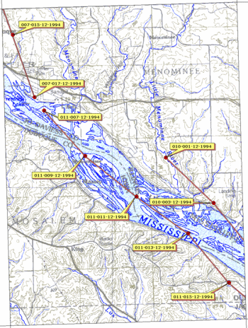
The Menominee River is a small but important river in the United States. It flows for about 11.3-mile-long (18.2 km) through parts of Wisconsin and Illinois. This river eventually joins the mighty Mississippi River in Jo Daviess County, Illinois.
Contents
The Menominee River: A Short Journey
The Menominee River might not be one of the longest rivers, but it plays a role in the local environment. It's a tributary, which means it's a smaller stream or river that flows into a larger one. In this case, the Menominee adds its waters to the Mississippi River.
What's in a Name?
The name "Menominee" has a special meaning. It comes from the Menominee, a group of Native American people. The name itself means "good seed" or "wild rice." This tells us that wild rice was likely an important food source for the Menominee people living near the river long ago.
Where Does It Flow?
The Menominee River begins in Grant County, Wisconsin. It starts where two smaller streams, Louisburg Creek and Kieler Creek, meet. This spot is just south of a town called Kieler.
From its start, the river flows south. It passes by a place called Sandy Hook. Soon after, it crosses the border and enters the northwestern part of Illinois. The Menominee River continues its journey south for about four miles through Illinois. Finally, it reaches its end point, joining the Mississippi River. Before it meets the Mississippi, it flows under U.S. Route 20.
The Driftless Area Mystery
The Menominee River flows through a unique region known as the Driftless Area. This area covers parts of Illinois and Wisconsin, and it's quite special. During the last ice age, huge sheets of ice called glaciers covered much of North America. However, for some reason, the Driftless Area was not covered by these glaciers.
Because it wasn't covered by ice, this region has a different landscape. It features steep hills, deep valleys, and rocky bluffs that were carved by water, not ice. This makes the Driftless Area a very interesting place to explore, and the Menominee River is a part of its natural beauty.
 | Jackie Robinson |
 | Jack Johnson |
 | Althea Gibson |
 | Arthur Ashe |
 | Muhammad Ali |

