
Mexican War Streets facts for kids
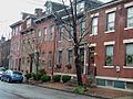
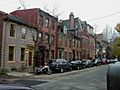
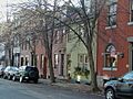
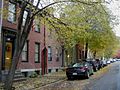
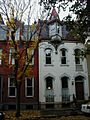
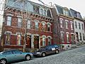
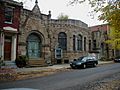
The Mexican War Streets is a special historic area in Pittsburgh, Pennsylvania. It's a neighborhood filled with beautiful old homes, lovely gardens, and streets lined with trees. This area got its start around the time of the Mexican–American War.
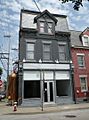
This historic district was first recognized in 1975. It included about 27 acres and 119 important buildings. Later, in 2008, the district grew to include even more buildings, adding 288 more over 25.7 acres. Today, the Mexican War Streets is still growing, with rules to help keep its historic look.
|
Mexican War Streets Historic District
|
|
 |
|

Location in Pittsburgh

Location in Pennsylvania

Location in the United States
|
|
| Location | Irregular pattern between Buena Vista to the north and North Ave. to Reddour St. (increase), Pittsburgh, Pennsylvania |
|---|---|
| Area | 27 acres (11 ha) (original) 25.7 acres (10.4 ha) (increase) |
| Architectural style | Late 19th and 20th Century Revivals, Greek Revival, Late Victorian (original) Greek Revival, Italianate, Romanesque, Second Empire (increase) |
| NRHP reference No. | 75001612 and 08000845 |
Quick facts for kids Significant dates |
|
| Added to NRHP | May 28, 1975 (original) September 4, 2008 (increase) |

History of the Streets
In the late 1800s, a city called Allegheny, Pennsylvania was known for its grand homes. Wealthy families lived in these large houses. The Mexican War Streets area was part of Allegheny before it joined Pittsburgh.
How the Area Started
The land for the Mexican War Streets once belonged to William Robinson Jr.. He was a former mayor of Allegheny. In 1847, he divided his property into streets and building lots. This is how the neighborhood began to take shape.
Street Names from History
Many streets in this district are named after important battles and generals from the Mexican–American War. This war happened from 1846 to 1848.
Some of these street names include:
- Buena Vista Street, named after the Battle of Buena Vista
- Monterey Street, named after the Battle of Monterey
- Palo Alto Street, named after the Battle of Palo Alto
- Resaca Place, named after the Battle of Resaca de la Palma
- Sherman Avenue, named after Thomas W. Sherman
- Taylor Avenue, named after Zachary Taylor
Fremont Street was once named for John C. Frémont. Today, it is known as Brighton Place. These names help us remember a part of American history.
Images for kids
-
-
-
-
-
-
-
-
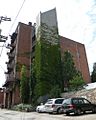
The Mattress Factory art museum at 500 Sampsonia Way. This building is not inside the Mexican War Streets Historic District.
-
The Mattress Factory's annex gallery building at 1414 Monterey Street. It is at the corner of Monterey and Jacksonia streets.


