Middle Branch Reservoir facts for kids
Quick facts for kids Middle Branch Reservoir |
|
|---|---|
 |
|
| Location | Town of Southeast, Putnam County, New York |
| Coordinates | 41°23′24″N 073°38′55″W / 41.39000°N 73.64861°W |
| Type | reservoir |
| Primary inflows | Middle Branch Croton River |
| Primary outflows | Middle Branch Croton River |
| Catchment area | 21 sq mi (54 km2) |
| Basin countries | United States |
| Surface area | 400 acres (160 ha) |
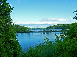
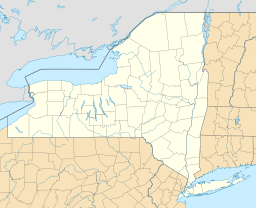
The Middle Branch Reservoir is an important part of the New York City water supply system. It is located in the Town of Southeast in Putnam County. This reservoir is about 35 miles (65 km) north of New York City.
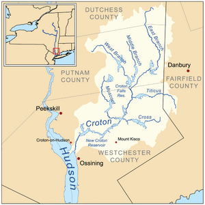
It was created in 1878 by building a dam across the Middle Branch of the Croton River. The Middle Branch Reservoir is one of twelve reservoirs in the Croton Watershed. This watershed helps collect water for the city.
Middle Branch Reservoir: A Key Water Source
The Middle Branch Reservoir covers about 400 acres (1.6 km²). Its average depth is 31 feet (9.4 m), which is like a three-story building. Some areas in the southern part of the reservoir are deeper, reaching up to 50 feet (15 m).
How the Reservoir Works
The reservoir collects water from a large area of 21 square miles (55 km²). This area even reaches into Dutchess County. When the reservoir is completely full, it can hold 4.1 billion gallons (6.4 million m³) of water. This water is then sent to New York City for people to drink and use.

 | Chris Smalls |
 | Fred Hampton |
 | Ralph Abernathy |


