Southeast, New York facts for kids
Quick facts for kids
Southeast, New York
|
||
|---|---|---|
| Town of Southeast | ||
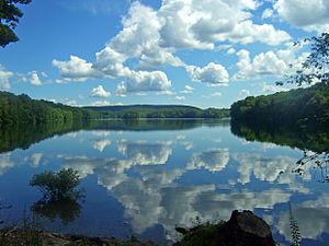
Bog Brook Reservoir
|
||
|
||

Location of Southeast, New York
|
||
| Country | United States | |
| State | New York | |
| County | Putnam | |
| Area | ||
| • Total | 34.98 sq mi (90.60 km2) | |
| • Land | 31.73 sq mi (82.19 km2) | |
| • Water | 3.25 sq mi (8.41 km2) | |
| Elevation | 338 ft (103 m) | |
| Population
(2020)
|
||
| • Total | 18,058 | |
| • Estimate
(2022)
|
||
| • Density | 572.51/sq mi (221.05/km2) | |
| Time zone | UTC-5 (Eastern (EST)) | |
| • Summer (DST) | UTC-4 (EDT) | |
| ZIP code |
10509
|
|
| Area code(s) | 845 | |
| FIPS code | 36-68924 | |
| GNIS feature ID | 0979507 | |
Southeast is a town located in Putnam County, New York, United States. It gets its name because it is in the southeastern part of the county. In 2020, about 18,058 people lived here.
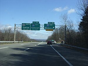
Many people informally call the whole town "Brewster". Brewster is also a small village inside the town. Major roads like Interstate 84 and Interstate 684 pass through Southeast.
Contents
History of Southeast
The first people settled in this area around 1730. They first explored a place called "The Oblong". This area was outside the land claimed by the Philipse family.
The Oblong Land Dispute
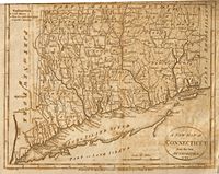
There was a disagreement between New York and Connecticut about their border. This created a strip of land about 4 miles (6.4 km) wide. This strip ran along the state line through what are now several counties. It was called "The Oblong".
Land in this area was sold by both the governor of New York and the King of England for Connecticut. This caused confusion because people had conflicting land deeds. In 1731, the Treaty of Dover settled the border. New York gained control of this land.
Southeast's Early Days
A small part of The Oblong was also known as Southeast. This was because it was the southeasternmost town in Dutchess County at the time. It included the eastern parts of what are now the towns of Patterson and Southeast.
The busiest areas of the "Oblong" version of Southeast were Frederickstown (now Patterson) and Sodom. The town of Southeast was officially formed in 1788. It was the southeast corner of Dutchess County.
In 1795, the town of Frederickstown was divided into Carmel, Kent, and Patterson. At the same time, Southeast lost its northern part to Patterson. It also grew to the west, becoming the shape it is today. In 1812, Putnam County separated from Dutchess County. Today, the most populated area in Southeast is the village of Brewster.
Post Offices in Southeast
The first "South East" post office opened in 1797. At that time, the town was still part of Dutchess County. On June 12, 1812, Putnam County was created from six towns in Dutchess County, including Southeast.
Before central post offices, local ones were set up in stores or train stations. Southeast had nine different post offices over time. Each had its own special postmark:
- Brewster's Station (1850-1883)
- Brewster (1883-present)
- Doanesburgh (1839-1855)
- Dykman's (1851-1894)
- Dykemans (1894-1935)
- Milltown (1826-1867)
- Putnam Lake Branch (1959-1968)
- South East (Dutchess County) (1797-1812)
- South East (Putnam County) (1812-1857)
- Tilly Foster (1881-1958)
By September 1968, all these local offices closed. The only post office for Southeast and Brewster was at 20 Main Street. It used the postmark "Brewster, New York 10509". In the 1990s, this post office moved. It is now on Mount Ebo Road, outside Brewster village. However, it still uses the "Brewster 10509" name and ZIP code.
Geography of Southeast
The town of Southeast covers about 35 square miles (90.6 square kilometers). Most of this is land, but about 2.9 square miles (7.5 square kilometers) is water. The town has several reservoirs that provide water to New York City.
The eastern border of Southeast touches Fairfield County, Connecticut. The southern border touches northern Westchester County.
The Metro-North Railroad serves the town. The Brewster station and Southeast station are on the Harlem Line. From Southeast, express trains can reach Grand Central Terminal in New York City in about 80 minutes.
Population and People
| Historical population | |||
|---|---|---|---|
| Census | Pop. | %± | |
| 1820 | 1,909 | — | |
| 1830 | 2,042 | 7.0% | |
| 1840 | 1,910 | −6.5% | |
| 1850 | 2,079 | 8.8% | |
| 1860 | 2,350 | 13.0% | |
| 1870 | 2,075 | −11.7% | |
| 1880 | 3,500 | 68.7% | |
| 1890 | 4,082 | 16.6% | |
| 1900 | 2,843 | −30.4% | |
| 1910 | 3,282 | 15.4% | |
| 1920 | 3,260 | −0.7% | |
| 1930 | 3,503 | 7.5% | |
| 1940 | 4,053 | 15.7% | |
| 1950 | 4,388 | 8.3% | |
| 1960 | 6,844 | 56.0% | |
| 1970 | 9,901 | 44.7% | |
| 1980 | 11,416 | 15.3% | |
| 1990 | 14,927 | 30.8% | |
| 2000 | 17,316 | 16.0% | |
| 2010 | 18,404 | 6.3% | |
| 2020 | 18,058 | −1.9% | |
| U.S. Decennial Census | |||
In 2020, the town had 18,058 people living in 7,058 households. About 6,516 of these were families.
Most of the people (about 71.95%) were White. About 2.65% were Asian, and 0.69% were Native American. People of Hispanic or Latino background made up about 24.98% of the population.
About 22.0% of households had children under 18 living with them. The average household had 2.77 people. The average family had 3.18 people.
The population was spread out by age. About 27.1% were under 18 years old. About 17.3% were 65 years or older. The average age was 41.9 years.
The average income for a household in Southeast was $104,167. For a family, the average income was $119,232. About 5.2% of the people lived below the poverty line. This included 5.8% of those under 18.
Communities and Locations in Southeast
Southeast has several smaller communities and interesting places:
- Bog Brook Reservoir – A large reservoir in the middle of the town.
- Brewster – The main village, located in the center of the town.
- Brewster Heights – A small community (hamlet) west of Brewster village.
- Brewster Hill – A hamlet north of Brewster village.
- Deans Corners – A hamlet in the southwestern part of the town.
- Deforest Corners – A hamlet in the northeastern corner of the town.
- Doansburg Preserve – A 13-acre nature preserve.
- Drewville Heights – A hamlet in the southwestern part of the town.
- Dykemans – A hamlet on Route 312, north of Brewster Hill.
- East Branch Reservoir – Another reservoir, east of Brewster.
- Fieldstone Pond – A community with condos off Doansburg Road.
- Milltown – A hamlet near the eastern border of the town.
- Peach Lake – A hamlet in the southeastern corner of the town. It is on the northeast shore of a small lake also called Peach Lake.
- Sears Corners – A hamlet where Routes 22 and 312 meet in the northeastern part of town.
- Sodom – A location east of Brewster village.
- Tilly Foster – A hamlet near the western border of the town.
- Tilly Foster Mine – An old, abandoned mine next to the Tilly Foster Farm Museum.
Notable People
Many interesting people have lived in Southeast:
- Julius Baker – A very famous flutist. He was the main flutist for the New York Philharmonic orchestra.
- Chester Beach – A sculptor, who creates art from materials like stone or metal.
- Fanny Crosby – A hymnist, who wrote many religious songs.
- Maurice R. Greenberg – The former head of AIG, a large insurance company.
- Dag Hammarskjöld – He was the Secretary General of the United Nations from 1953 until he passed away in 1961.
- James Kent – A Chancellor of New York from 1814 to 1823. A Chancellor is a high-ranking judge.
- Mark Rivera – A saxophone player who has played with famous musicians like Billy Joel and Elton John.
- John Wolff – A law professor at Georgetown University.
See also
 In Spanish: Southeast para niños
 | Claudette Colvin |
 | Myrlie Evers-Williams |
 | Alberta Odell Jones |


