Putnam County, New York facts for kids
Quick facts for kids
Putnam County
|
|||
|---|---|---|---|
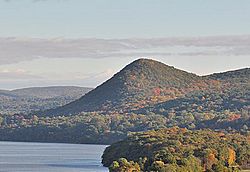
Sugarloaf Hill in the Hudson Highlands
|
|||
|
|||
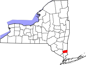
Location within the U.S. state of New York
|
|||
 New York's location within the U.S. |
|||
| Country | |||
| State | |||
| Founded | 1812 | ||
| Named for | Israel Putnam | ||
| Seat | Carmel | ||
| Largest town | Carmel | ||
| Area | |||
| • Total | 246 sq mi (640 km2) | ||
| • Land | 230 sq mi (600 km2) | ||
| • Water | 16 sq mi (40 km2) 6.5% | ||
| Population
(2020)
|
|||
| • Total | 97,668 | ||
| • Density | 424.2/sq mi (163.8/km2) | ||
| Time zone | UTC−5 (Eastern) | ||
| • Summer (DST) | UTC−4 (EDT) | ||
| Congressional district | 17th | ||
Putnam County is a county in the U.S. state of New York. In 2020, about 97,668 people lived here. The main town, called the county seat, is Carmel. Putnam County is part of the beautiful Hudson Valley area.
The county shares borders with Dutchess County to the north and Connecticut to the east. To the south is Westchester County, and the Hudson River is to the west. It's about an hour's drive from Midtown Manhattan. Putnam County is part of the larger New York City area.
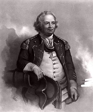
Putnam County was created in 1812 from parts of Dutchess County. It is named after Israel Putnam. He was a hero in the French and Indian War and a general in the American Revolutionary War.
It is known as one of the richest counties in America. This is based on how much money households earn each year.
Contents
History of Putnam County
Long ago, in 1609, the Wappinger Native American people lived along the east side of the Hudson River. They farmed, hunted, and fished. They traded furs with Dutch traders. They received metal tools, alcohol, and firearms in return.
In 1683, the Province of New York and the Connecticut Colony agreed on their border. It was set 20 miles (32 km) east of the Hudson River. Dutchess county was formed, including all of what is now Putnam County.
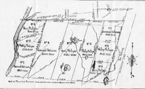
In 1691, Dutch traders bought land from the Wappingers. This land stretched from the Hudson River to Connecticut. Six years later, they sold it to Adolphus Philipse. He got a special permission from the King for this land, called the "Highland Patent." This land later became most of Putnam County.
In 1737, this land was named the South Precinct of Dutchess County. The Philipses rented out farms to people moving from other areas. During the French and Indian War, many Wappinger people moved away.
Settlement in Putnam County was slow compared to other areas. This was because the land was privately owned. Farmers had to pay the Philipse family to rent land. Also, the county was very hilly and rocky. This made it hard to grow crops. So, people mostly used the land for dairy farming and cutting wood.
Some of the first settlers who didn't rent land came to the eastern edge. The unclear border with Connecticut drew farmers from New England. They thought Philipse did not own the disputed area. The first village was Fredericksburg, now called Patterson.
During the American Revolution, the Philipses stayed loyal to the King. Because of this, the New York government took their lands. They sold the Philipse Patent and other lands. After the war, the border dispute was fixed.
Putnam County was separated from Dutchess County in 1812. This happened because the population grew. Also, it was a long way from the county seat in Poughkeepsie.
Travelers in Putnam County often used boats on the Hudson River. Goods were shipped up the river to places like Peekskill, New York. From there, they were taken by road into Putnam County. Or, goods were unloaded directly in Putnam County at Cold Spring, New York. In winter, the river froze, making transport difficult.
The Philipstown Turnpike was built in 1815. It was a toll road from Cold Spring to Connecticut. Wagons carried farm products and iron ore on this road. Later, transportation got much better with the railroad. The Harlem Line was built in the 1840s. It connected Putnam to New York City by train.
Putnam County played a part in the Civil War. Many men from the county served in the military. After the war, industries and farms faced problems. New York City needed more drinking water. So, many farms in Putnam County were flooded to create reservoirs. These reservoirs are part of New York City's Croton Watershed. This led to beautiful scenic lands, which attracted many tourists from New York City.
By the 1900s, better roads brought more vacationers. The Taconic State Parkway was built during the Great Depression. This brought even more visitors. They loved the scenery and affordable hotels. Putnam County's population would double in the summer.
After World War II, Putnam County became a bedroom community for New York City. Many homes were built. However, the rocky hills and protected reservoirs limited how much could be built.
Geography of Putnam County
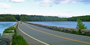
Putnam County covers about 246 square miles (640 km2). About 230 square miles (600 km2) is land, and 16 square miles (41 km2) (6.5%) is water.
It is in the lower Hudson Valley in southeastern New York. The Hudson River is to its west. The New York-Connecticut border is to its east.
Putnam is southeast of Newburgh and north of White Plains. It is about 45 to 65 miles (72 to 105 km) from New York City.
The county's land is mostly hilly. The area near the Hudson River is especially hilly. This part is called the Hudson Highlands. The highest point is Scofield Ridge, about 1,540 feet (470 m) above sea level. The lowest point is sea level along the Hudson River.
The Hudson River, named after Henry Hudson, has always been important for moving goods. Between the hills and rocky areas, Putnam County has many wetlands. It also has creeks, ponds, lakes, and reservoirs. One large lake is Lake Mahopac, which is 583 acres.
Reservoirs and Lakes
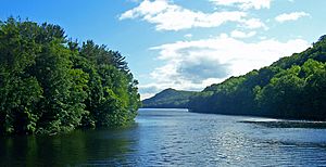
Putnam County is famous for its many clean reservoirs. These are part of the New York City water supply system. They are in the Croton Watershed.
Some of these reservoirs include:
- Bog Brook in Southeast
- Croton Falls Reservoir in Carmel and Southeast
- Diverting Reservoir in Southeast
- East Branch in Brewster
- Middle Branch Reservoir in Southeast
- West Branch in Kent and Carmel
- Boyds Corner Reservoir in Kent
There are also three special lakes in the system in Carmel: Kirk, Gilead, and Gleneida.
Neighboring Counties
- Dutchess County (north)
- Fairfield County, Connecticut (east)
- Westchester County (south)
- Rockland County (southwest)
- Orange County (west)
Climate and Weather
Putnam County has a humid continental climate. This means it has warm, humid summers and cold, snowy winters. In winter, cold, dry air comes from Canada. In summer, warm, moist air comes from the ocean.
Storms often affect the county. In winter, strong storms called Nor'easters bring heavy snow and rain. In summer and fall, thunderstorms can occur. Putnam County gets about 36 inches of snow each year.
People and Population
| Historical population | |||
|---|---|---|---|
| Census | Pop. | %± | |
| 1820 | 11,268 | — | |
| 1830 | 12,628 | 12.1% | |
| 1840 | 12,825 | 1.6% | |
| 1850 | 14,138 | 10.2% | |
| 1860 | 14,002 | −1.0% | |
| 1870 | 15,420 | 10.1% | |
| 1880 | 15,181 | −1.5% | |
| 1890 | 14,849 | −2.2% | |
| 1900 | 13,787 | −7.2% | |
| 1910 | 14,665 | 6.4% | |
| 1920 | 10,802 | −26.3% | |
| 1930 | 13,744 | 27.2% | |
| 1940 | 16,555 | 20.5% | |
| 1950 | 20,307 | 22.7% | |
| 1960 | 31,722 | 56.2% | |
| 1970 | 56,696 | 78.7% | |
| 1980 | 77,193 | 36.2% | |
| 1990 | 83,941 | 8.7% | |
| 2000 | 95,745 | 14.1% | |
| 2010 | 99,710 | 4.1% | |
| 2020 | 97,668 | −2.0% | |
| U.S. Decennial Census 1790-1960 1900-1990 1990-2000 2010-2013 2010 and 2020 |
|||
In 2020, there were 97,668 people living in Putnam County. There were 38,713 households, with about 2.76 people per home. About 50.1% of the population was female.
Most people (77.1%) were White, not Hispanic or Latino. About 16.4% of people were Hispanic or Latino. About 12.9% of the population was born in another country.
About 19.4% of the population was under 18 years old. The average age was 43.4 years.
The average household income was $104,486. About 5.2% of the people lived in poverty.
Most adults (93%) had at least a high school degree. About 39.6% had a bachelor's degree or higher.
Education in Putnam County
Putnam County has several public school districts:
- Brewster Central School District
- Carmel Central School District
- Garrison Union Free School District
- Haldane Central School District
- Lakeland Central School District
- Mahopac Central School District
- North Salem Central School District
- Pawling Central School District
- Putnam Valley Central School District
Mahopac is the biggest school district. It teaches over 5,000 students. It has four elementary schools, a middle school, and a high school.
The county has eight public libraries. These include the Brewster Public Library and the Reed Memorial Library in Carmel.
SUNY Westchester Community College offers some classes at Mahopac High School.
Important Services and Facilities
Most of Putnam County's electricity used to come from the Indian Point Energy Center. This nuclear power plant was in Westchester County and closed in 2021.
Water for the county comes from wells, lakes, or the Hudson River.
The Putnam Hospital Center in Carmel serves the eastern part of the county. Hospitals in Dutchess or Westchester counties serve the western part.
Transportation in Putnam County
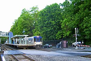
Putnam County has train services. The Harlem Line and the Hudson Line of the Metro-North Railroad run north and south. The Harlem Line stops at Brewster, Southeast, and Patterson. The Hudson Line stops at Manitou, Garrison, Cold Spring, and Breakneck Ridge.
You can connect to Amtrak trains at Croton-Harmon or Poughkeepsie. A train ride to Grand Central Terminal in Manhattan takes about an hour.
There used to be another train line, the Putnam Division. It closed between 1962 and 1980. Its old tracks are now walking and biking trails. These include the South County Trailway and Putnam County Trailway.
Putnam Transit is a bus service run by the county. It provides local public transportation.
Unlike nearby counties, Putnam does not have an airport.
Main Roads
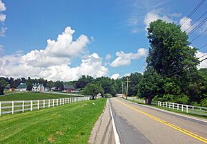
Putnam has two major interstate highways. Interstate 84 runs east-west. Interstate 684 goes south towards the Connecticut border. The Taconic State Parkway runs north-south through the middle of Putnam.
Some other important routes include:
 US 6
US 6 US 9
US 9 US 202
 NY 22
NY 22 NY 52
NY 52 NY 301
 NY 311
 NY 312
Fun Places to Visit
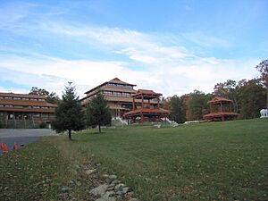
The Chuang Yen Monastery, in Kent, has the largest indoor statue of Buddha in the Western Hemisphere. It also has the only library in the United States focused on Buddhist history.
Clarence Fahnestock State Park is a huge natural area. It has over 50 miles of trails for walking and hiking. Nine miles of the famous Appalachian Trail are here. Donald J. Trump State Park is also in Putnam and Westchester counties, but it is currently closed.
Thunder Ridge Ski Area is a small ski resort in Patterson. It has 30 trails and three ski lifts.
Local News and Media
The Journal News covers news for Putnam County and nearby areas.
For many years, the Putnam County News and Recorder was a local newspaper. It started in 1866. In 2008, it was sold to Roger Ailes, who owned Fox News. His wife, Elizabeth, became the publisher. The paper's content changed, causing some local discussion. The Ailes family also bought the Putnam County Courier in 2009. These two newspapers now share an editor and many stories.
Two other weekly newspapers are the Putnam County Times and Putnam County Press. They are very similar.
In 2010, a news website called Philipstown.info was started. It later launched a print version called The Paper. After its founder passed away, it became a nonprofit. In 2016, it changed its name to The Highlands Current.
Communities in Putnam County
Putnam County has six towns and three villages. There are no cities in the county.
Towns
Carmel
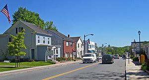
Carmel is the largest town in Putnam County, with about 33,576 people. It includes the county seat, Carmel, and other small areas like Mahopac. Carmel is located along the southern border of the county.
Carmel is known for its historic courthouse and high school. The town was formed in 1795 from an older town called Frederickstown.
Kent

Kent is a town on the northern border of Putnam County. It has about 12,900 people. Coles Mills was settled here in 1747. Kent includes areas like Lake Carmel. Kent was the last part of the original Frederickstown town, founded in 1788.
Patterson
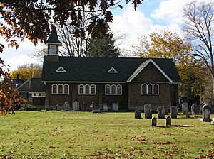
The Town of Patterson is in the northeast part of Putnam County. It has about 11,541 people. Patterson was also formed from Frederickstown in 1795. It includes areas like Putnam Lake.
Philipstown
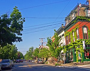
Philipstown is on the western side of Putnam County. It has about 9,831 people. It includes the villages of Cold Spring and Nelsonville. It also includes areas like Garrison. Philipstown was founded in 1788.
West Point is across the Hudson River from Cold Spring. Philipstown has three train stations on the Metro North Hudson line.
Putnam Valley
Putnam Valley is on the southern border of Putnam County. It has about 11,762 people, making it the third largest town. It includes areas like Lake Peekskill.
Putnam Valley was created in 1835. It was split off from Philipstown. Clarence Fahnestock State Park is largely located in Putnam Valley.
Southeast
The Town of Southeast is in the southeastern corner of Putnam County. It has about 18,058 people. It was one of the three original towns formed in 1788.
Southeast is the second-largest town in Putnam County, after Carmel. Major highways like Interstates 684 and 84 meet here. The Metro-North Harlem Line has two stops in this area. Southeast includes the village of Brewster.
Villages
Brewster
Brewster is a village located within the Town of Southeast.
Cold Spring
Cold Spring is a village located within the Town of Philipstown.
Nelsonville
Nelsonville is a village located within the Town of Philipstown.
Other Communities
Putnam County also has other smaller communities called hamlets:
- Dykemans
- Farmers Mills
- Garrison
- Lake Peekskill
- Ludingtonville
- Milltown
- Sodom
- Tompkins Corners
Some places that used to be communities are now called "ghost towns":
- Coles Mills
- Dicktown
- Doanesburgh
- Towners
See also
 In Spanish: Condado de Putnam (Nueva York) para niños
 | Aurelia Browder |
 | Nannie Helen Burroughs |
 | Michelle Alexander |


