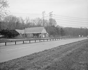
Taconic State Parkway facts for kids
Quick facts for kids
Taconic State Parkway |
|
|---|---|
|
Taconic State Parkway highlighted in red
|
|
| Route information | |
| Maintained by NYSDOT | |
| Length | 104.12 mi (167.56 km) |
| Existed | 1925–present |
| Restrictions | No trucks, buses, trailers, or campers; no vehicles 8 ft (2.4 m) tall or taller; no drivers with learner's permits south of exit 23 |
| Major junctions | |
| South end | |
|
|
| North end | |
| Location | |
| Counties: | Westchester, Putnam, Dutchess, Columbia |
| Highway system | |
| Numbered highways in New York Interstate • U.S. • N.Y. (former) • Reference • County |
|
|
Taconic State Parkway
|
|
| Area | 7,067 acres (2,860 ha) |
| Architect | Westchester County Park Commission; et al. |
| NRHP reference No. | 05001398 |
| Added to NRHP | December 8, 2005 |
The Taconic State Parkway (often called the Taconic or the TSP) is a long road in New York State. It stretches for about 104.12-mile (167.56 km) (167.57 km). This makes it the longest parkway in New York. It runs generally north and south. You can find it between the Hudson River and the borders of Connecticut and Massachusetts.
This special road was designed to be beautiful. It offers amazing views of mountains and valleys. Franklin D. Roosevelt, who later became president, helped make this road happen. He wanted a scenic route to connect people to state parks. The parkway was finished in the early 1960s. In 2005, it was added to the National Register of Historic Places. This means it's an important historical site. It's recognized for its role in developing parkways in the 20th century.
Today, the Taconic is still used to reach many state parks. It's also a major route for people traveling from New York City and Long Island to northern New England and upstate New York. Many people living in the suburbs use the southern parts of the parkway for their daily commute.
Contents
What is the Taconic Parkway Like?
The Taconic Parkway changes as it goes through different areas. In the busy suburbs, it starts as a regular road. It runs next to a train line through a small town. Soon after, it becomes a wide, divided highway. It has gentle curves, much like a major Interstate Highway. This part handles a lot of daily traffic.
How Does the Taconic Parkway Change?
In the Hudson Highlands, the road gets narrower. It winds and climbs quickly to its highest point. When the land becomes flatter, it widens again. Here, you'll find more scenic views. The northern part of the parkway is on ridges. These ridges are between the Hudson Valley and the Taconic Mountains. This section offers beautiful mountain and hilltop views. The road itself curves gently through peaceful, rural areas. Its winding path is why the Taconic is so long.
Westchester County: Busy Beginnings
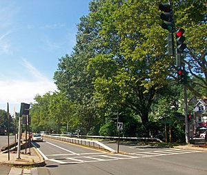
The Taconic starts at Kensico Circle. This is just south of the Kensico Dam. It's also where the Bronx River Parkway ends. At first, the road is narrow. It has two lanes in each direction. A metal barrier divides them. It curves northwest to a traffic light in Valhalla. The Valhalla train station is on one side. The town center is on the other. This is the only busy town the road goes right through.
After passing under a stone bridge, the Taconic goes past Gate of Heaven Cemetery. It runs next to the train tracks. Then, the road crosses over the train line. The two sides of the road split wide apart. They become ramps for the Sprain Brook Parkway.
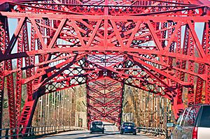
When the roads merge, the Sprain Brook becomes the Taconic. This part is wider, with three lanes in each direction. It has a clear median and shoulders. For the rest of Westchester County, the Taconic has been updated. It's wider and more modern. It looks different from its original design.
Further north, the Taconic goes through quiet, low hills. It passes exits for towns like Pleasantville and Millwood. The two sides of the road sometimes separate far apart. Houses and neighborhoods are built between them. This happens near the bridges over the New Croton Reservoir. This reservoir is part of the New York City water supply system.
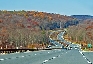
The Taconic then enters Yorktown. This is the last town in Westchester County. An exit here leads to Franklin D. Roosevelt State Park. Another exit connects to US 202 and NY 35. The Bear Mountain Parkway also branches off here. The road then drops into a wide valley. This is where the landscape starts to get more hilly. The parkway continues through undeveloped woods. It passes exits for NY 132 and US 6. Soon after, the parkway crosses into Putnam County.
Putnam County: Winding Roads and Hills
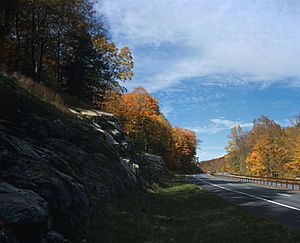
In Putnam Valley, the road narrows. The shoulders disappear. This prepares for the rugged land ahead. From here, the Taconic mostly keeps its original design. The curves become sharper. The land around the road is heavily wooded. It's less developed than Westchester.
The road descends steeply into Peekskill Hollow. It narrows to less than 100 feet (30 m) wide. A high stone wall runs along one side. It then climbs again. The Taconic enters Clarence Fahnestock State Park. For the next 5.5 miles (8.9 km), it crosses this large protected area. You won't see any buildings from the highway.
The two sides of the parkway separate widely in the park. Signs mark the Taconic's highest point. It's almost 1,200 feet (370 m) above sea level. A stone bridge marks the NY 301 exit. This is the main way to get to the state park. The parkway then starts to go downhill. It enters Kent, its last town in Putnam County. Within two miles (3.2 km), it crosses into Dutchess County.
Dutchess County: Farms and Suburbs
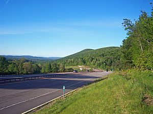
In East Fishkill, the Taconic starts to level out. This is the largest section of the parkway in any county. The road widens. You can see hills in the distance. Sometimes, there are views of the valley to the west.
An old crossing for the Appalachian Trail was made safer in 2000. It used to have a flashing light. Now, it's a grade-separated exit. The Taconic then goes northeast along a steep slope. Stone walls are on both sides. This ends at the Interstate 84 (I-84) interchange. This is the only full cloverleaf interchange on the Taconic.
North of I-84, the parkway bends northwest. It takes on a new look for most of Dutchess County. The median is wider and sometimes cleared. The turns are gentler. This area used to be mostly farms. Now, it has more homes and golf courses.
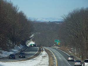
The road then bends back northeast. It narrows through wooded areas. It passes the Beekman Road exit. Further north, it reaches NY 82 at Arthursburg. Some old crossings have been closed. New ramps have been built. The road widens again through a wooded area. It narrows past another service area. Then, it drops to cross a creek. It rises again to the NY 55 exit. This road leads to Poughkeepsie.
The parkway continues north into Pleasant Valley. The two sides of the road separate widely here. This happens in the woods east of James Baird State Park. The roads come back together. The Taconic climbs a hill, then descends. Several local roads cross the parkway. It reaches a straight section. Then, it curves to the US 44 exit. This is another main route to Poughkeepsie.
The road goes through more woods. It makes a long curve to the Hibernia Road crossing. A bridge over Wappinger Creek separates this from the Hollow Road crossing. This takes the road into Clinton. Further north, NY 115 ends at an exit. The parkway continues through rural areas. Fields and woods alternate. It climbs onto high ground. You can sometimes see the Catskill Escarpment to the west. The parkway enters Milan. It climbs slowly through wooded areas. It passes the Cold Spring Road crossing. The next exit, at NY 199, is the last in Dutchess County. After another long bend, the Taconic goes north. It crosses into Columbia County.
Columbia County: Open Views and Farmland
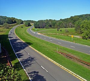
The land in Columbia County is similar to northern Dutchess. More views open up as the road levels out. The farms and woods are larger here. After entering the county, the Taconic goes north through Gallatin. It passes through unbroken woods. It bends slightly to the CR 8 intersection. This leads to Lake Taghkanic State Park. The access road for the park leaves the northbound lanes. Further north is the second interchange with NY 82.
North of that exit, the parkway bends northeast. It briefly enters Claverack. Then, it goes back into Taghkanic. It re-enters Claverack. It heads east briefly, then north again. This leads to the NY 23 exit. This is near the hamlet of Martindale. It bends northeast to Philmont. Here, NY 217 ends at an exit with the Taconic.
Past a rise, there are parking areas for scenic overlooks. They offer wide views west to the Catskills. The road curves into Ghent. There are two more intersections here. One is Rigor Hill Road, which has a gas station.
The Taconic continues north for five miles (8.0 km) more. It crosses into Chatham. An exit for NY 203 is soon after. Signs warn drivers that the NY 295 exit is the last before the Thruway tolls. The intersections in the last few miles are only for southbound traffic. This helps commercial vehicles that accidentally got on the parkway to exit. A small toll booth marks the end of the Taconic State Parkway. It's about 104 miles (167 km) from Kensico Circle.
Why is the Taconic Parkway So Beautiful?
[[multiple image |header=Parkway scenery |header_align=center |align=right |direction=vertical |width=220 |image1=Taconic State Parkway NB near LaGrangeville, NY.jpg |alt1=A paved roadway seen from its right with a solid yellow line on the left, dashed white line in the middle and solild white at right goes into an area at the center of the image where branches from the tall trees on either side hang over and shade it from the sunlight coming in from the left |caption1=Trees overhanging the Taconic in LaGrange, Dutchess County |image2=Stone bridge on Taconic State Parkway near Shrub Oak, NY.jpg |alt2=A stone bridge over a divided highway in an autumn landscape |caption2=Stone overpass in Shrub Oak, Westchester County ]] Landscape architects worked closely with engineers. They made sure the Taconic was beautiful and safe. Curves on hills were banked. This helps cars grip the road better. It also helps water drain away. Curves were placed to give good views. They also reduced blind spots.
The road was designed to show off the scenery. This includes wooded hillsides and farms. Trucks were not allowed on the road. This meant tree branches could hang over the lanes. This creates a park-like feeling. The curve of the AMVETS Memorial Bridge matches the hills. Plants along the road were chosen carefully. They blend with the surrounding woods.
Overpasses were built with local stone. This made them look natural. Even the intersections helped connect the road to the landscape. Many people have praised the Taconic. They say it blends perfectly with nature. Writer Lewis Mumford called it "a consummate work of art." He said engineers avoided "brutal assaults against the landscape." Novelist William Kennedy called it "a 110-mile [180 km] postcard." He said it was "the most beautiful road I've ever known."
How Was the Taconic Parkway Built?
The way the parkway was built changed over 40 years. The northern parts used newer technology. But some things stayed the same throughout.
Early Planning and Challenges
The Westchester County parts were planned first. Their engineers later helped with the northern sections. At first, the Taconic State Parks Commission (TSPC) didn't have much money. They struggled to hire enough engineers. The land was also challenging.
One big problem was a disagreement between Robert Moses and Franklin D. Roosevelt. Moses controlled the park budget. He kept the TSPC's money low. This made it hard for them to buy land or hire staff. Roosevelt was very upset by this. The lack of money and local resistance made the commission change plans. They had to give up on routing the parkway over Stissing Mountain.
The situation improved when Roosevelt became governor in 1928. He could then make sure the parkway was built. He had the final say over the state budget.
Building the First Sections
In 1929, construction began on the Westchester section. The connection to the Taconic started in 1930. In April 1931, digging finally began in Putnam County. Roosevelt and Moses both spoke at the ceremony. Roosevelt still hoped the parkway would reach Canada one day. Eight months later, a new steel bridge opened over the reservoir. It was the longest of its kind then. The next day, 20,000 cars used the new road. They drove from the city into the Manhattan Hills.
Overcoming Difficulties in Putnam County
Drivers couldn't go into Putnam County yet. Land prices were rising there. The county leaders didn't support the parkway. They thought the county had enough roads. This made it hard for engineers to plan.
The section going into Peekskill Hollow was very difficult. It cost ten times more to build than other parts. Workers had to move a lot of earth. They also replanted many trees and shrubs. Roosevelt still cared about the parkway. He made changes to the stone work on the Peekskill Hollow Road overpass. This made it match local styles.
The first part of the TSPC's section was finished in late 1932. Paving began in 1933. The first 2.4 miles (3.9 km) had to be redone. The concrete froze in winter because of bad drainage. Horse riding paths were opened along the median. These went to Route 301 and Fahnestock State Park. The road was temporarily opened in July 1935. It opened permanently a few weeks later.
Expanding into Dutchess County
Roosevelt became president in 1932. The TSPC used money from his New Deal programs. These funds helped build the road. Workers from the Civilian Conservation Corps (CCC) improved the parks and landscaping. Roosevelt still gave suggestions sometimes. He suggested where to put picnic areas.
The next part of the Taconic opened in late 1939. It went north to NY 55. This was nine miles (14 km) east of Poughkeepsie. This connection helped traffic access the new Mid-Hudson Bridge. The Taconic became a more important road.
The War Years and Beyond
In 1940, traffic on the parkway increased a lot. It was being used for more than just fun weekend trips. The TSPC built two more service areas. They were Shenandoah and Todd Hill Road. In 1941, the U.S. entered World War II. This stopped construction for a while.
The War Department called the Taconic a military highway. It had to be open for troop movements. The Croton Reservoir bridge was important. It was protected by armed guards. The speed limit was lowered. Maintenance was limited to snow removal and mowing. Streetlights were turned off.
Planning continued for the northern Dutchess section. It would be built after the war. The commission also looked for ways to improve the existing road. The Hawthorne Circle was a big problem. It had many accidents and traffic jams. A study in 1944 suggested replacing it with a three-level interchange.
The road's northern end was still undecided. In 1942, a state official suggested it go west towards Albany. This would connect to a proposed bridge over the Hudson. But this route would be too expensive. In 1943, it was decided the Taconic would continue north as planned.
In 1946, construction started again after the war. Paving began to Clinton Corners. But there was a problem with Lake Taghkanic. Many cottages had been built there. The proposed route would mean tearing down 110 of them. The owners objected. They got a law passed to move the parkway further west. This delayed planning for two years.
Governor Thomas E. Dewey wanted a statewide "thruway" system. These roads would be for trucks and buses. Part of this was the "Berkshire Thruway." This would be the Taconic's northern end. In October 1949, Dewey opened the section between Routes 55 and 199.
Finishing the Parkway in Columbia County
As builders moved north into Columbia County, they used the open land. They made the road more scenic. Medians were wider. Views of the Catskills were easier to see. A service station was built at Lake Taghkanic State Park. A scenic overlook was also added.
Dewey opened the link from Route 199 to 82 in October 1954. He was proud of getting the parkway out of Dutchess County. He also wanted parkways to be straighter. Robert Moses remembered Roosevelt's old dream. He wanted the parkway to go all the way to Canada. But this seemed unlikely. The Taconic would end at the Thruway. The Adirondack Northway was also being planned.
The last section of the Taconic was paved in the early 1960s. It went to the Thruway. Governor Nelson Rockefeller suggested a new group manage the road. This was the East Hudson Parkway Authority (EHPA). The TSPC didn't like this idea. They feared their work would become just one of many roads. They also worried about tolls. The EHPA was created. The TSPC operated the Taconic until 1962.
The EHPA set the toll gate at the Thruway as the northern limit. This ended any plans to continue the road further north. A ceremony was planned for November 25, 1963. It was canceled because President John F. Kennedy was assassinated three days earlier.
Modern Improvements and Safety
The Taconic has been updated over the years. Some parts in Westchester were already old by 1941. After the war, money was tight. Most funds went to finishing the road. One improvement was made in 1954. The intersection at Underhill Road was removed. A new bridge was built.
In 1962, the EHPA started improving the road. The original parkway became the northbound lanes. A new southbound road was built. These changes made the road safer. They also made it better for commuters. But they changed the road's original look. It was widened. Concrete was replaced with asphalt. Wooden guardrails were replaced with steel ones.
In 1964, I-84 was built. This gave the middle of the Taconic a new connection. It made it easier to reach areas like Danbury and Newburgh. Other EHPA improvements included a new interchange at Hawthorne Circle. A new southbound bridge was built at Croton Reservoir. This bridge was called very beautiful in 1970.
The EHPA also wanted to improve the Peekskill Hollow section. It had many accidents. The trees and cliffs made it icy in winter. The EHPA planned to build a metal barrier. They also thought about building a new southbound road. But local residents objected. They worried about the impact on Fahnestock State Park. They also feared isolating a summer camp. Because of this, the EHPA stopped these plans.
In 1979, the EHPA closed down. The state Department of Transportation (NYSDOT) took over the road. They continued to improve the parkways.
Taconic Parkway Today: Safety First
In 1980, the Sprain Brook Parkway was completed. It connected to the Taconic. This provided a faster way to travel. DOT continued to update the road in Westchester. They changed exits and widened roads. They put asphalt over the original concrete. Most of the parkway in Westchester now looks different from its original design.
The Taconic was named a State Scenic Byway in 1992. A plan was made to keep it scenic and safe. This plan helps guide future changes. In the 21st century, DOT focused on safety in Dutchess County. Traffic had increased a lot there. A report in 2003 suggested changes to many intersections. Some were closed completely. Others had their medians closed.
There was some local debate about these changes. Some rural residents worried about being isolated. Others welcomed noise barriers near their homes. There are no plans to change intersections north of Route 199. Traffic hasn't increased much there. The Pudding Street intersection in Putnam County is being replaced. This will make it safer.
In 2005, the entire parkway was added to the National Register of Historic Places. This made it a large historic district. In 2006, Donald Trump donated land. It became Donald J. Trump State Park.
In 2009, a serious accident happened on the parkway. It led to safety improvements. Two large "Wrong Way" signs were installed. All onramp signs were checked. A new law, Leandra's Law, was passed. It made it a serious crime to drive while impaired with a child in the car. This was partly a result of the accident.
In 2009 and 2010, old guide rails were replaced. New zinc-coated guide rails were installed. The Taconic has a lower accident rate than average for New York. But state police still blame speeding, wildlife, and trucks using GPS. The state plans to add more signs. These signs will clearly state that trucks are not allowed on parkways.
Exit List
The exits on the Taconic used to have numbers with a letter for the county. These numbers would reset at each county line. The signs were small. From 2016 to 2018, new signs were put up. The new exit numbers are based on miles. This means they match the nearest mile marker. Intersections that are not exits do not have numbers. The Taconic is the longest parkway in the state. It used to be unique for not having clear exit numbers.
| County | Location | Mile |
Roads intersected | Notes | ||
|---|---|---|---|---|---|---|
| Westchester | North Castle | 0.00 | Kensico Circle; southern terminus; northern terminus of Bronx River Parkway | |||
| Valhalla | 0.10 | At-grade intersection; southbound exit and northbound entrance | ||||
| 0.40 | At-grade intersection | |||||
| 0.45 | Valhalla Place | Northbound at-grade intersection | ||||
| 0.50 | Legion Drive | Intersection replaced with overpass | ||||
| 1.20 | Lakeview Avenue – Kensico Cemetery, Sharon Gardens | At-grade intersection | ||||
| 1.60 | Commerce Street | At-grade intersection | ||||
| Mount Pleasant | 2.40 | At-grade intersection | ||||
| none | ||||||
| Hawthorne | 2.85 | Southbound exit and northbound entrance | ||||
| 3.10 | Northbound exit and southbound entrance | none | ||||
| 3.30 | Northbound exit and southbound entrance | |||||
| 3.80 | Southbound exit and northbound entrance | |||||
| Mount Pleasant | 4.00 | Northbound exit and entrance | ||||
| 4.67 | Northbound exit and southbound entrance; southern terminus of Briarcliff–Peekskill Parkway | |||||
| Briarcliff Manor | 5.63 | Pleasantville Road – Briarcliff Manor, Pleasantville | ||||
| 7.00 | Chappaqua Road | Intersection replaced with overpass | ||||
| Millwood | 8.30 | Campfire Road | Intersection eliminated | |||
| 8.50 | ||||||
| New Castle | 9.80 | Pines Bridge Road | Northbound exit and southbound entrance | |||
| Yorktown | 10.84 | Signed as exits 11A (east) and 11B (west) southbound | ||||
| 12.00 | Illington Road | Intersection replaced with overpass | ||||
| Croton Reservoir | 12.70– 12.90 |
20.44– 20.76 |
AMVETS Memorial Bridge | |||
| Yorktown | 14.00 | Underhill Avenue – Croton-on-Hudson, Yorktown Heights | ||||
| 15.00 | Baldwin Road | |||||
| 16.40 | Franklin D. Roosevelt State Park | Additional southbound entrance from White Hill Road | ||||
| Crompond | 17.14 | |||||
| 17.36 | No northbound entrance | |||||
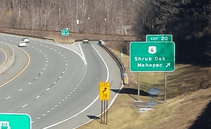
| Shrub Oak | 19.76 | Northbound exit and southbound entrance; other movements via exit 20 | ||||
| 20.13 | ||||||
| Putnam | Putnam Valley | 23.20 | Bryant Pond Road | |||
| 24.30 | Bullet Hole Road | Intersection eliminated | ||||
| 25.65 | Peekskill Hollow Road (CR 21) | |||||
| Fahnestock State Park | 28.10 | Pudding Street | Exit opened December 2020 ahead of schedule. | |||
| 28.40 | Wiccopee Road | Intersection eliminated | ||||
| 31.14 | Signed as exits 31A (east) and 31B (west) | |||||
| Kent | 33.30 | Hortontown Hill Road | Intersection with right-in/right-out connections | |||
| 33.90 | Knapp Road | Northbound at-grade intersection | ||||
| Dutchess | East Fishkill | 35.00 | Miller Hill Road | Location of Appalachian Trail crossing | ||
| 36.92 | Site of former exit with Jackson Road; signed as exits 37A (east) and 37B (west; exits 52A-B on I-84 | |||||
| 37.60 | Hosner Mountain Road | Former southbound entrance | ||||
| 38.39 | ||||||
| 40.10 | Intersection with right-in/right-out connections | |||||
| 40.90 | Stormville Road | Intersection eliminated | ||||
| 41.40 | ||||||
| LaGrange | 43.69 | Signed as exits 43A (east) and 43B (west) | ||||
| 44.40 | No northbound entrance | |||||
| 46.25 | ||||||
| none | Todd Hill Road | Intersection with right in/right out connections | ||||
| 47.05 | Signed as exits 47A (east) and 47B (west) | |||||
| 47.55 | Skidmore Road | Intersection eliminated | ||||
| 48.30 | James Baird State Park | Left exit northbound | ||||
| 49.65 | Mountain Road | At-grade intersection; no turns | ||||
| 50.50 | McDonnell Road | Southbound at-grade intersection | ||||
| Pleasant Valley | 52.00 | Rossway Road / Drake Road | At-grade intersection | |||
| 52.80 | Tyrrel Road | At-grade intersection | ||||
| 53.75 | Forest Ridge Lane | At-grade intersection | ||||
| 54.72 | ||||||
| Clinton, Dutchess County | 57.60 | Hibernia Road | Intersection with right-in/right-out connections | |||
| 57.80 | Northbound at-grade intersection | |||||
| 58.30 | ||||||
| 61.30 | Willow Lane | Southbound at-grade intersection | ||||
| Stanford | 62.80 | Nine Partners Road | Intersection with right-in/right-out connections | |||
| 64.60 | ||||||
| Milan | 65.80 | Willow Brook Road | Intersection with right-in/right-out connections | |||
| 66.40 | Cold Spring Road | Intersection with right-in/right-out connections | ||||
| 67.75 | ||||||
| 69.30 | North Road | At-grade intersection | ||||
| 70.30 | Wilbur Flats Road | At-grade intersection | ||||
| 70.98 | Ferris Lane | At-grade intersection | ||||
| 72.24 | ||||||
| Columbia | Gallatin | 73.10 | Ten Neighbors Road | At-grade intersection | ||
| 76.30 | ||||||
| Taghkanic | 78.30 | At-grade intersection; also serves Lake Taghkanic State Park | ||||
| 78.60 | Lake Taghkanic State Park | Northbound at-grade intersection and southbound entrance | ||||
| 79.72 | ||||||
| 80.50 | At-grade intersection | |||||
| 81.60 | Post Hill Road | At-grade intersection | ||||
| 84.10 | Snydertown Road | At-grade intersection | ||||
| 84.60 | Manor Rock Road | At-grade intersection | ||||
| 86.50 | Bauer Road | At-grade intersection | ||||
| Claverack | 87.30 | Palmer Road | At-grade intersection | |||
| 87.77 | Access to Athens-Hudson Ferry and Rip Van Winkle Bridge | |||||
| Philmont | 91.34 | |||||
| 92.00 | ||||||
| Ghent | 93.70 | Harlemville Road | At-grade intersection | |||
| 94.90 | Rigor Hill Road | At-grade intersection, gas station | ||||
| Town of Chatham | 99.25 | |||||
| 101.88 | ||||||
| 104.00 | Southbound exit and northbound entrance | |||||
| 104.10 | ||||||
| 104.12 | Exit B2 on I-90 / Thruway; northern terminus | |||||
| 1.000 mi = 1.609 km; 1.000 km = 0.621 mi | ||||||
 | George Robert Carruthers |
 | Patricia Bath |
 | Jan Ernst Matzeliger |
 | Alexander Miles |


