Philipstown, New York facts for kids
Quick facts for kids
Philipstown, New York
|
||
|---|---|---|
| Town of Philipstown | ||
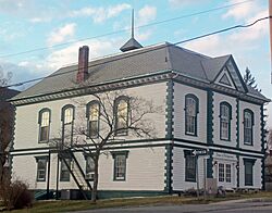
Town hall
|
||
|
||
| Etymology: Early local landowners, the Philipse family | ||
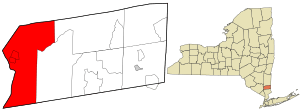
Location of Philipstown, New York
|
||
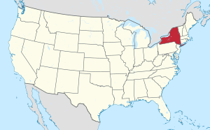
Location of New York in the United States
|
||
| Country | United States | |
| State | New York | |
| County | Putnam | |
| Founded | 1788 | |
| Area | ||
| • Total | 51.55 sq mi (133.52 km2) | |
| • Land | 48.77 sq mi (126.32 km2) | |
| • Water | 2.78 sq mi (7.20 km2) | |
| Elevation | 200 ft (60 m) | |
| Lowest elevation | 0 ft (0 m) | |
| Population
(2020)
|
||
| • Total | 9,831 | |
| • Density | 201.56/sq mi (77.82/km2) | |
| Time zone | UTC-5 | |
| • Summer (DST) | UTC-4 (Eastern Daylight Time) | |
| ZIP code |
10516 and 10524
|
|
| Area code(s) | 845 | |
| FIPS code | 36-079-57584 | |
| FIPS code | 36-57584 | |
| GNIS feature ID | 0979363 | |
| Wikimedia Commons | Philipstown, New York | |
| Website | Town of Philipstown | |
Philipstown is a town in Putnam County, New York, United States. It is located in the western part of the county. In 2020, about 9,831 people lived there.
Contents
History of Philipstown
How Philipstown Began
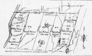
In 1697, a rich landowner named Adolphus Philipse bought a large piece of land. This land was called the Highland Patent. It was about 250 square miles. It stretched along the eastern side of the Hudson River.
The first people settled in the western part of this land around 1715. In 1754, the Highland Patent was divided among Philipse's family. In 1788, Philipstown was officially created from parts of this land. It was one of the first three towns in what is now Putnam County.
Changes to Town Borders
Over the years, Philipstown's borders changed a few times. In 1806, a small part of the town was given to the Town of Fishkill. Later, in 1839, Putnam Valley became its own town, taking some land from Philipstown. In 1877, a small piece of land was also transferred to Kent.
Main Communities in Philipstown
Philipstown has several important communities. These include the village of Cold Spring, the hamlet of Garrison, and the village of Nelsonville.
Geography of Philipstown
Philipstown covers about 51.6 square miles (133.6 square kilometers). Most of this area, about 48.8 square miles (126.4 square kilometers), is land. The rest, about 2.8 square miles (7.2 square kilometers), is water.
Where Philipstown is Located
The Hudson River forms the western border of Philipstown. Across the river are towns in Orange County and Rockland County. To the north, Philipstown borders towns in Dutchess County. The southern border is next to a town in Westchester County. On its eastern side, Philipstown is next to Kent and Putnam Valley.
Local News and Media
Philipstown has two weekly newspapers that keep residents informed. The Highlands Current started in 2010 and is published every Friday. The Putnam County News & Recorder is an older paper, founded in 1868, and comes out every Wednesday.
Population and People
How Many People Live Here?
| Historical population | |||
|---|---|---|---|
| Census | Pop. | %± | |
| 1820 | 3,733 | — | |
| 1830 | 4,816 | 29.0% | |
| 1840 | 3,814 | −20.8% | |
| 1850 | 5,063 | 32.7% | |
| 1860 | 4,526 | −10.6% | |
| 1870 | 5,117 | 13.1% | |
| 1880 | 4,375 | −14.5% | |
| 1890 | 4,113 | −6.0% | |
| 1900 | 4,642 | 12.9% | |
| 1910 | 5,345 | 15.1% | |
| 1920 | 3,272 | −38.8% | |
| 1930 | 3,982 | 21.7% | |
| 1940 | 4,246 | 6.6% | |
| 1950 | 4,332 | 2.0% | |
| 1960 | 5,918 | 36.6% | |
| 1970 | 7,717 | 30.4% | |
| 1980 | 9,155 | 18.6% | |
| 1990 | 9,242 | 1.0% | |
| 2000 | 9,422 | 1.9% | |
| 2010 | 9,662 | 2.5% | |
| 2020 | 9,831 | 1.7% | |
| U.S. Decennial Census | |||
In 2010, there were 9,662 people living in Philipstown. This means there were about 198 people for every square mile. Most people (93.1%) were White. About 6.9% of the population was Hispanic or Latino.
Families and Households
There were 3,685 households in the town in 2010. About 31.4% of these households had children under 18 living with them. Most households (58.2%) were married couples living together. The average household had 2.53 people.
Age Groups in Philipstown
The population in Philipstown is made up of different age groups. About 28.1% of the people were under 20 years old. People aged 45 to 64 made up the largest group, at 35.3%. The median age in the town was 41 years old.
Communities and Places in Philipstown
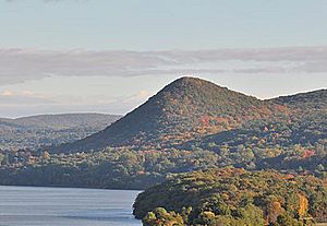
Philipstown is home to many interesting communities and locations:
- Cold Spring – A village located right by the Hudson River.
- Constitution Island – An island also located by the Hudson River.
- Continental Village – A small community in the southeastern part of the town.
- Clarence Fahnestock State Park – A large state park in the northeastern section.
- Fahnestock Corners – A specific spot within the town.
- Forsonville – A community in the southern part, southeast of Garrison.
- Garrison – Another community located by the Hudson River.
- Garrison Four Corners – A location southeast of Garrison.
- Glenclyffe – A community near the Hudson River.
- Graymoor – A community in the southeastern part of the town.
- Hudson Highlands State Park – A state park in the southwestern part of the town.
- Manitou – A community in the very southwestern corner, by the Hudson River.
- McKeel Corners – Another specific spot.
- Nelsonville – A village located northeast of Cold Spring.
- North Highlands – A community northeast of Nelsonville.
- South Highland – A community near the eastern border of the town.
- Travis Corners – A location east of South Highland.
See also
 In Spanish: Philipstown para niños
 | Leon Lynch |
 | Milton P. Webster |
 | Ferdinand Smith |


