Middle River, Maryland facts for kids
Quick facts for kids
Middle River, Maryland
|
|
|---|---|

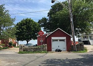
End of Wilson Point Road in Middle River, Maryland
|
|

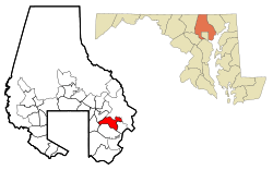
Location of Middle River, Maryland
|
|
| Country | |
| State | |
| County | |
| Area | |
| • Total | 13.64 sq mi (35.34 km2) |
| • Land | 12.76 sq mi (33.04 km2) |
| • Water | 0.89 sq mi (2.30 km2) |
| Elevation | 26 ft (8 m) |
| Population
(2020)
|
|
| • Total | 33,203 |
| • Density | 2,602.52/sq mi (1,004.86/km2) |
| Time zone | UTC−5 (Eastern (EST)) |
| • Summer (DST) | UTC−4 (EDT) |
| ZIP code |
21220
|
| Area code(s) | 410 and 443 |
| FIPS code | 24-52300 |
| GNIS feature ID | 0590793 |
Middle River is a community in Baltimore County, Maryland, United States. It's called a census-designated place, which means it's an area with a lot of people that the government counts as a single place, even though it's not an official city or town. In 2020, about 33,203 people lived there.
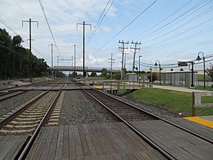
Middle River first appeared on maps in 1877 as a train station. By 1898, it had its own Post Office and a small network of streets. The community grew a lot in the 1930s and 1940s. A special housing area called "Aero Acres" was built. This area was for people who worked at the Glenn L. Martin Company, which made airplanes. Famous architects Skidmore, Owings & Merrill designed the homes in Aero Acres. They built 600 houses there in 1941.
Contents
Where is Middle River?
Middle River is located in Maryland at about 39.33 degrees North and 76.44 degrees West.
The area of Middle River is about 35.34 square kilometers (13.64 square miles). Most of this area is land, about 33.04 square kilometers (12.76 square miles). The rest is water, which is about 2.30 square kilometers (0.89 square miles).
Who Lives in Middle River?
The number of people living in Middle River has changed over the years:
| Historical population | |||
|---|---|---|---|
| Census | Pop. | %± | |
| 1960 | 10,825 | — | |
| 1970 | 19,935 | 84.2% | |
| 1980 | 26,756 | 34.2% | |
| 1990 | 24,616 | −8.0% | |
| 2000 | 23,958 | −2.7% | |
| 2010 | 25,191 | 5.1% | |
| 2020 | 33,203 | 31.8% | |
| U.S. Decennial Census | |||
In 2000, there were about 23,958 people living in Middle River. About 33% of the homes had children under 18 living there. The average age of people in Middle River was 36 years old.
A Look at Middle River's Past
Middle River has an interesting history. Before, during, and after World War II, many people from the Appalachian mountains moved to the Baltimore area, including Middle River. These people were looking for jobs and a better life. They helped the community grow.
Schools in Middle River
Middle River has several schools that serve the local children:
- Victory Villa Elementary School was first built in the 1930s. It was created to teach the children of the people working at the Martin Aerospace Center. The school was rebuilt in 2018.
- Martin Boulevard Elementary School was built in the 1950s. It was rebuilt again in the 1990s to make space for more students as the community grew.
- Middle River Middle School used to teach students from seventh to ninth grade. Now, it teaches students from sixth to eighth grade. After middle school, students often go to Kenwood High School in nearby Essex.
- Glenmar Elementary School is located across from Middle River Middle School.
- Hawthorne Elementary is another school that borders the community of Essex.
See also
 In Spanish: Middle River (Maryland) para niños
 | Leon Lynch |
 | Milton P. Webster |
 | Ferdinand Smith |


