Milakokia River facts for kids
Quick facts for kids Milakokia River |
|
|---|---|
| Country | United States |
| State | Michigan |
| Physical characteristics | |
| Main source | Milakokia Lake 46°04′40″N 85°48′25″W / 46.0777222°N 85.8070418°W |
| River mouth | Lake Michigan Port Inland 581 ft (177 m) 45°58′02″N 85°53′37″W / 45.9672044°N 85.8937247°W |
| Length | 17.6 mi (28.3 km) |
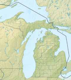
The Milakokia River is a cool waterway located in the Upper Peninsula of Michigan, in the United States. This river is about 17.6-mile-long (28.3 km), which is like running a marathon and a half! It flows through two counties, Mackinac County and Schoolcraft County, before its journey ends in the big Lake Michigan.
Exploring the Milakokia River
The Milakokia River is a natural feature that plays a part in the local environment of Michigan. It's a relatively short river, but it connects different parts of the landscape. Rivers like the Milakokia are important for the plants and animals that live nearby.
Where Does the Milakokia River Start and End?
Every river has a beginning and an end! The Milakokia River starts its journey from Milakokia Lake. This lake is its "source," meaning it's where the river gets its water to begin flowing.
After winding its way through the land, the Milakokia River eventually reaches its "mouth." The mouth of the Milakokia River is where it empties into Lake Michigan. This happens near a place called Port Inland. So, the river's water becomes part of the much larger Great Lake!
 | Audre Lorde |
 | John Berry Meachum |
 | Ferdinand Lee Barnett |


