
Milecastle 28 facts for kids
Quick facts for kids Milecastle 28 |
|
|---|---|
| Northumberland, England, UK | |

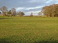
B6318 Military Road at the site of Milecastle 28
|
|

Milecastle 28
Location in Northumberland
|
|
| Coordinates | 55°01′45″N 2°09′10″W / 55.029086°N 2.152839°W |
Milecastle 28 (Walwick) was a small fort built by the Romans as part of Hadrian's Wall in England. Today, you can't see any remains of it. It was located just south of the B6318 Military Road in a place called Walwick.
Contents
Building Milecastle 28
Milecastle 28 was likely a long-axis milecastle. This means its longer sides faced east and west along the Wall. We don't know what kind of gates it had. Roman soldiers from either the legio VI Victrix (based in York) or the legio XX Valeria Victrix (based in Chester) probably built it.
Searching for the Milecastle
People have looked for Milecastle 28 many times over the years. It's been quite hard to find!
- 1957 - A book about Hadrian's Wall mentioned a raised area near Walwick Hall. This area might have been where the milecastle stood. It suggested it was a long-axis milecastle.
- 1967 - Experts from English Heritage investigated the site. They couldn't confirm the milecastle's exact spot. However, they found a small slope that might have been its south side.
- 1989 - Another English Heritage team checked the area again. They found no clear signs of the milecastle. The slope seen earlier seemed too new and too far from the Wall. They concluded that the milecastle's exact location is still a mystery. It is thought to be somewhere around the general area of NY 903 705.
Guard Towers: Turrets 28A and 28B
Every milecastle on Hadrian's Wall had two smaller guard towers, called turrets. These turrets were placed about one-third and two-thirds of a Roman mile to the west. Soldiers from the milecastle would have guarded these turrets. Milecastle 28 had two turrets: Turret 28A and Turret 28B.
Turret 28A
You can't see any remains of Turret 28A today. It was first described in 1727 by Alexander Gordon. He said it was a small stone tower, about 12 feet long and a bit less wide. It was found again in 1920, about 300 metres west of Walwick Hall.
Location on Ordnance Survey map: 55°01′52″N 2°09′38″W / 55.031035°N 2.160512°W
Turret 28B
Turret 28B is located the usual distance from Turret 28A and the next milecastle, Milecastle 29. In 1965, experts found slight traces of stones sticking out of the ground. These stones seemed to show the outline of a structure. It was about 4.0 metres north-south and 5.0 metres east-west.
Location on Ordnance Survey map: 55°01′58″N 2°10′04″W / 55.032660°N 2.167699°W
Visiting the Sites
The sites of Milecastle 28 and Turret 28A are not open to the public. However, the site of Turret 28B is just off the Hadrian's Wall National Trail. This means you can get close to it if you are walking the trail.
Images for kids
-
The site of Turret 28B
_Turret_28b_(near_Rye_Hill)_-_geograph.org.uk_-_1250150.jpg)
