Milecastle 29 facts for kids
Quick facts for kids Milecastle 29 |
|
|---|---|
| Northumberland, England, UK | |
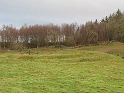
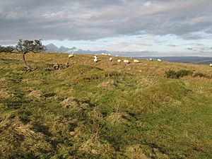
The site of Milecastle 29
|
|
|
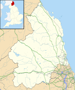
Location in Northumberland
|
|
| Coordinates | 55°02′03″N 2°10′32″W / 55.034267°N 2.175435°W |
Milecastle 29 (Tower Tye) was a small fort built by the Romans as part of Hadrian's Wall. Today, you can still see its remains as a raised area of earth. It also has deep ditches around it, which were dug by people looking for old stones. This milecastle is located right next to the B6318 Military Road. Like some other milecastles, it had a ditch around it, probably for drainage. You can still see parts of this ditch today.
Contents
Building Milecastle 29
Milecastle 29 was built in a "long-axis" shape, meaning it was longer from north to south. We don't know exactly what its gates looked like. Roman army groups called legions built these milecastles. It's thought that either the Legio VI Victrix (who were based in York) or the Legio XX Valeria Victrix (who were based in Chester) built this one.
In 1840, people measured the milecastle. It was about 19 meters (63 feet) long from north to south and 18 meters (58 feet) wide from east to west. The two corners on the south side, away from the wall, were rounded.
You can still see the ditch around the milecastle. There was also a path, or causeway, that crossed this ditch right in front of the milecastle's south gate. There's also a break in the earth mound of the vallum (a large ditch and earthwork south of Hadrian's Wall) and a causeway over its ditch. This causeway was a bit to the east of the milecastle.
Discovering the Past
People have been studying Milecastle 29 for a long time. Here's what they found:
- Before 1732: An early archaeologist named John Horsley visited the site. He wondered if the milecastle was separate from Hadrian's Wall, but later studies showed it was part of the wall.
- 1840: The Rev John Hodgson wrote down the milecastle's size. He also noted its rounded southern corners.
- 1858: Henry MacLauchlan reported that most of the milecastle's walls had been taken away. Only low, grassy mounds showed where the walls once stood.
- 1957: A book about Hadrian's Wall mentioned that Milecastle 29 was "long axis." It also noted signs of an outer ditch, possibly for drainage.
- 1989: English Heritage did a detailed study. They saw clear "robber trenches" where stones had been removed from all sides. They also found a clear hollow from an outer ditch on the southwest side.
Nearby Turrets
Every milecastle on Hadrian's Wall had two smaller watchtowers, called turrets. These turrets were placed about one-third and two-thirds of a Roman mile to the west of the milecastle. Soldiers from the milecastle would have guarded them. The turrets connected to Milecastle 29 are called Turret 29A and Turret 29B.
Turret 29A (Black Carts)
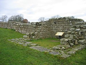
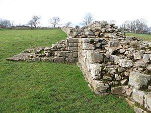
Turret 29A (Black Carts) is about 100 meters (109 yards) east of the road to Simonburn. It's part of a 460-meter (503-yard) long section of Hadrian's Wall that still stands. You can clearly see the foundation stones here. The name "carts" comes from an old English word meaning "rocky and rough."
Even though much of the south side is missing, the stone walls inside the turret are still up to eleven layers high. The wide "wing walls" of the turret show that it was built before the main Hadrian's Wall. The upright parts of the door frame are made from single large stones. At the highest point, there are fourteen cut stones in each horizontal row.
The inside of the turret measures about 3.45 meters (11.3 feet) by 3.40 meters (11.2 feet). It's thought that the Legio XX Valeria Victrix built this type of turret. The entrance is 0.9 meters (3 feet) wide and is on the east side of the south wall.
The vallum (the large ditch and earthwork) is still visible on the south side of the turret.
Archaeologists dug here in 1873, 1912, and 1971. They found pieces of millstones and many Roman coins. These coins were from emperors like Vespasian, Trajan, Hadrian, and Constantine the Great.
Location on map: 55°02′10″N 2°10′57″W / 55.036009°N 2.182452°W
Turret 29B (Limestone Bank)
Turret 29B (Limestone Bank) now looks like a low, grassy mound with very few visible stones. You can also see the path that connected this turret to the Military Way, which was a Roman road behind Hadrian's Wall.
When archaeologists dug here in 1912, they found that this turret also had "wing walls," just like Turret 29A. They found roofing slabs, many with nails still in them, among the debris. They also found three large flat stones, which might have been part of an upper floor.
Below these stones, they found two different floor levels. The later floor was made of flat stones, and the original floor was made of clay. In one corner, they found a stone platform. Near the east wall, a large Roman jar called an amphora was set into the ground. A fireplace was found against the west wall.
They also discovered many interesting items, including:
- A shield boss (the metal center of a shield)
- A spear head
- Brooches (decorative pins)
- A melon bead (a type of glass bead)
- A gaming board (for playing games)
- More millstone fragments
- Two flints (stone tools)
- Pieces of pottery, which showed that people lived here only until the second century AD.
Location on map: 55°02′15″N 2°11′22″W / 55.037481°N 2.189484°W
Visiting the Site
You can visit Milecastle 29 and both turrets. They are all easy to reach from the Hadrian's Wall National Trail, a long walking path that follows the wall.
 | Georgia Louise Harris Brown |
 | Julian Abele |
 | Norma Merrick Sklarek |
 | William Sidney Pittman |


