Milecastle 32 facts for kids
Quick facts for kids Milecastle 32 |
|
|---|---|
| Northumberland, England, UK | |

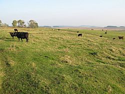
The site of Milecastle 32
|
|
|
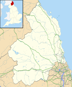
Location in Northumberland
|
|
| Coordinates | 55°02′00″N 2°14′35″W / 55.033207°N 2.243002°W |
Milecastle 32 (Carraw) was a small fort, or milecastle, that was part of Hadrian's Wall built by the Romans. Today, you can still see its remains as low bumps in the ground, but there are no stone walls standing. The outlines of its walls are still visible as shallow ditches where stones were removed long ago. The northern wall of the milecastle is now hidden under a modern wall.
Contents
What's in a Name?
The name Carraw likely comes from an old language called Cumbric. This word is similar to the Welsh word carrau, which means 'rocks'.
How Was Milecastle 32 Built?
Milecastle 32 was built with a "long-axis" design, meaning it was longer from front to back than side to side. We don't know exactly what kind of gates it had.
Historians believe that Roman armies called the legio VI Victrix or the legio XX Valeria Victrix might have built this milecastle. The Legio VI Victrix was based in Eboracum (which is now York), and the Legio XX Valeria Victrix was based in Deva Victrix (which is now Chester).
The milecastle measured about 20 metres (66 ft) long and 16.5 metres (54 ft) wide. This size was pretty normal for these small forts. There might have been a raised path, or causeway, leading up to the milecastle across the wall's ditch.
Discoveries and Investigations
Over the years, people have studied and dug at Milecastle 32 to learn more about it.
Early Records
- 1961 – A researcher named Eric Birley officially recorded the exact spot of the milecastle.
- 1966 – A group called English Heritage looked at the site. They noted that it was a low, damaged area with a ditch around it where stones had been taken. No original stone walls were visible.
Digging for Clues
- 1971 – The milecastle was measured, and the southern gate was dug up. Unfortunately, so many stones had been removed that it was hard to tell what the gate looked like. However, they did find pottery from the 4th century AD, which tells us the Romans were still using the site then.
- 1989 – English Heritage checked the site again as part of a big project on Hadrian's Wall. Their findings matched what had been seen before.
Nearby Watchtowers: Turrets 32A and 32B
Every milecastle along Hadrian's Wall had two smaller watchtowers, called turrets, associated with it. These turrets were usually placed about one-third and two-thirds of a Roman mile to the west of the milecastle. Soldiers from the milecastle would have likely guarded these turrets.
The two turrets linked to Milecastle 32 are known as Turret 32A and Turret 32B.
Turret 32A (Carraw West)
Turret 32A was found in 1920. Most of its remains are now buried under the modern B6318 Military Road.
You can find its location on a map here: 55°01′57″N 2°15′01″W / 55.032411°N 2.250272°W.
Turret 32B (Brown Moor)
The likely spot for Turret 32B was figured out just by measuring distances. Any remains of this turret would also be hidden beneath the B6318 Military Road.
Its estimated location is: 55°01′55″N 2°15′32″W / 55.031898°N 2.258889°W.
Visiting Milecastle 32
Milecastle 32 is on private land next to the B6318 Military Road. Both Turret 32A and Turret 32B are buried under the road itself. This means they are not easily accessible to the public.
 | Aurelia Browder |
 | Nannie Helen Burroughs |
 | Michelle Alexander |


