Millers Run facts for kids
Quick facts for kids Millers Run |
|
|---|---|

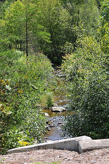
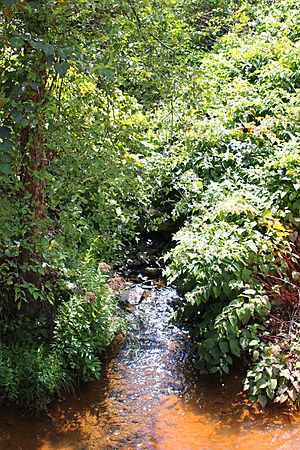
Millers Run in its lower reaches
|
|
| Physical characteristics | |
| Main source | hill in Ralpho Township, Northumberland County, Pennsylvania between 900 and 920 feet (270 and 280 m) |
| River mouth | Shamokin Creek in Ralpho Township, Northumberland County, Pennsylvania 574 ft (175 m) 40°50′21″N 76°35′03″W / 40.8393°N 76.5842°W |
| Length | 4.1 mi (6.6 km) |
| Basin features | |
| Progression | Shamokin Creek → Susquehanna River → Chesapeake Bay |
| Basin size | 5.48 sq mi (14.2 km2) |
Millers Run is a small stream that flows into Shamokin Creek in Northumberland County, Pennsylvania. It's like a mini-river that feeds into a bigger one. The stream is about 4.1 miles (6.6 kilometers) long. It flows through a place called Ralpho Township.
The area of land that drains water into Millers Run, called its watershed, is about 5.48 square miles (14.2 square kilometers). Good news! This stream isn't harmed by mining and is considered clean and healthy. It's a small stream located near the lower part of the Shamokin Creek area. Many bridges have been built over it, helping people cross. The area around Millers Run is special because it's a "Coldwater Fishery" and a "Migratory Fishery". This means it's a great place for fish that like cold water, and also for fish that travel long distances.
Contents
Where Millers Run Flows
Millers Run starts on a hill in Ralpho Township. It then flows into a valley and moves generally west-southwest for a short distance. After a little while, it turns west, then west-southwest again.
Further downstream, the stream turns northwest for more than a mile. Then it turns west and flows next to a place called Gilgers Ridge. After a short distance, it turns south and then northwest. Finally, it reaches its end where it joins Shamokin Creek. Millers Run meets Shamokin Creek about 16.84 miles (27.10 kilometers) upstream from the creek's own mouth.
How Clean is the Water?
Millers Run is a very clean stream. All the other streams in its watershed are also clean. It's not affected by mining, which can sometimes pollute water.
In 1975, scientists measured how well electricity could pass through the water, which tells them about the minerals in it. They also checked how "hard" the water was. Hard water means it has more minerals like calcium and magnesium.
Scientists also looked for tiny amounts of different elements in the water. They found small amounts of things like sodium, potassium, magnesium, and calcium. They also found very tiny amounts of other elements like strontium and barium. Some elements, like cadmium, chromium, and lead, were found in extremely small amounts, showing the water was very clean.
Land and Water Area
The elevation near where Millers Run joins Shamokin Creek is about 574 feet (175 meters) above sea level. The stream starts at a higher elevation, between 900 and 920 feet (270 and 280 meters) above sea level. Millers Run is considered a relatively small stream.
The land area that collects water for Millers Run, its watershed, covers about 5.48 square miles (14.2 square kilometers). The entire stream is located within the Shamokin area on maps made by the United States Geological Survey. The watershed of Millers Run is next to the lower part of the Shamokin Creek watershed.
History of Millers Run
Millers Run was officially added to the Geographic Names Information System on August 2, 1979. This system keeps track of names and locations of places in the United States.
Over the years, several bridges have been built over Millers Run:
- In 1918, a concrete bridge was built to carry State Route 2016 over the stream. It's about 28.9 feet (8.8 meters) long and is located southeast of Paxinos.
- In 1929, another concrete bridge was built for State Route 2018. This bridge is about 32.2 feet (9.8 meters) long and is northwest of Bear Gap.
- In 1930, a similar bridge for State Route 2016 was built. It's also 32.2 feet (9.8 meters) long and is southeast of Paxinos.
- In 1998, a concrete culvert bridge was built south of Paxinos. This bridge is 21.0 feet (6.4 meters) long and carries Township Road 764.
In the mid-1990s, the state of Pennsylvania approved money to fix up one of the bridges carrying State Route 2018 over Millers Run.
Animals and Plants
The area that drains into Millers Run is special for fish. It's called a "Coldwater Fishery" and a "Migratory Fishery". This means it's a good home for fish that like cold water, and also for fish that travel long distances to lay their eggs. There is aquatic life in the stream, and it has historically been a healthy place for water-dwelling creatures.
 | James Van Der Zee |
 | Alma Thomas |
 | Ellis Wilson |
 | Margaret Taylor-Burroughs |


