Millingen aan de Rijn facts for kids
Quick facts for kids
Millingen aan de Rijn
|
|||
|---|---|---|---|
|
Town and former municipality
|
|||

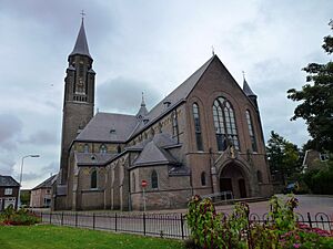
Church in Millingen aan de Rijn
|
|||
|
|||

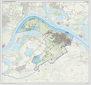
Location in Gelderland
|
|||
| Country | Netherlands | ||
| Province | Gelderland | ||
| Municipality | Berg en Dal | ||
| Area | |||
| • Total | 10.27 km2 (3.97 sq mi) | ||
| • Land | 8.66 km2 (3.34 sq mi) | ||
| • Water | 1.61 km2 (0.62 sq mi) | ||
| Elevation | 13 m (43 ft) | ||
| Population
(August 2017)
|
|||
| • Total | 5,918 | ||
| • Density | 683/km2 (1,770/sq mi) | ||
| Time zone | UTC+1 (CET) | ||
| • Summer (DST) | UTC+2 (CEST) | ||
| Postcode |
6566
|
||
| Area code | 0481 | ||
Millingen aan de Rijn is a town located in the eastern part of the Netherlands. It sits right on the border with Germany. The town is known for its location along the Rhine river.
Contents
About Millingen aan de Rijn
Millingen aan de Rijn is a small town in the province of Gelderland. It is close to the German border. The town is part of the larger Berg en Dal municipality.
Where is it?
Millingen aan de Rijn is in the eastern Netherlands. It is very close to the border with Germany. The town is also located right by the river Rhine. This river is very important for trade and travel in Europe.
What happened to the municipality?
Millingen aan de Rijn used to be its own separate municipality. A municipality is like a local government area. On January 1, 2015, Millingen aan de Rijn joined with other areas. It became part of a bigger municipality.
First, this new larger area was called Groesbeek. Then, on January 1, 2016, its name changed again. It is now known as Berg en Dal. So, Millingen aan de Rijn is now a town within the Berg en Dal municipality.
Images for kids
 | Sharif Bey |
 | Hale Woodruff |
 | Richmond Barthé |
 | Purvis Young |


