Milner, Colorado facts for kids
Quick facts for kids
Milner, Colorado
|
|
|---|---|

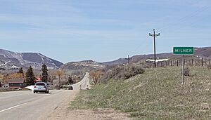
Milner in May 2014
|
|
| Country | |
| State | |
| County | Routt |
| Elevation | 6,522 ft (1,988 m) |
| Time zone | UTC-7 (MST) |
| • Summer (DST) | UTC-6 (MDT) |
| ZIP code |
80487
|
| Area code(s) | 970 |
| GNIS feature ID | 171404 |
Milner is a small, quiet community located in Routt County, Colorado, in the United States. It's known as an unincorporated community, which means it doesn't have its own local government like a city or town. Instead, it's managed by the county.
About Milner
Milner is located high up in the mountains! It sits about 6,522 feet (or 1,988 meters) above sea level.
Time Zone and Location
The community is in the Mountain Time Zone. This means it uses Mountain Standard Time (MST) during part of the year. When it's warmer, they switch to Mountain Daylight Time (MDT) to make the most of the daylight.
Milner is easy to find because it's right along U.S. Highway 40. This highway connects Milner to two other nearby places: Craig and Steamboat Springs.
Black History Month on Kiddle
Prominent African-American Women
 | Claudette Colvin |
 | Myrlie Evers-Williams |
 | Alberta Odell Jones |

All content from Kiddle encyclopedia articles (including the article images and facts) can be freely used under Attribution-ShareAlike license, unless stated otherwise. Cite this article:
Milner, Colorado Facts for Kids. Kiddle Encyclopedia.
