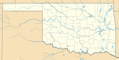
Milo, Oklahoma facts for kids
Quick facts for kids
Milo, Oklahoma
|
|
|---|---|
| Country | United States |
| State | Oklahoma |
| County | Carter |
| Elevation | 892 ft (272 m) |
| Time zone | UTC-6 (Central (CST)) |
| • Summer (DST) | UTC-5 (CDT) |
| ZIP codes |
73401
|
| GNIS feature ID | 1095425 |
Milo is a small community located in Carter County, Oklahoma, in the United States. It is known as an "unincorporated community," which means it doesn't have its own local government like a city or town.
Contents
Discovering Milo, Oklahoma
Where is Milo Located?
Milo is found in the southern part of Oklahoma. It sits on State Highway 53. This road runs south of the beautiful Arbuckles, a range of ancient hills.
The Story Behind the Name Milo
The name "Milo" has an interesting origin story. It is believed to be a "portmanteau." This means it was created by blending parts of other words. In this case, it supposedly came from the first letters of four daughters of a local resident named J.W. Johnson.
However, there's a small puzzle! J.W. Johnson actually had five daughters. Their names were May Belle, Willie Mallissa, Lola Maude, Ezella Marigold, and Elba (who was also called "Cutchie"). So, the exact combination of initials that formed "Milo" remains a bit of a local mystery.
Post Office History
A post office was first opened in Milo on October 28, 1899. This was an important service for the community, allowing people to send and receive mail. Later, the post office in Milo was closed. Today, the mail for Milo is handled by the post office in Springer, Oklahoma, and uses the ZIP Code 73458.
 | George Robert Carruthers |
 | Patricia Bath |
 | Jan Ernst Matzeliger |
 | Alexander Miles |


