Miner's Way Trail facts for kids
Quick facts for kids Miner's Way Trail |
|
|---|---|

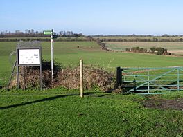
Footpath and fields near Elvington
|
|
| Length | 27 mi (43 km) |
| Location | South East England |
| Trailheads | Sholden 51°13′30″N 1°22′08″E / 51.225°N 1.369°E Northbourne 51°14′13″N 1°19′59″E / 51.237°N 1.333°E |
| Use | Hiking |
| Season | All year |
The Miner's Way Trail is a fun, circular walking path in Kent, England. It starts in Sholden and connects many villages that were once part of the East Kent coal mining area. This trail is a great way to explore the history of mining in the region.
The trail is about 27 miles (43 km) long. It's designed so you can walk the whole thing or choose shorter sections. There's even a special link route that lets you split the trail into two walks, each around 14 miles (22.5 km) long. Look for the trail's special sign, called a Waymark. It's a white circle with a miner's lamp, a train, and a leaf.
There's also a cycling route that follows most of the Miner's Way Trail. This bike path is about 30 miles (48 km) long and begins and ends in Deal. It connects to other popular cycling routes like the Sustrans National Cycle Network Regional Route 16 and 17. You can also link up with the Viking Coastal Trail and National Cycle Route 1. Most people can complete the cycling route in just one day.
Contents
Exploring the Miner's Way Trail
The Miner's Way Trail takes you through several interesting villages. These include Deal, Ash, Aylesham, Eastry, Elvington, Nonington, Northbourne, Staple, Tilmanstone, and Wingham. Each village has its own unique story and connection to the area's mining past.
The trail mostly follows public footpaths, bridleways (paths for horses), and byways (paths for vehicles). This means you'll walk through beautiful countryside. You'll see lots of fields, hedges, and woodlands. Much of this landscape has looked similar since Saxon times, showing its long and rich history.
Connecting to Other Trails
The Miner's Way Trail also connects to other famous long-distance paths. You can link up with the North Downs Way, which is another popular trail between Canterbury and Dover. It also connects to the East Kent Light Railway at Shepherdswell. These connections make it easy to explore even more of Kent's beautiful countryside.
History of East Kent Coal Mining
The story of the Miner's Way Trail begins with coal. In 2001, the Dover District Council started a project called 'Coalfields Heritage Initiative Kent' (CHIK). This project aimed to record and protect the history of mining in East Kent.
Coal Discovery and Mines
Coal was first found near Dover in 1890. This discovery led to the start of a small coal mining industry. Many coal mines were opened, but most of them didn't last long. Only four main coal mines, called collieries, survived: Snowdown, Tilmanstone, Betteshanger, and Chislet.
New Villages for Miners
Most of the workers for these new mines came from other parts of the UK where coal mining was common. They came from places like South Wales, the Midlands, and the North East of England. To house all these new workers and their families, new villages were built. These included Aylesham, Elvington, Hersden, and Mill Hill in Deal. The last colliery in the area, Betteshanger, closed in 1989. The Miner's Way Trail was created to link these important historical mining villages and preserve their heritage.
 | James Van Der Zee |
 | Alma Thomas |
 | Ellis Wilson |
 | Margaret Taylor-Burroughs |

