Mitchellville, Iowa facts for kids
Quick facts for kids
Mitchellville, Iowa
|
|
|---|---|

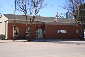
City Hall
|
|

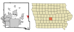
Location of Mitchellville, Iowa
|
|
| Country | |
| State | |
| Counties | Polk, Jasper |
| Area | |
| • Total | 2.53 sq mi (6.55 km2) |
| • Land | 2.52 sq mi (6.53 km2) |
| • Water | 0.01 sq mi (0.01 km2) |
| Elevation | 955 ft (291 m) |
| Population
(2020)
|
|
| • Total | 2,485 |
| • Density | 985.33/sq mi (380.37/km2) |
| Time zone | UTC-6 (Central (CST)) |
| • Summer (DST) | UTC-5 (CDT) |
| ZIP code |
50169
|
| Area code(s) | 515 |
| FIPS code | 19-52950 |
| GNIS feature ID | 2395360 |
Mitchellville is a city located in Polk and Jasper counties in the state of Iowa. In 2020, about 2,485 people lived there.
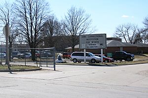
Mitchellville is part of the larger Des Moines area. It is also home to the Iowa Correctional Institution for Women.
Contents
History of Mitchellville
Mitchellville was started by a man named Thomas Mitchell in 1856. It officially became a city on September 30, 1875.
Thomas Mitchell was the first white settler in Polk County, Iowa. His old farm is now a park called Thomas Mitchell Park.
Geography of Mitchellville
Mitchellville covers about 2.53 square miles (6.55 square kilometers). Most of this area is land, with a very small part being water.
People of Mitchellville
Population in 2020
In 2020, there were 2,485 people living in Mitchellville. There were 660 households, which are groups of people living together.
About 88.4% of the people were White. Around 4.8% were Black or African American. Other groups included Native American, Asian, and Pacific Islander people. About 4.1% of the population was Hispanic or Latino.
The average age of people in Mitchellville was 37.3 years old.
Population in 2010
In 2010, Mitchellville had 2,254 people. The city had 651 households.
About 91.7% of the people were White. Around 5.8% were African American. Other groups included Native American and Asian people. About 2.4% of the population was Hispanic or Latino.
The average age in the city was 37.2 years.
Economy
A major part of Mitchellville's economy is the Iowa Correctional Institution for Women. This facility is part of the Iowa Department of Corrections.
Education
Students in Mitchellville attend schools in the Southeast Polk High School district.
Notable People from Mitchellville
- Clair Cameron Patterson (1922–1995) was a scientist who studied the Earth. He helped figure out how old the Earth is. He also found out about lead pollution from factories.
- Lawrence Timothy "Buck" Shaw (1899–1977) was a famous American football player and coach. He coached many college teams like Santa Clara University and the University of California, Berkeley. He also coached professional teams like the San Francisco 49ers and the Philadelphia Eagles. He played college football at the University of Notre Dame.
- J. J. Stiffler (1934–2019) was an electrical engineer and computer scientist.
See also
 In Spanish: Mitchellville (Iowa) para niños
 | Claudette Colvin |
 | Myrlie Evers-Williams |
 | Alberta Odell Jones |


