Moncouche Lake (Mont-Valin) facts for kids
Quick facts for kids Moncouche Lake |
|
|---|---|
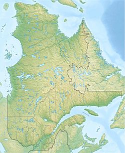
| Location | Mont-Valin (TNO), Le Fjord-du-Saguenay Regional County Municipality, Saguenay–Lac-Saint-Jean |
| Coordinates | 47°57′28″N 71°57′26″W / 47.95778°N 71.95722°W |
| Lake type | Natural |
| Primary inflows | (clockwise from the mouth) Lac Dino, Doumic Lake, lac du Diamant, décharge des lacs Clair, des Jumeaux et Bernières, décharge d’un ensemble de lacs dont Dugal et du Détour, décharge du lac Montplaisir, décharge du lac Belette, décharge du lac Jacob. |
| Primary outflows | Maingard Lake |
| Basin countries | |
| Max. length | 8.0 km (5.0 mi) |
| Max. width | 7.1 km (4.4 mi) |
| Surface area | 15 km2 (5.8 sq mi) |
| Surface elevation | 700 m (2,300 ft) |
Moncouche Lake is a large freshwater lake in Quebec, Canada. It's part of a bigger water system that flows into the rivière aux Sables. This lake is located in a wild, unorganized area called Mont-Valin. It's also found within the Le Fjord-du-Saguenay Regional County Municipality in the Saguenay–Lac-Saint-Jean region of Quebec.
Most of Moncouche Lake is inside the zec Martin-Valin territory. The main activities around the lake are forestry, which means cutting down trees, and also fun outdoor activities like fishing or camping.
There are special forest roads, like R0208 and R0201, that help people get around the area. These roads are used for forestry work and for visitors who want to enjoy nature.
The lake usually freezes over in late November. It stays frozen until early April. However, it's generally safe to walk or play on the ice from mid-December to the end of March.
Contents
Where is Moncouche Lake?
Moncouche Lake is surrounded by many other rivers and lakes. These are all part of its "watershed," which is the area of land where all the water drains into this lake.
Nearby Rivers and Lakes
- North: Wapishish River, Poulin River, rivière aux Sables.
- East: Doumic Lake, Betsiamites Lake, lac Le Marié.
- South: Sainte-Marguerite River.
- West: Saint-Louis River.
Lake Size and Shape
Moncouche Lake is completely surrounded by forest. It is about 8.0 kilometers (5 miles) long and 7.1 kilometers (4.4 miles) wide. The lake sits high up, at an altitude of about 700 meters (2,300 feet) above sea level.
The lake has a very interesting and wiggly shape, with many bays and points of land sticking out. It also has many islands. Moncouche Lake is connected to other lakes like Doumic, Maingard, and Le Marié. All these lakes feed into the beginning of the rivière aux Sables.
How Water Flows from the Lake
The water from Moncouche Lake flows out into Maingard Lake. From there, it travels through a series of other lakes, including Lac Le Marié and Lac des Trois Chutes. Finally, this water joins the rivière aux Sables.
The rivière aux Sables then flows north into the large Pipmuacan Reservoir. From the reservoir, the water eventually joins the Betsiamites River, which flows southeast. This river then empties into the huge Saint Lawrence estuary.
What's in a Name?
The name "Lac Moncouche" has been around for a long time. It was first written down in a book about Quebec's rivers and lakes in 1914.
The name "Moncouche" comes from the Innu and Cree languages, spoken by Indigenous peoples. In these languages, "muak" means "loon," which is a type of water bird. "Moncouche" might be a way of saying "loons" in their language.
The official name "Lac Moncouche" was formally recognized on December 5, 1968, by the Commission de toponymie du Québec, which is the group in charge of naming places in Quebec.
 | Bessie Coleman |
 | Spann Watson |
 | Jill E. Brown |
 | Sherman W. White |


