Moneypenny Creek facts for kids
Quick facts for kids Moneypenny Creek |
|
|---|---|

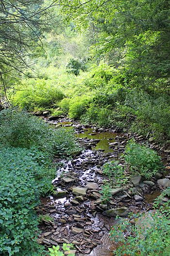
Moneypenny Creek looking downstream
|
|
| Physical characteristics | |
| Main source | Miller Mountain in Eaton Township, Wyoming County, Pennsylvania between 1,280 and 1,300 feet (390 and 396 m) |
| River mouth | Susquehanna River in Eaton Township, Wyoming County, Pennsylvania 564 ft (172 m) 41°28′53″N 75°54′26″W / 41.4815°N 75.9073°W |
| Length | 2.2 mi (3.5 km) |
| Basin features | |
| Progression | Susquehanna River → Chesapeake Bay |
| Basin size | 3.64 sq mi (9.4 km2) |
| Tributaries |
|
Moneypenny Creek is a small stream in Wyoming County, Pennsylvania. It flows into the Susquehanna River. The creek is about 2.2 miles (3.5 km) long. It runs through Eaton Township.
The area of land that drains into Moneypenny Creek, called its watershed, covers about 3.24 square miles (8.4 km2). The creek has one named smaller stream, or tributary, called Thurston Hollow. Moneypenny Creek has experienced sudden, heavy floods in the past. The land around the creek has different types of soil and rocks. Fish that like cold water and fish that travel to lay eggs live here.
Contents
Where Does the Creek Flow?
Moneypenny Creek starts on Miller Mountain in Eaton Township, Wyoming County. It flows east for a short distance. Then, it turns southeast and moves through a valley.
After a while, the creek turns northeast. Here, another stream called Thurston Hollow joins it from the right side. Moneypenny Creek then flows east again. Its valley becomes less deep before it meets the Susquehanna River.
Moneypenny Creek joins the Susquehanna River about 213.18 miles (343.08 km) before the Susquehanna River reaches the ocean.
Meet Thurston Hollow
Thurston Hollow is the only named stream that flows into Moneypenny Creek. It joins Moneypenny Creek about 0.95 miles (1.53 km) before Moneypenny Creek meets the Susquehanna River. The area that drains into Thurston Hollow is about 1.62 square miles (4.2 km2).
How High is the Creek?
The elevation of Moneypenny Creek where it meets the Susquehanna River is 564 feet (172 m) above sea level. Where the creek begins, its elevation is between 1,280 and 1,300 feet (390 and 396 m) above sea level. This means the creek flows downhill quite a bit!
What's Under the Ground?
The ground along the lower parts of Moneypenny Creek has mostly alluvium. Alluvium is soil left behind by flowing water. Nearby, there are also rocks and soil left by glaciers from the Ice Age.
Further upstream, the ground is still mostly alluvium and bedrock (solid rock). In the upper parts of the creek, the ground is mostly made of till. Till is another type of soil left by glaciers.
What is a Watershed?
The watershed of Moneypenny Creek is the entire area of land where all the rain and snowmelt drain into the creek. This watershed covers about 3.24 square miles (8.4 km2). The creek is located entirely within a map area called Center Moreland.
A Look at the Creek's Past
Moneypenny Creek was officially added to the Geographic Names Information System on August 2, 1979. This system keeps track of names and locations of places in the United States.
The Big Storm of 2004
On May 12, 2004, a very strong thunderstorm stayed over Miller Mountain for a long time. This caused serious flash flooding on Moneypenny Creek. About 6 inches (150 mm) of rain fell, and sometimes it rained more than 4 inches (100 mm) per hour! The damage from this flood cost about $500,000.
A weather warning was sent out about an hour before the storm. It specifically warned that areas near Moneypenny Creek were at risk of flooding.
Who Lives in the Creek?
The watershed of Moneypenny Creek is a special place for fish. It is called a Coldwater Fishery. This means it's a good home for fish that need cold water to live. It is also a Migratory Fishery. This means it's a place where fish travel to, often to lay their eggs.


