Thurston Hollow facts for kids
Quick facts for kids Thurston Hollow |
|
|---|---|

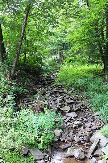
Thurston Hollow looking upstream
|
|
| Other name(s) | Thurston Hollow Creek |
| Physical characteristics | |
| Main source | slopes of a ridge in Eaton Township, Wyoming County, Pennsylvania between 1,180 and 1,200 feet (360 and 366 m) |
| River mouth | Moneypenny Creek in Eaton Township, Wyoming County, Pennsylvania 869 ft (265 m) 41°28′39″N 75°55′23″W / 41.47747°N 75.92303°W |
| Length | 1.4 mi (2.3 km) |
| Basin features | |
| Progression | Moneypenny Creek → Susquehanna River → Chesapeake Bay |
| Tributaries |
|
Thurston Hollow is a small stream in Wyoming County, Pennsylvania. It is also known as Thurston Hollow Creek. This stream flows into Moneypenny Creek.
Thurston Hollow is about 1.4 miles (2.3 km) long. It runs through an area called Eaton Township. The land area that drains into this stream is 1.62 square miles (4.2 km2). The water in Thurston Hollow is clean and healthy. It has one small stream that flows into it.
The Stream's Path
Thurston Hollow starts on the side of a hill in Eaton Township. It flows mostly north for a short distance. Along its way, it passes through a small pond. Another small stream joins it from the left side.
Then, Thurston Hollow enters a valley. It continues flowing north and goes through another pond. After that, it turns towards the east. A little further downstream, it meets and joins Moneypenny Creek. Thurston Hollow flows into Moneypenny Creek about 0.95 miles (1.53 km) before Moneypenny Creek ends.
Land and Rocks
The land around the end of Thurston Hollow is about 869 feet (265 m) above sea level. Where the stream begins, the land is higher. It is between 1,180 and 1,200 feet (360 and 366 m) above sea level.
The ground along the lower part of Thurston Hollow is mostly made of alluvium. Alluvium is soil and sand left behind by flowing water. To the east, you can find solid bedrock and some Till. Till is a mix of clay, sand, and rocks left by glaciers. To the west, the ground is all Till.
The Area Around the Stream
The entire area that drains water into Thurston Hollow is called its watershed. This watershed covers about 1.62 square miles (4.2 km2). The stream is completely within the Center Moreland map area. This stream is important for supporting aquatic life, like fish and other water creatures.
There was a plan for a pipeline project nearby. This pipeline would have crossed some small streams that flow into Thurston Hollow.
Stream's Name and History
Thurston Hollow doesn't have its own special name. It gets its name from the valley it flows through. The valley of Thurston Hollow was officially named on August 2, 1979.
People have also called this stream Thurston Hollow Creek. In the past, people used to do farming in the area near Thurston Hollow.


