
Mont-Saint-Guibert facts for kids
Quick facts for kids
Mont-Saint-Guibert
|
|||
|---|---|---|---|

Mont-Saint-Guibert town hall
|
|||
|
|||

Mont-Saint-Guibert
Location in Belgium
|
|||
| Country | Belgium | ||
| Community | French Community | ||
| Region | Wallonia | ||
| Province | Walloon Brabant | ||
| Arrondissement | Nivelles | ||
| Area | |||
| • Total | 18.63 km2 (7.19 sq mi) | ||
| Population
(2018-01-01)Lua error in Module:Wd at line 1575: attempt to index field 'wikibase' (a nil value).
|
|||
| • Total | Lua error in Module:Wd at line 1,575: attempt to index field 'wikibase' (a nil value). | ||
| Postal codes |
1435
|
||
| Area codes | 010 | ||
| Website | www.mont-saint-guibert.be | ||


Mont-Saint-Guibert is a small town, also called a municipality, in Wallonia, which is a region in Belgium. It is located in the Belgian province of Walloon Brabant.
As of January 1, 2012, about 7,000 people lived in Mont-Saint-Guibert. The total area of the municipality is 18.63 square kilometers. This means there were about 344 people living in each square kilometer. This is called the population density.
Besides the main town of Mont-Saint-Guibert, the municipality also includes two smaller villages. These villages are called Corbais and Hévillers.
How do people travel in Mont-Saint-Guibert?
Mont-Saint-Guibert is growing quickly. Many people who work in Brussels, the capital city, are moving here. They can easily travel to work because the town has its own train station. There is also a big highway nearby, called the E411, which connects Brussels to Luxembourg.
Images for kids
- Monuments
-

Griffon du Bois Tower
-
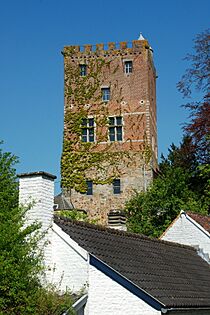
Dungeon of Bierbais
-

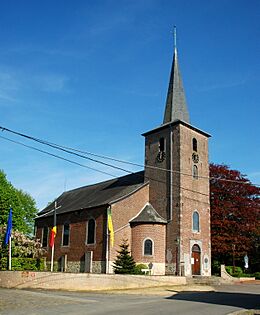
Saint-Guibert Church
-
Saint-Pierre Church in Corbais


See also
 In Spanish: Mont-Saint-Guibert para niños
