Mont-Saint-Sulpice facts for kids
Quick facts for kids
Mont-Saint-Sulpice
|
|
|---|---|
| Country | France |
| Region | Bourgogne-Franche-Comté |
| Department | Yonne |
| Arrondissement | Auxerre |
| Canton | Seignelay |
| Area
1
|
19.62 km2 (7.58 sq mi) |
| Population
(2006)
|
794 |
| • Density | 40.47/km2 (104.81/sq mi) |
| Time zone | UTC+01:00 (CET) |
| • Summer (DST) | UTC+02:00 (CEST) |
| INSEE/Postal code |
89268 /89250
|
| Elevation | 87–192 m (285–630 ft) |
| 1 French Land Register data, which excludes lakes, ponds, glaciers > 1 km2 (0.386 sq mi or 247 acres) and river estuaries. | |
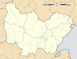
Mont-Saint-Sulpice is a small and charming commune (which is like a town or village) located in the beautiful Yonne department. This area is right in the center of France. It's a place where people live and work, just like towns in your own country!
Contents
What is Mont-Saint-Sulpice Like?
Mont-Saint-Sulpice is a quiet place with a small population. In 2006, about 794 people lived there. It covers an area of 19.62 square kilometers. This means it's not too big, but it has enough space for homes and nature.
Where is Mont-Saint-Sulpice Located?
This commune is part of the Auxerre arrondissement. An arrondissement is a type of administrative area in France, similar to a district. It also belongs to the Seignelay canton, which is another way France organizes its local areas.
How High is Mont-Saint-Sulpice?
The land in Mont-Saint-Sulpice has different heights. The lowest point is 87 meters above sea level. The highest point reaches 192 meters. This difference in height can create interesting landscapes and views.
See also
 In Spanish: Mont-Saint-Sulpice para niños
 | Delilah Pierce |
 | Gordon Parks |
 | Augusta Savage |
 | Charles Ethan Porter |


