
Montagu Island facts for kids

South Sandwich Islands.
|
|

Location of Montagu Island
|
|
| Geography | |
|---|---|
| Location | Atlantic Ocean |
| Coordinates | 58°25′S 26°23′W / 58.417°S 26.383°W |
| Archipelago | South Sandwich Islands |
| Length | 12 km (7.5 mi) |
| Width | 10 km (6 mi) |
| Highest elevation | 1,370 m (4,490 ft) |
| Administration | |
|
United Kingdom
|
|
| Demographics | |
| Population | Uninhabited |
Montagu Island is the biggest island in the South Sandwich Islands. It is located in the Weddell Sea, which is a part of the Atlantic Ocean near Antarctica. This island is part of a British Overseas Territory called South Georgia and the South Sandwich Islands. It is about 60 kilometers (37 miles) northeast of Bristol Island and 62 kilometers (39 miles) south of Saunders Island.
A famous explorer named James Cook first saw Montagu Island in 1775. He named it after John Montagu, 4th Earl of Sandwich, who was an important leader in the British navy at that time. The first time someone actually landed on the island was in 1908. This landing was made by a Norwegian whaler and explorer named Carl Anton Larsen.
Island Geography and Ice Cover
Montagu Island is a lonely place where no one lives. It is about 12 kilometers (7.5 miles) long and 10 kilometers (6 miles) wide. More than 90% of the island is always covered in ice. The most important natural feature on the island is a volcano called Mount Belinda.
Mount Belinda: An Active Volcano
Mount Belinda rises 1,370 meters (4,495 feet) above the sea. For a long time, people thought this volcano was not active. However, in 2002, scientists from the British Antarctic Survey saw small amounts of ash coming out. They also thought they saw lava flowing. This showed that the volcano was actually active!
In November 2005, satellite pictures showed that Mount Belinda had erupted. This eruption created a river of melted rock, called lava, that was about 90 meters (295 feet) wide. This lava flowed all the way to the northern coast of the island.
This eruption added about 0.2 square kilometers (0.077 square miles) of new land to the island. It also gave scientists a rare chance to study how volcanoes erupt when they are under a thick sheet of ice. As of August 2009, pictures on Google Earth still showed the volcano was active, with a clear plume of smoke and lava flow. You could even see how the eruption had changed the ice sheet.
Images for kids
-

NASA satellite photograph of Montagu Island.
-
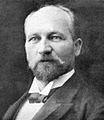
Captain Carl Anton Larsen.


See also

In Spanish: Isla Jorge (Sandwich del Sur) para niños
