Monticello, New Mexico facts for kids
Quick facts for kids
Monticello
|
|
|---|---|
| Country | United States |
| State | New Mexico |
| County | Sierra |
| Elevation | 5,256 ft (1,602 m) |
| Time zone | UTC-7 (Mountain (MST)) |
| • Summer (DST) | UTC-6 (MDT) |
| Area code(s) | 575 |
| GNIS feature ID | 908852 |
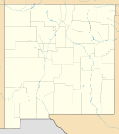
Monticello is a small, unincorporated community in Sierra County, New Mexico, United States. An unincorporated community is a place where people live and work, but it doesn't have its own local government like a city or town. Monticello is located along Alamosa Creek. It is about 22 miles (35 km) northwest of a larger town called Truth or Consequences. Monticello has its own post office with the ZIP code 87939.
History of Monticello
Early Settlement: Canada Alamosa
The area that is now Monticello began as farmland around 1863. This valley was first known as Cañada Alamosa. The Alamosa Creek (also called Arroyo Alamosa or Rio Alamosa) flows through it. These early farms were owned by people from a nearby farming settlement. This settlement was named San Ygnacio de la Alamosa. It was founded in 1859. People often just called it Alamosa.
Alamosa was located where the Alamosa Creek met the Rio Grande river. A wagon road ran along the west side of the Rio Grande. This road connected two important forts: Fort Craig and Fort Thorn. In the summer of 1862, big floods on the Rio Grande destroyed the crops in Alamosa.
Because of the floods, many farmers moved their farms in 1863. They moved up the Cañada Alamosa valley. They found a new area with water from springs, closer to the mountains. This new area was below a narrow canyon where the Alamosa Creek flowed out.
After another flood destroyed Alamosa in 1867, more residents moved up the valley. They settled in the new town, also called Canada Alamosa. This new town had been organized between 1864 and 1866. Other people moved across the river. They went a few miles downstream to start a new town called Alamocita.
A military fort, Fort McRae, was built in April 1863. It was about six miles north of Alamocita. This fort helped protect these new settlements. It also protected travelers along the river and on the old road to the east. This road was known as the Jornada del Muerto. Fort McRae provided protection and economic benefits to the towns. It operated until October 30, 1876.
Renaming to Monticello
In 1881, the community of Canada Alamosa was given a new name: Monticello. It was named after Monticello, New York. This was the former home of an important early settler in the area. A post office named Monticello has been serving the community since 1881.
Education
The schools in Monticello are part of the Truth or Consequences Municipal Schools district. This district covers the entire county. Students in Monticello attend schools in Truth or Consequences. These include Truth or Consequences Middle School and Hot Springs High School.
 | Misty Copeland |
 | Raven Wilkinson |
 | Debra Austin |
 | Aesha Ash |


