Montopolis, Austin, Texas facts for kids
Quick facts for kids
Montopolis
|
|
|---|---|
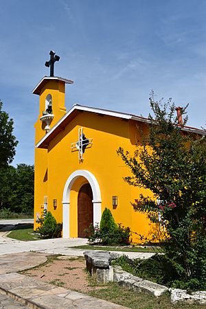
Dolores Catholic Church
|
|
| Country | United States |
| State | Texas |
| City | Austin |
| Time zone | UTC-6 (CST) |
| • Summer (DST) | UTC-5 (CDT) |
| ZIP Codes |
78741
|
| Area code(s) | 512, 737 |
Montopolis is a neighborhood in Austin, Texas, located southeast of the city center. It sits south of the Colorado River and is known for its rich history. The neighborhood is bordered by Lake Lady Bird to the north and major highways like Texas State Highway 71 and U.S. Route 183. It's also very close to Austin-Bergstrom International Airport. Montopolis is part of Austin's City Council District 3.
Contents
Montopolis: A Tale of Two Places
Did you know there have actually been two places called Montopolis in Travis County? This can sometimes be confusing because they were in different spots.
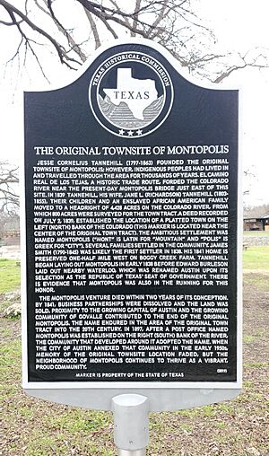
The first Montopolis was a planned town. It was created by Jesse Cornelius Tannehill during the Republic of Texas period. This town was located north of the Colorado River, right next to where Austin would later be built. It had a careful design with streets and lots, much like Austin itself.
The second Montopolis is the community we know today. It grew south of the Colorado River after the Civil War. This community developed over many years to become the Montopolis neighborhood in Austin.
The one thing that connects both old and new Montopolis is a historic river crossing. This crossing, which later became a ferry and then a bridge, has always been called Montopolis. Its history goes back even further than either of the two communities.
The First Montopolis: A Republic of Texas Town
The first Montopolis was founded by Jesse Cornelius Tannehill (1797-1863). Some people mistakenly think it started in 1830, but Tannehill didn't arrive in Texas until 1828. He first settled near Caney and then moved to Bastrop.
In 1836, during the Texas fight for independence, Tannehill and his family had to flee Bastrop. This event was called the Runaway Scrape. After the war, they lived in Huntsville and La Grange until 1839.
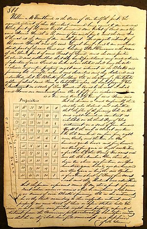
In 1839, Tannehill and his family moved to a large piece of land near the Colorado River. They set aside 800 acres to create the town of Montopolis. This town was officially established on July 2, 1839, on the north side of the Colorado River. Tannehill never owned land south of the river, where today's Montopolis is located.
The name "Montopolis" comes from "mont" (Latin for "mountain") and "polis" (Greek for "city"). So, it means "mountain city" or "city on a hill." Several families settled there, with James Smith likely being the first in 1838. His home from 1841 is still preserved today at Boggy Creek Farm.
Tannehill began planning Montopolis even before Austin was laid out. Montopolis was even considered as a possible capital for the Republic of Texas! However, the commissioners chose the site of Waterloo (which became Austin) instead. By 1841, the Montopolis town project ended, and the land was sold.
Even though the town project stopped, the name "Montopolis" stuck around. The famous writer O. Henry wrote a story called The Door of Unrest that mentioned a community of Montopolis next to Austin. O. Henry lived in Austin from 1884 to 1898.
Old roads also show how the original Montopolis connected to Austin. For example, Montopolis's "Broad Street" is now part of Austin's 5th Street. This shows that the first Montopolis didn't truly disappear; it just became part of Austin. Even in the 20th century, businesses like the Montopolis Drive-In Theater kept the name alive.
The first time "Montopolis" appeared on a map south of the Colorado River was in 1894. This map showed the "Montopolis Ferry," which was named after the river crossing, not a community. A post office named Montopolis was opened on the south bank in 1897 but closed in 1902.
The community south of the river likely started using the name Montopolis when the post office opened. When Austin began to annex this community in the 1950s, the memory of the original townsite started to fade.
From Reconstruction to Today's Neighborhood
After the Civil War, the area south of the Colorado River became a freedmen's town. This was a place where newly freed slaves settled and worked, often as sharecroppers. Burditt Prairie Cemetery, a Texas historic cemetery, was used for burials of enslaved people and their families.
The Montopolis post office was established in 1897, with Jefferson D. Randolph as postmaster. It closed in 1902. In 1900, the population of Montopolis was 142 people.
Around 1891, a school for African American children was built in the Colorado School District. A storm destroyed the building in 1935. Land was then given by the St. Edward’s Baptist Church, and a new school was built. This school joined the Austin Independent School District in 1952 but closed in 1962 due to desegregation.
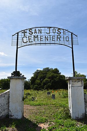
In the early 1900s, many Mexican immigrants moved to the neighborhood. Between 1919 and 1922, San Jose Cemetery (Cemeterio San José) was created. It became a historic cemetery for Mexican and Mexican-American families.
Montopolis Drive is a good example of how the neighborhood changed. In 1950, residents asked to rename two old roads, Miller Lane and Boothe Lane. These roads connected the Montopolis bridge to Burleson Road. The county approved the change, creating Montopolis Drive and strengthening the neighborhood's identity.
Even though Montopolis was close to Austin, the city didn't fully annex it until the 1970s. Montopolis has historically been one of Austin's poorer neighborhoods. In 2000, many residents over 25 did not have a high school diploma.
With Austin growing so much, Montopolis has seen more development in recent years. It's in a great location, right next to the Austin-Bergstrom International Airport and major highways. In 2005, Austin started working on a plan for the entire East Riverside Drive area, including Montopolis.
This new development has caused worries about gentrification. This is when a neighborhood changes, and housing becomes too expensive for the original residents. In 2014, activists tried to stop new condos from being built, but they were approved later that year. In 2015, Google announced that its Google Fiber internet service would be available in the area.
The Historic Colorado River Crossing
The Montopolis river crossing is the main link between the old and new Montopolis. The name "Montopolis" for the river ford dates back to the first Montopolis town. This geographic name lasted long after the first town was gone, and before the current community adopted the name. The river crossing is a constant feature connecting the two Montopolis areas.
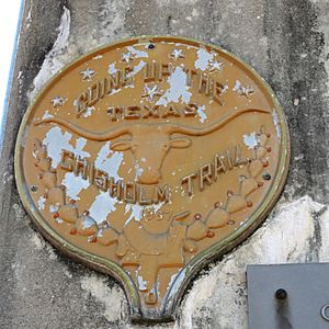
After the Civil War, Texas had many longhorn cattle that could be sold in northern markets. The Montopolis ford was a major crossing point for the Chisholm Trail, used from about 1867 to 1884. Historians say that cattle drives through Austin were common, and the cattle would moo loudly as they crossed the river at Montopolis. In 1878, a newspaper reported that about 15,000 cattle crossed the Montopolis ford in one week!
But the crossing is even older than both Montopolis communities. Native American people lived and traveled through this area for thousands of years. The historic El Camino Real de los Tejas, an old Spanish trail, crossed the Colorado River east of today's Montopolis Bridge.
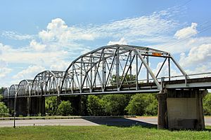
The Montopolis Bridge, which marks the old Montopolis ford, is on the National Register of Historic Places. In 2018, the bridge was closed to cars and is now being used for walking and biking. It will also have signs explaining its history. In 2020, the National Park Service worked with local groups to add signs to the bridge. These signs recognize the crossing as part of the historic El Camino Real de los Tejas.
Education in Montopolis
Montopolis is served by two different school districts: the Austin Independent School District (AISD) and the Del Valle Independent School District (DVISD).
AISD schools for Montopolis include:
- Allison Elementary School
- Martin Middle School
- Eastside Memorial High School at the Johnston Campus
Del Valle schools for Montopolis include:
- Baty Elementary
- Gilbert Elementary School
- Hillcrest Elementary School
- Hornsby-Dunlap Elementary School
- Dailey Middle School
- Ojeda Middle School
- Del Valle High School
Montopolis Population and Facts
As of 2019, Montopolis had a population of 10,700 people. It covers an area of about 2.2 square miles. This means there are about 4,825 people living in each square mile, which is a bit more crowded than Austin's average.
The population is made up of different groups:
- Hispanic or Latino: 67.1%
- White: 19.7%
- Black: 7.7%
- Two or more races: 3.2%
- Asian: 1.4%
- American Indian: 0.6%
- Native Hawaiian and Other Pacific Islander: 0.3%
- Some other race: 0.04%
In 2019, the average household income in Montopolis was $45,360. This is lower than Austin's average of $75,413. The average age for males was 32.7 years, and for females, it was 31.9 years. The estimated value of detached houses in Montopolis was $470,732, which was also lower than Austin's average.
 | Leon Lynch |
 | Milton P. Webster |
 | Ferdinand Smith |


