Mosque River facts for kids
Quick facts for kids Mosque River |
|
|---|---|
|
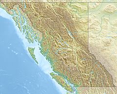
Location of mouth of Mosque River
|
|
| Country | Canada |
| Province | British Columbia |
| Physical characteristics | |
| Main source | Diagonal Mountain Omineca Mountains 1,700 m (5,600 ft) 56°45′9″N 127°16′50″W / 56.75250°N 127.28056°W |
| River mouth | Skeena River Skeena Mountains 673 m (2,208 ft) 56°31′2″N 127°33′28″W / 56.51722°N 127.55778°W |
| Length | 50 km (31 mi) |
| Basin features | |
| Basin size | 499 km2 (193 sq mi) |
The Mosque River is a river in British Columbia, Canada. It flows into the larger Skeena River. The river starts in the Skeena Mountains. It flows southwest for about 50 kilometers (31 miles). It joins the Skeena River near Hazelton and Stewart.
The area of land that drains into the Mosque River is about 148 square kilometers (57 square miles). The average amount of water flowing in the river is about 15.4 cubic meters per second. The river was named in 1940, just like Mosque Mountain.
The entire area around the Mosque River belongs to the Gitxsan First Nation. These lands are currently part of important discussions about aboriginal title in British Columbia.
Where is the Mosque River?
The Mosque River begins on the east side of Diagonal Mountain. A major natural boundary, called the continental divide, runs along the east and north sides of the river's watershed. This divide separates river systems that flow to different oceans.
Just a short distance northeast of where the Mosque River starts, across this divide, is Thutade Lake. This lake is the source of another important river, the Finlay River.
The Mosque River generally flows towards the southwest. Along its journey, it collects water from many smaller streams that don't have names. It eventually empties into the Skeena River. The river's watershed is found in both the Skeena Mountains and the Omineca Mountains.
Several notable mountains are located near the Mosque River's watershed. These include Fort Mountain (2,030 meters or 6,660 feet tall) and Diagonal Mountain (2,210 meters or 7,250 feet tall). Other peaks are South Pass Peak, Bird Hill, and Mosque Mountain.
History of the Mosque River Area
The Mosque River is located within the traditional lands of the Gitxsan First Nation. The Gitxsan people have many important salmon fishing spots along the Skeena River. Some of these are found right where the Mosque River meets the Skeena River.
The Mosque River got its name in 1940. It was named after Mosque Mountain, which is on the southern edge of the river's watershed. Mosque Mountain was named because its dome shape looked like a mosque.
Two other streams in the area are also named in connection with Mosque Mountain: Islam Creek and Minaret Creek. Both of these flow south from Mosque Mountain into the Sustut River.
The land around the Mosque River is part of ongoing discussions about aboriginal title for the Gitxsan people. These talks are part of the British Columbia Treaty Process. As of August 2021, these treaty negotiations were in their fourth stage. This means they are working on detailed agreements. The Mosque River watershed is covered by two special agreements within this treaty process.
See also
 | Delilah Pierce |
 | Gordon Parks |
 | Augusta Savage |
 | Charles Ethan Porter |


