Mount Carleton facts for kids
Quick facts for kids Mount Carleton |
|
|---|---|
 |
|
| Highest point | |
| Elevation | 820 m (2,690 ft) |
| Listing | |
| Geography | |
| Parent range | Appalachian Mountains |
| Topo map | NTS 21O/07 |
| Climbing | |
| Easiest route | Hike |
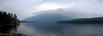
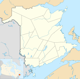
Mount Carleton is the tallest mountain in New Brunswick, Canada. It stands 817 meters (about 2,680 feet) high. You can find it inside Mount Carleton Provincial Park. This mountain is a special part of the International Appalachian Trail in Canada. It also marks the end of the Nepisiguit Mi'gmaq Trail.
The mountain got its name from Thomas Carleton. He was New Brunswick's very first lieutenant governor. A lieutenant governor is like a representative of the King or Queen in a Canadian province. Mount Carleton is part of the Notre Dame Mountains chain.
What is Mount Carleton?
Mount Carleton is a type of mountain called a monadnock. Imagine a big, flat area of land that slowly gets pushed up. Then, over millions of years, wind, water, and ice wear away most of the land. What's left standing tall is a monadnock. It's like a leftover piece of a much older, flatter landscape.
How Mount Carleton Formed
Mount Carleton is made of very old rocks. These rocks are about 400 million years old! They are igneous rocks, which means they formed from cooled lava or magma. Specifically, they are rhyolitic and basaltic volcanic rocks.
Long, long ago, during the Mesozoic Era (the time of dinosaurs), this area was a flat plain. Later, in the Cenozoic Era (when mammals became common), this flat land was lifted up. This created a high, flat area called a plateau. Over millions of years, weather and glaciers slowly carved away at the plateau. The tough volcanic rocks of Mount Carleton resisted this erosion, leaving it standing tall.
Fire Spotting on the Mountain
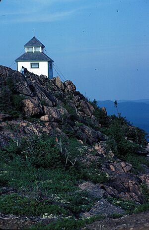
Years ago, before we had airplanes and satellites, people used Mount Carleton to spot forest fires. There was a small hut built right on the top of the mountain. From this hut, people could look out over the vast forests.
There was a similar hut on Big Bald Mountain. By using a method called triangulation, fire spotters could quickly figure out where a wildfire was. They would use signals from different huts to pinpoint the exact location of the fire. This helped firefighters get to the blaze faster.
See also
 In Spanish: Monte Carleton para niños
 | Kyle Baker |
 | Joseph Yoakum |
 | Laura Wheeler Waring |
 | Henry Ossawa Tanner |


