Mount Helena City Park facts for kids
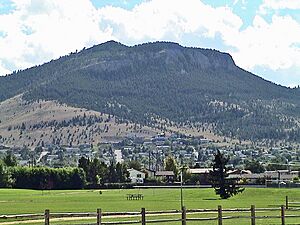
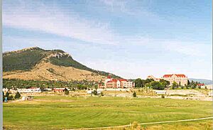
Mount Helena City Park is a super cool park located in Helena, Montana. It covers about 620-acre (2.5 km2) of land. The park is home to Mount Helena itself, which stands tall at 5,468 feet (1,667 m) above sea level. That's like looking down from a really high building! The city of Helena is about 1,300 feet (396 m) below the mountain.
This park has six main trails that go up and around the mountain. Some of these trails even connect to other paths in the nearby Helena National Forest. You can also find a cool cave called "Devil's Kitchen" and a giant letter "H" on the side of the mountain. This "H" overlooks the city and was repainted in April 2015. Of course, you can also hike all the way to the top of the mountain! It's free to visit and is looked after by the City of Helena and local groups who love nature and outdoor fun. Mount Helena City Park was added to the National Register of Historic Places in 1997 because it's an important historical spot.
Contents
Exploring the Trails
Mount Helena City Park has many different trails for you to explore. Each one offers a unique adventure and different views of the park and the city. Here are some of the main trails:
The 1906 Trail
This trail is often considered the easiest way to reach the top of Mount Helena. Along the way, you can see interesting limestone caves and the famous "Devil's Kitchen." If you're into rock climbing, you'll find some great spots here too!
Powerline Trail
The Powerline Trail is the most direct path to the summit from the park's entrance. It's very steep, so it can be a tough climb up and tricky to walk down. Make sure to be careful if you choose this route!
Prairie Trail
This trail offers beautiful views of prairie wildflowers and rocky cliffs. It's a flatter, longer way to get to the summit. However, as you get closer to the top, there are some switchbacks (zigzag turns) that make it a bit more challenging.
Backside Trail
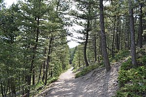
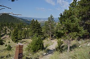
The Backside Trail takes you through a lovely grassy woodland area. You'll get to see lots of tall pine trees and enjoy the peaceful forest.
Hogback Trail
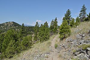
The Hogback Trail is a bit rougher and leads from the summit down to a ridge called the hogback. It's usually recommended to walk this trail downhill. From here, you'll get amazing panoramic views of Helena and the entire park.
Prospector Shafts Trail
This is a very long trail that goes through the southeast part of the park. It offers many different types of landscapes to see. About halfway through, you'll find old prospector shafts, which are holes dug by people looking for valuable minerals long ago.
West End Trail
The West End Trail explores the most remote and quiet part of the park. It goes through a beautiful meadow and eventually connects to the Mount Helena Ridge trail in the Helena National Forest.
 | Jessica Watkins |
 | Robert Henry Lawrence Jr. |
 | Mae Jemison |
 | Sian Proctor |
 | Guion Bluford |


