Mount Herbert (Yakutat) facts for kids
Quick facts for kids Mount Herbert |
|
|---|---|
| Boundary Peak 172 | |
| Highest point | |
| Elevation | 6,102 ft (1,860 m) |
| Prominence | 132 ft (40 m) |
| Geography | |
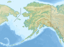
| Location | Stikine Region, British Columbia Glacier Bay National Park and Preserve, Alaska |
Mount Herbert, also known as Boundary Peak 172, is a mountain found in both Alaska (USA) and British Columbia (Canada). It sits right on the border between these two places. This mountain is part of the Southern Icefield Ranges, which are a section of the larger Saint Elias Mountains.
Contents
About Mount Herbert
Mount Herbert is a significant peak in the Saint Elias Mountains. It stands tall at 6,102 feet (about 1,860 meters) above sea level. The mountain is often covered in snow and ice, as it is part of a large icefield region.
Location and Features
This mountain is located where the Stikine Region of British Columbia meets Glacier Bay National Park and Preserve in Alaska. Its position on the international border makes it a "boundary peak." Boundary Peak 172 means it was the 172nd marker used to define the border.
The Saint Elias Mountains are a huge range in northwestern North America. They are known for their massive glaciers and very high peaks. Mount Herbert is one of many mountains in this impressive range.
Naming the Mountain
Mount Herbert was officially named in 1923. It was named after Sir Michael Henry Herbert, who lived from 1857 to 1903. Sir Michael Herbert was an important person in British politics. He served as the British Ambassador to the United States. An ambassador is a country's main representative in another country.
Sir Michael Herbert's Role
Sir Michael Herbert played a part in the early discussions of the Alaska boundary dispute. This was a disagreement between the United States and Great Britain (representing Canada) over where the border between Alaska and Canada should be. His work helped set the stage for how this important border issue would be resolved.
The Alaska Boundary Dispute (Simplified)
The Alaska boundary dispute was a disagreement about the exact line of the border. It involved the United States, Canada, and Great Britain. The dispute was about who owned certain lands rich in gold, especially during the Klondike Gold Rush.
Resolving the Dispute
To solve this problem, a special group called the Alaska Boundary Tribunal was formed. A tribunal is like a court that helps settle disagreements between countries. This tribunal looked at old treaties and maps to decide where the border should be. The final decision helped define the border we know today.
Mount Herbert stands as a reminder of this historical process. It marks a point on the border that was once a subject of international discussion.
 | Emma Amos |
 | Edward Mitchell Bannister |
 | Larry D. Alexander |
 | Ernie Barnes |


