Mount Langford facts for kids
Quick facts for kids Mount Langford |
|
|---|---|

1977
|
|
| Highest point | |
| Elevation | 10,623 ft (3,238 m) |
| Geography | |
| Parent range | Absaroka Range |
| Topo map | Plenty Coups Peak |
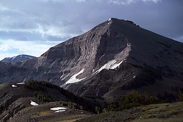
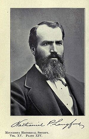
Mount Langford is a mountain peak that stands 10,623 feet (3,238 meters) tall. It is located in the Absaroka Range within Yellowstone National Park. This mountain is named after Nathaniel P. Langford, who was the very first superintendent of Yellowstone. He also played a big role in an important trip to Yellowstone in 1870, called the Washburn–Langford–Doane Expedition.
Langford's work and his writings helped people learn about Yellowstone. This was very important in getting the park created in 1872.
Nathaniel P. Langford: A Park Pioneer

Nathaniel P. Langford was a key figure in the early days of Yellowstone National Park. He was chosen as the park's first superintendent. This meant he was in charge of looking after the new park.
Langford was also a leader of the Washburn–Langford–Doane Expedition in 1870. This group explored the Yellowstone area. Their discoveries and Langford's reports helped show how special Yellowstone was. This led to it becoming the world's first national park in 1872.
The Washburn Expedition's Discovery
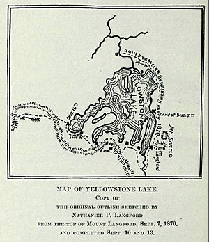
On September 7, 1870, the Washburn expedition was camping by Yellowstone Lake. On that day, Langford and another explorer, Lt. Gustavus Cheyney Doane, decided to climb a nearby mountain.
From the top of this mountain, Langford drew the first fairly accurate map of Yellowstone Lake. When they returned to camp, the expedition leader, Henry D. Washburn, named the peak they had climbed "Mount Langford." He also named a nearby peak "Mount Doane" after Lt. Doane. Both peaks were marked on the map Langford drew.
Langford described the amazing view from the summit: "The view from the top of this mountain... is like nothing I have ever seen before. The Yellowstone area and the Wind River mountains were spread out below us like a map." He saw steam rising from geysers and volcanoes, showing even more wonders in the distance. He also described jagged mountains, deep valleys, and tall cliffs.
Changing Names of the Peaks
A year later, in 1871, another group called the Hayden Geological Survey explored the area. For reasons that are not fully known, they moved the names of Mount Langford and Mount Doane to peaks farther north.
This meant the original mountain that Langford had climbed was left without a name for a while. It wasn't until 1885 that the original Mount Langford was given a new name: Colter Peak.
 | Aurelia Browder |
 | Nannie Helen Burroughs |
 | Michelle Alexander |


