
Mount Liptak facts for kids


Mount Liptak is a tall mountain in Antarctica. It stands about 3,052 meters (or 10,013 feet) high and has two peaks, like twin tops! This impressive mountain is found in the Ellsworth Mountains, which are part of the Sentinel Range. It's located about 7 nautical miles (or 13 kilometers) southeast of another mountain called Mount Craddock.
Mount Liptak has glaciers on both sides. To its west, you'll find the Bolgrad Glacier, and to its east, the Kornicker Glacier. These icy rivers slowly move down the mountain.
Contents
Discovering Mount Liptak
Mount Liptak was first mapped between 1957 and 1959. This mapping was done by the United States Geological Survey using special surveys and air photos taken by the United States Navy.
How Mount Liptak Got Its Name
The mountain was named by the Advisory Committee on Antarctic Names. They chose to honor L.H. Liptak. He was an aviation machinist mate in the U.S. Navy. In January 1958, L.H. Liptak was the plane captain on the very first flights that explored this area.
Climbing Mount Liptak
Mount Liptak was first successfully climbed on December 28, 2012. The brave climbers who reached its summit were Pachi Ibarra, Ralf Laier, and Todd Passey.
Images for kids
-
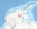
Location of Sentinel Range in Western Antarctica.
-
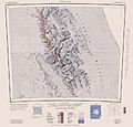
Sentinel Range map.
