Mount Murchison (Tasmania) facts for kids
Quick facts for kids Mount Murchison |
|
|---|---|

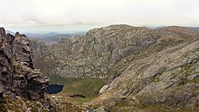
A view over Shaded Lake near the peak of Mount Murchison
|
|
| Highest point | |
| Elevation | 1,275 m (4,183 ft) |
| Prominence | 760 m (2,490 ft) |
| Isolation | 19.96 km (12.40 mi) |
| Geography | |
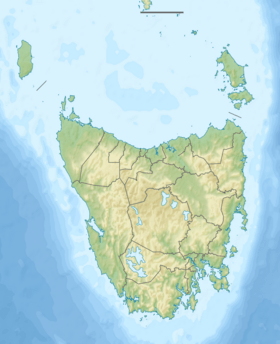
| Location | Western Tasmania, Australia |
| Parent range | West Coast Range |
| Geology | |
| Age of rock | Jurassic |

Mount Murchison is a large mountain located in Tasmania, Australia. It is part of the West Coast Range in the western part of the state.
Standing at 1,275 metres (about 4,183 feet) above sea level, Mount Murchison is the highest mountain in its range. It is also one of the top thirty tallest mountains in all of Tasmania.
Contents
Discover Mount Murchison: Tasmania's Tallest Peak
Mount Murchison is a well-known landmark in western Tasmania. It is often seen in old photographs from the early mining days. The mountain is found within the Mount Murchison Regional Reserve. It sits east of towns like Zeehan and Mount Read. To its north is Mount Tyndall.
Where is Mount Murchison?
This impressive mountain is located near the mining areas of Williamsford and Tullah. These towns are important parts of Tasmania's mining history. The area around Mount Murchison has interesting rocks. This is because of the many mining activities that have taken place nearby.
Climbing Mount Murchison: What to Expect
Climbing Mount Murchison is a great adventure for people with some hiking experience. The full walk to the top and back usually takes about 5.5 to 6 hours. The climb itself takes about 2.5 hours, with short breaks.
The Trail: Bush to Rocky Paths
The first part of the path goes through thick bushland. You will need to step over many tree roots. After this, the track opens up, giving you amazing views of the area. From this point, you follow rock piles called cairns and pieces of tape to stay on the right path.
About two-thirds of the way up, you can find a small spring. This spring is fed by melting snow, providing fresh water. One part of the track, about a third from the top, requires climbing up a 2-metre (about 6.5 feet) rise. There is often a rope to help you here.
Reaching the Summit: Views and Challenges
The last part of the track to the very top is quite narrow. It has a steep drop-off to one side. There is also a 1.5-metre (about 5 feet) ledge to climb up. Once you reach the trig point at the summit, you can see far and wide. On a clear day, you might spot the towns of Tullah, Rosebery, and Zeehan. Be careful, as some parts of the path have loose and slippery rocks.
Lakes and Legends Around the Mountain
On the southeastern side of Mount Murchison, there are several beautiful lakes. From the north, you'll find Shaded Lake, Little Sister, Lake Gaye, and Lake Sandra. These lakes lie below a very steep cliff.
There's a fun local tradition about Mount Murchison. Some people believe it brings good luck to throw a sausage off the top of the mountain. This is said to keep animals away during the walk back down!
Who Named Mount Murchison?
Mount Murchison was named in the early 1860s. It was named by a geologist named Charles Gould.
 | May Edward Chinn |
 | Rebecca Cole |
 | Alexa Canady |
 | Dorothy Lavinia Brown |


