
Mount Orab, Ohio facts for kids
Quick facts for kids
Mount Orab, Ohio
|
|
|---|---|
|
City
|
|

Aerial view of central Mt. Orab
|
|

Location of Mount Orab, Ohio
|
|

Location of Mount Orab in Brown County
|
|
| Country | United States |
| State | Ohio |
| County | Brown |
| Area | |
| • Total | 9.69 sq mi (25.09 km2) |
| • Land | 9.69 sq mi (25.09 km2) |
| • Water | 0.00 sq mi (0.00 km2) |
| Elevation | 935 ft (285 m) |
| Population
(2020)
|
|
| • Total | 4,347 |
| • Density | 448.79/sq mi (173.28/km2) |
| Time zone | UTC-5 (Eastern (EST)) |
| • Summer (DST) | UTC-4 (EDT) |
| ZIP code |
45154
|
| Area code(s) | 937, 326 |
| FIPS code | 39-52906 |
| GNIS feature ID | 2399414 |
| Website | https://www.mtoraboh.us/ |
Mount Orab is a small village located in Brown County, Ohio, in the United States. As of the 2020 United States census, about 4,347 people live there.
Contents
History of Mount Orab
Mount Orab was first established in 1850. Its name likely comes from Mount Horeb, a place mentioned in the Hebrew Bible. The Cincinnati Eastern Railroad (CCET) line also runs through the village.
Geography of Mount Orab
Mount Orab is located in Ohio. According to the United States Census Bureau, the village covers a total area of about 8.89 square miles (23.02 square kilometers). All of this area is land.
Population and People of Mount Orab
| Historical population | |||
|---|---|---|---|
| Census | Pop. | %± | |
| 1880 | 242 | — | |
| 1890 | 336 | 38.8% | |
| 1900 | 561 | 67.0% | |
| 1910 | 539 | −3.9% | |
| 1920 | 545 | 1.1% | |
| 1930 | 541 | −0.7% | |
| 1940 | 589 | 8.9% | |
| 1950 | 758 | 28.7% | |
| 1960 | 1,058 | 39.6% | |
| 1970 | 1,306 | 23.4% | |
| 1980 | 1,573 | 20.4% | |
| 1990 | 1,929 | 22.6% | |
| 2000 | 2,307 | 19.6% | |
| 2010 | 3,664 | 58.8% | |
| 2020 | 4,347 | 18.6% | |
| U.S. Decennial Census | |||
Mount Orab's Population in 2010
In 2010, there were 3,664 people living in Mount Orab. These people lived in 1,381 households. About 1,013 of these were families.
Most people living in the village were White (97.7%). Other groups included African American, Native American, and Asian residents. A small number of people were of Hispanic or Latino background.
Many households (41.2%) had children under 18 living with them. About 50.8% were married couples. The average household had 2.64 people. The average family had 3.08 people.
The average age of people in the village was 33.7 years. About 29.7% of residents were under 18.
Education in Mount Orab
Mount Orab has several schools for students. These include Mount Orab Elementary School and Mount Orab Middle School. Older students attend Western Brown High School.
For those seeking higher education, Southern State Community College is also in the village. Mount Orab also has a public library. It is a branch of the Brown County Public Library.
Mount Orab in the Media
Mount Orab used to have a special place called the Lake Drive-In movie theater. This was a place where people could watch movies from their cars.
Sadly, a big storm destroyed the theater in the late 1980s. After it closed, the theater's sign famously read "Gone with the Wind." This was a clever play on words about the storm. It also referred to the famous movie Gone with the Wind.
A local newspaper printed a picture of the sign. This led to stories that a tornado had hit the theater. People thought it happened while the movie Gone with the Wind was playing again.
Gallery
-
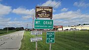
Mt. Orab corporation limit sign
-
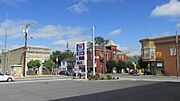
Looking northwest at the intersection of Tri-County Highway (Old Ohio Highway 32) and High Street (U.S. Route 68) in Mt. Orab
-
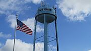
Water tower in Mt. Orab


See also
 In Spanish: Mount Orab (Ohio) para niños
