Mount Schank facts for kids
Quick facts for kids Mount Schank |
|
|---|---|

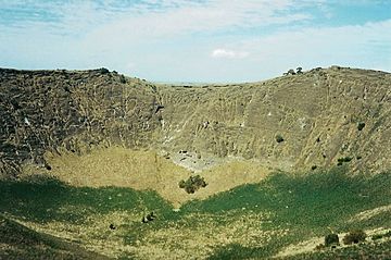
View inside the cone from the rim
|
|
| Highest point | |
| Elevation | 100 m (330 ft) |
| Geography | |
| Geology | |
| Last eruption | 4500-5000 years ago |
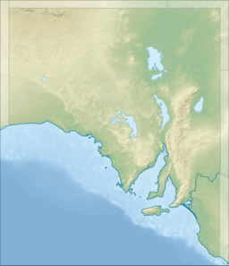
Mount Schank is a 100 m (330 ft) tall dormant volcano in South Australia. It is located near Mount Gambier in the southeast part of the state.
A navigator named James Grant first saw Mount Schank on December 3, 1800. He named it after Admiral John Schank. Admiral Schank designed Grant's ship, the HMS Lady Nelson.
Mount Schank is part of the Newer Volcanics Province. This area has the youngest volcanic field in Australia.
Contents
When Did Mount Schank Erupt?
Mount Schank erupted about 5,000 years ago. This was around the same time as the Mount Gambier volcano. It is mostly an ash cone. The bottom of its crater does not go deep enough to reach the water underground. This means it does not have a crater lake, unlike Mount Gambier.
There are two smaller craters next to the main cone. Some lava flows from the eruption can also be seen. The northern crater is round, 300 m (980 ft) across and 100 m (330 ft) deep. The older southern crater is 200 m (660 ft) across. The larger northern crater partly covers it.
Aboriginal Stories of the Volcano
The local Aboriginal Bunganditj people saw Mount Schank erupt over time. Their creation story about the volcanoes in the area was written down in 1880. A local woman named Christina Smith recorded it.
The story tells of Craitbul, a giant, who was looking for a home with his family. They camped at Mount Muirhead and Mount Schank. But a moaning bird spirit scared them away from both places. They ran to Mount Gambier, leaving their "camp ovens" (the volcanoes) burning.
Later, water filled their ovens and put out the fires. This also drove the spirit away. Craitbul and his family continued to live in a cave on the side of Mount Gambier.
Visiting Mount Schank Today
You can reach Mount Schank from the Riddoch Highway. It is about 20 km (12 mi) south of Mount Gambier. There is a small parking area and a picnic table.
Steps have been built to help with the short but very steep walk to the crater's edge. Walking around the rim is fairly easy. However, it can be dangerous in very windy weather because it is so exposed.
Images for kids
Weather at Mount Schank
| Month | Jan | Feb | Mar | Apr | May | Jun | Jul | Aug | Sep | Oct | Nov | Dec | Year |
|---|---|---|---|---|---|---|---|---|---|---|---|---|---|
| Average rainfall mm | 29.2 | 21.3 | 37.4 | 55.1 | 70.6 | 98.2 | 109.5 | 106.2 | 76.3 | 58.0 | 42.7 | 39.1 | 739.6 |
| Average rainfall inches | 1.15 | 0.84 | 1.47 | 2.17 | 2.78 | 3.87 | 4.31 | 4.18 | 3.00 | 2.28 | 1.68 | 1.54 | 29.12 |
 | James Van Der Zee |
 | Alma Thomas |
 | Ellis Wilson |
 | Margaret Taylor-Burroughs |


