Mount Sorell facts for kids
Quick facts for kids Mount Sorell |
|
|---|---|

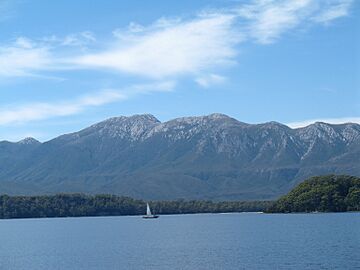
Mount Sorell viewed from the Macquarie Harbour fjord
|
|
| Highest point | |
| Elevation | 1,144 m (3,753 ft) |
| Prominence | 673 m (2,208 ft) |
| Isolation | 11.49 km (7.14 mi) |
| Geography | |
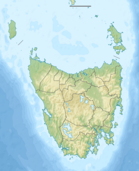
| Location | Western Tasmania, Australia |
| Parent range | West Coast Range |
| Geology | |
| Age of rock | Jurassic |
Mount Sorell is a mountain located in the West Coast region of Tasmania, Australia.
Standing at 1,144 meters (about 3,753 feet) above sea level, it is the most south-westerly peak in the West Coast Range.
The Story Behind the Name
Mount Sorell was named to honor William Sorell. He was a soldier who served as the third Lieutenant-Governor of Van Diemen's Land. This was the old name for Tasmania.
In the 1880s, people found gold in the creeks near the mountain. This type of gold is called alluvial gold.
What Makes Mount Sorell Special?
The eastern side of Mount Sorell looks over the Clark River valley. This valley separates it from Mount Darwin.
Because of its location and how it stands out over Macquarie Harbour, Mount Sorell was named very early. It was seen as a big natural barrier.
Unlike some other mountains in the West Coast Range, Mount Sorell does not have many old mine workings or walking tracks. It remains mostly untouched by human activity.
There are other places named after William Sorell too. These include Cape Sorell at the entrance to Macquarie Harbour and a town called Sorell in south-eastern Tasmania.
 | Jewel Prestage |
 | Ella Baker |
 | Fannie Lou Hamer |


