Mountain Parkway Byway facts for kids
Quick facts for kids
[[File:|x70px|alt= marker]] |
|
|---|---|
| Lua error in Module:Infobox_road/map at line 15: attempt to index field 'wikibase' (a nil value). | |
| Route information | |
| Length | 9.8 mi (15.8 km) |
| Existed | August 2, 1999–present |
| Major junctions | |
| South end | Intersection of WV 20 and Hodam Creek Road (CR 20/18) |
| North end | Upshur–Webster county line at Cleveland |
| Highway system | |
| West Virginia Routes State • County |
|
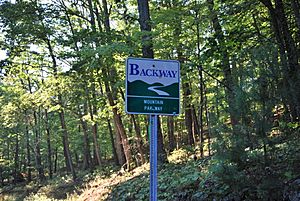
The Mountain Parkway Byway and Mountain Parkway Backway are two special roads in northern Webster County, West Virginia. They are great for exploring the beautiful mountain areas. The Byway is a special "scenic byway" that follows West Virginia Route 20 for about 9.8 miles (15.8 km). It goes through areas where many mountain streams begin, like the Right Fork Little Kanawha River and Holly River. The Backway is a longer, 32-mile (51 km) route that explores smaller, less-traveled roads in the same area. It also follows parts of the Right Fork Little Kanawha River and Left Fork Holly River.
Contents
- Mountain Parkway Byway: A Scenic Drive
- Mountain Parkway Backway: Exploring Hidden Paths
- Boggs Mill Stone: A Tale of Strength
- Johnson Home: A Glimpse into the Past
- Mollohan Mill: A Unique Water Wheel
- Hanging Rock: Nature's Shelter
- Mount Zion Church: Built with Care
- Lowther Store: A Century of Service
- Wheeler Overlook: A Village View
- Long Run Farm: Apple Orchard Views
- Pugh: A Historic Community Site
- Visitor kiosks
Mountain Parkway Byway: A Scenic Drive
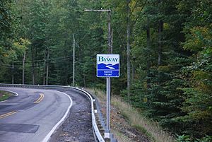
The Mountain Parkway Byway is a beautiful drive along West Virginia Route 20. If you're heading south, the Byway starts when you cross the Right Fork Little Kanawha River into Webster County. There's a special information spot, called a visitor kiosk, just south of the county line. From there, you can follow WV 20 south to discover many interesting places!
Cleveland: A Historic Village
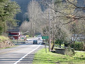
Cleveland is the village furthest north in Webster County. It was first settled in 1844 by Robert McCray Sr. It used to have different names like Buffalo Fork and Point. In 1885, it was renamed to honor President Grover Cleveland. A post office, where people sent and received mail, was open here for many years.
Jerry Run Summer Theater: Live Music Fun
Along West Virginia Route 20, you'll find the Jerry Run Summer Theater. It's a big wooden building with a stage, a snack bar, and seats for 150 people. Every Friday or Saturday evening from May to early October, you can enjoy live music! Bands play Bluegrass, country, folk, and gospel music. Dusty and Renee Anderson, who live nearby, own this fun theater.
Sharon: A Community's Past
Near Jerry Run, there used to be a post office called Sharon. It served the Jerry Run community from 1890 to 1900. Important people like Dr. William W. Hutchinson and Patrick W. Bruffey, who was even a school superintendent, worked as postmasters there.
Old Sulphur Spring: A Refreshing Stop
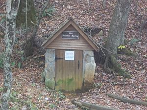
Also at Jerry Run is the Old Sulphur Spring. In the late 1800s and early 1900s, this spring provided water for travelers and students at the nearby Jerry Run one-room school. Today, it's still a favorite meeting spot for people in the community.
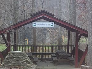
Close to the spring, there's a shelter, a picnic table, and a stone fireplace. This cozy spot is a great rest stop along the Mountain Parkway Byway.
Hacker Valley: Named After a Pioneer
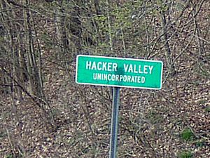
The village of Hacker Valley is named after John Hacker. It's said that Hacker claimed land nearby around 1772 by making a "tomahawk mark" on trees. This was a way pioneers marked their land. A post office was open here from 1856 to 1892, first called Hacker's Valley.
Holly River State Park: Nature's Playground
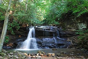
Located along Laurel Fork, Holly River State Park is the second-largest state park in West Virginia! It covers about 8,294 acres (33.56 km²). The park is famous for its beautiful mountains and several waterfalls. You can also enjoy camping, picnicking, and swimming in the park. It's a perfect place for outdoor adventures!
Mountain Parkway Backway: Exploring Hidden Paths
| Location: | Junction of WV 20 and Replete Road (CR 3) to junction of WV 20 and Boggs Mill Road (CR 1) |
|---|---|
| Length: | 32 mi (51 km) |
The Mountain Parkway Backway takes you on quieter, less-traveled roads in the area. It runs alongside parts of the Right Fork Little Kanawha River and Left Fork Holly River. Starting near Cleveland on WV 20, you can follow County Routes 1 (Boggs Mills Road), 1/1 (Three Lick Run Road), 6 (Westbrook Lane), and 3 (Replete Road). This creates a 32-mile (51 km) loop that brings you back to WV 20, south of Holly River State Park. Just remember, many of these Backway roads are gravel, so they might be bumpy!
There are also extra paths, called "spurs," that lead from the main Backway to other interesting spots:
- County Route 4 (Williams Camp Run Road) starts at County Route 1 and leads to the Johnson Home.
- County Route 8 (Poling Road) branches off County Route 3 and takes you to the Mollohan Mill.
- County Route 3/8 (Cowger Hill Road) goes west from County Route 3 to Long Run Farm.
- County Route 20/2 (Mount Zion Road) connects County Route 3 and WV 20.
Boggs Mill Stone: A Tale of Strength
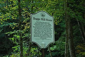
Along Webster County Route 1, you can see a very large rock. People say that Andrew Boggs, a strong man and gunsmith from the late 1800s, moved this rock from across the Right Fork Little Kanawha River to his mill! He was known for his amazing physical strength. Andrew Boggs was the first person buried in the Boggs Cemetery, on a hill east of the millstone. A story is told that during the Civil War, he hid from soldiers on that high, rugged hilltop. He supposedly said it was such a good hiding spot, it would even hide him from the devil!
Johnson Home: A Glimpse into the Past
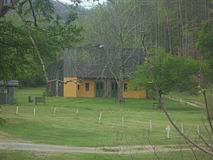
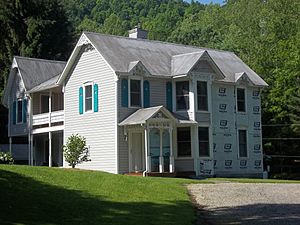
The Johnson home was built in 1887 by John Nathaniel "Squire" Johnson. It's a great example of how homes looked in the 1800s and is very well-preserved. John Johnson was a carpenter and even built some of the one-room schools in the area. As of 2003, the Johnson family still owned this historic home.
Mollohan Mill: A Unique Water Wheel
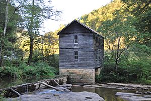
Bernard Mollohan built this mill on the Left Fork Holly River in 1894. It was a very successful business until a flood damaged it in 1951. What makes this mill special is its water wheel: it lies flat (horizontal) to the water, instead of standing upright (vertical) like most water wheels. The Mollohan family still owns the mill today through Bernard's great-granddaughter, Beth Mollohan. This mill was the first place in Webster County to be added to the National Register of Historic Places on September 2, 1982, which means it's a very important historical site!
Hanging Rock: Nature's Shelter
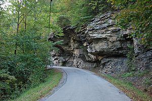
Just east of Poling, you'll find a huge rock formation called "Hanging Rock." This cliff stretches out over and along Replete Road for hundreds of feet. It's made of sandstone that formed about 313 million years ago! Over time, water from the nearby Left Fork Holly River carved out the rock underneath. Many years ago, people traveling on horseback used these rocks as a shelter when the weather was bad. Because it's so unique and beautiful, Hanging Rock has even been a special place for weddings!
Mount Zion Church: Built with Care
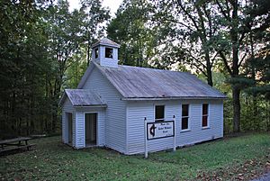
At the corner of Replete and Mount Zion Roads, the Mount Zion Church sits on a small hill high above the Left Fork Holly River. The first church building was put up in 1892, but a strong windstorm destroyed it in 1932. People saved materials from the old building and used them to build the current church in 1933.
Lowther Store: A Century of Service
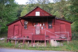
The store, now known as Lowther Store, first opened in 1900 by John A. Hinkle. It's the oldest store in Webster County that has been open continuously! It was added to the National Register of Historic Places on April 7, 1997, showing its importance. A post office also operated at the store for many years, starting in 1903.
Wheeler Overlook: A Village View
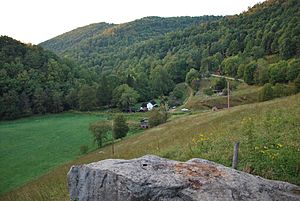
Along the Mountain Parkway Backway, you'll find the small village of Wheeler, named after Galloway Wheeler. The Wheeler Overlook gives you a wide, beautiful view of the entire village. In the early 1900s, Wheeler was a busy center for the area. It had a store, a post office, a mill for grinding grain, a jewelry repair shop, and even a photography shop!
Long Run Farm: Apple Orchard Views
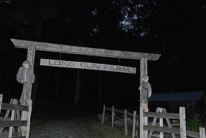
At the bottom of Cowger Hill, you'll see the Long Run Farm apple orchard. This orchard marks the western end of a special side path, or "spur," of the Backway along County Route 3/8 (Cowger Hill Road).
Pugh: A Historic Community Site
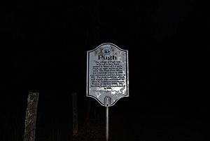
This is where the Pugh post office used to be (from 1888 to 1911), and also the site of the Wesley Anderson Store and Grist Mill. Wesley Anderson's home and the old store building are still standing today. A paper from 1906 shows that the Wesley Anderson Store sold all kinds of goods. It even listed materials for burials, including a child's coffin for $6.45.
Visitor kiosks
Three special information kiosks have been built along the Mountain Parkway Byway and Backway to help guide travelers and give them useful information:
 | Frances Mary Albrier |
 | Whitney Young |
 | Muhammad Ali |


