Mud Creek (Toronto) facts for kids
Quick facts for kids Mud Creek |
|
|---|---|

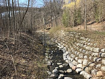
Mud Creek near the end of Moore Park Ravine
|
|
| Country | Canada |
| Province | Ontario |
| City | Toronto |
| Physical characteristics | |
| Main source | Toronto, Ontario, Canada |
| River mouth | Don River, just south of Don Valley Brick Works, Toronto, Ontario, Canada 84 m (276 ft) |
| Length | 11.5 km (7.1 mi) |
Mud Creek is a stream in Toronto, Ontario, Canada. It flows mostly underground and is a branch of the Don River. People have also called it Mount Pleasant Brook and Spring Valley Creek.
Long ago, Mud Creek started near Downsview Airport. It flowed for about 11.5 kilometers (7.1 miles) southeast to the Don River. Today, most of the creek is buried. Only a 2.1-kilometer (1.3-mile) part can still be seen. This visible section starts in Moore Park Ravine and goes to the Don River. Mud Creek is known as one of Toronto's "lost rivers." However, recent efforts to protect it have been very successful. It is now a great example of good ravine management.
Contents
The Hidden Path of Mud Creek
Most of Mud Creek's original path is now hidden underground. You can still see hints of its former route in the land. These hints stretch from the Downsview area to Mount Pleasant Cemetery. They also appear in the dip at the start of Moore Park Ravine.
The creek's source was thought to be near Downsview Airport. From there, it flowed towards Highway 401. It then crossed into what is now the Baycrest Medical Center parking lot. The creek continued south through Woburn Park. It crossed Lawrence Avenue and flowed into Caribou Park. After that, it followed the curve of Coldstream Avenue. Here, you can briefly see water in the Kimbark-Coldstream Ravine. This water then goes into sewers and is sent east.
From the ravine, Mud Creek traveled southeast. It crossed Avenue Road into Lytton Park. Then, it flowed south along Rosewell Avenue into Eglinton Park. The creek left Eglinton Park near Edith Street. Even today, the high water in the soil here shows where the creek once was. From the park, it went southeast, crossing Yonge Street at Hillsdale Avenue.
Mud Creek then flowed through what is now Tulis Drive. It passed June Rowlands Park and entered Mount Pleasant Cemetery. Here, the high water still feeds a small wetland garden. The creek's waters then flowed southeast into Moore Park Ravine.
The Visible Sections of Mud Creek
The only part of Mud Creek that still flows openly is south of Moore Avenue. This section starts in Moore Park Ravine. Most of the water in this open part does not come from its original source. Instead, it comes from storm sewers near the ravine. These sewers collect water from the Upper Cudmore Creek area.
The open section of Mud Creek is 2.1 kilometers (1.3 miles) long. It runs to the Don River. For most of its path, it flows next to the Beltline Trail. The creek is buried for short parts as it crosses under the trail. Finally, it comes out into the open through the Don Valley Brick Works.
Moore Park Ravine
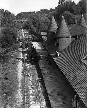
Moore Park Ravine starts just south of Moore Avenue. It ends in the open space of the Don River valley. This ravine is next to Mount Pleasant Cemetery. The first part of the ravine, from Moore Avenue to Heath Street, was once called Spring Valley. The Toronto Belt Line Railway Company used this name to promote the area. The creek was also called Spring Valley Creek.
People consider the creek and the ravine to be one of Toronto's best nature walks. It is a beautiful place to explore.
Don Valley Brick Works
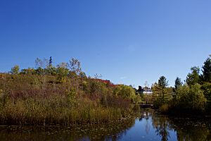
The creek enters the Don River valley at the Don Valley Brick Works. Here, its water splits up and flows through or near several ponds. The water then comes back together before flowing into the Don River. This happens just south of Bayview Avenue.
The ponds at the Brick Works help clean the water from Mud Creek. They hold the water and filter it naturally before it goes into the Don River. This is an important part of Toronto's plan to manage storm water. Because of the land's natural features, work is always being done to prevent erosion. Trees are also planted to keep the ravine healthy. This also helps protect the Beltline Trail that runs through it.
 | James B. Knighten |
 | Azellia White |
 | Willa Brown |


